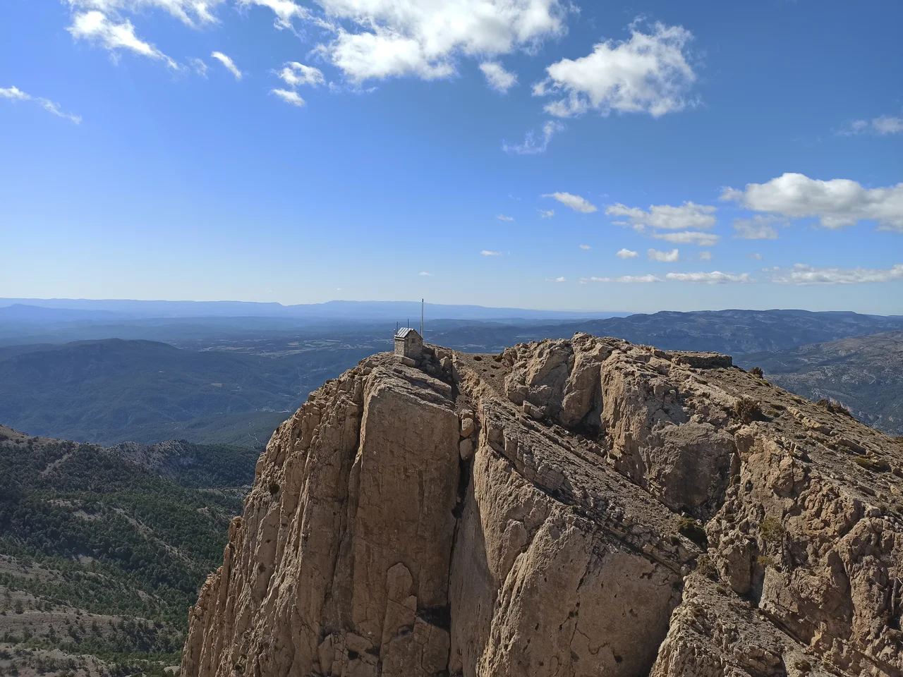

Penyagolosa
For generations, the people of the Valencian interior looked up at Penyagolosa and saw the roof of their world. It rises alone, unshouldered by close neighbors, from the tangled highlands of eastern Spain, and that solitude made it seem the obvious high point of the whole region. They were wrong - though only by a little, and it never really mattered. At 1,813 meters, often crowned with snow through the winter, Penyagolosa remains the most emblematic mountain the Valencian Community has, tallest or not.
The Giant of Stone
Locals call it El Gegant de Pedra, the giant of stone, and the name suits a peak that stands so conspicuously apart. It belongs to the Iberian System, the long spine of highlands at the eastern edge of the Iberian Peninsula, and it is the highest summit in the province of Castellón. Its isolation is the whole point. With no rival ridge crowding close, Penyagolosa commands every horizon that can see it, and in winter its bare upper slopes turn white - a pale beacon visible for miles across the dry, brown country spread out below.
The Mountain That Wasn't Quite the Tallest
For a long time people assumed Penyagolosa was the highest peak in the entire region, a natural guess for a mountain that so plainly towers over its surroundings. The measurements told a different story. The true high point of the Valencian Community is Cerro Calderón, 1,839 meters, tucked away in the Rincón de Ademuz - a fragment of Valencian territory stranded as an exclave, cut off from the rest, where three more summits climb past 1,500 meters. Penyagolosa lost the record by twenty-six meters. It kept the affection anyway. Isolation, it turns out, can beat altitude when it comes to being loved.
A Path to Sant Joan
At the mountain's foot stands the sanctuary of Sant Joan de Penyagolosa, one of the important pilgrimage destinations of the Valencian lands. For centuries the faithful have made their way to it on foot, tracing old routes up through the highlands to the hermitage sheltered beneath the peak. The pilgrimage folds faith, landscape, and endurance into a single act - the long approach on foot, the mountain swelling larger with every hour, the small stone sanctuary waiting at the end of the climb. Even for those who come only to walk, the shape of that journey still holds.
Where the Massif Meets Aragon
Penyagolosa is not a lone rock but the head of a whole massif. Lesser ranges gather around it, among them the Sierra de la Batalla, which reaches westward toward Aragon and knits this Valencian summit into the broader Iberian System. The surrounding country is protected today as a natural park, its forests, ridges, and pilgrim paths held in trust. To fly over it is to watch the land rise in slow steps from the Mediterranean plains, gathering height and wildness, until it crests at the pale, solitary dome that the region simply calls the Giant.
From the Air
Penyagolosa peaks at 1,813 m near 40.23°N, 0.35°W, standing well inland from the Castellón coast as a striking, isolated summit - snow-capped in winter and visible from a great distance in clear air. Treat it as significant terrain: give the ridgeline generous clearance and watch for mountain turbulence, downdrafts, and rapidly changing weather near the peak. Valencia (LEVC) lies roughly 100 km to the south-southwest and Alicante-Elche (LEAL) farther down the coast. Approach from the Mediterranean side to appreciate how the plains step up toward the massif.
Nearby Stories
- La Vall d'Uixó 10 km away
- Carnival of Vinaròs 11 km away
- Vía Verde de Ojos Negros 16 km away
- Catí 17 km away
- Peniscola Castle 22 km away
- Illa Grossa 29 km away
- Rock Art of the Iberian Mediterranean Basin 31 km away
- Battle of Belchite (1937) 97 km away