
Plantation of Ulster
On 14 September 1607, ninety-nine Irish chieftains and their retinues - the lords of Tyrone and Tyrconnell among them - boarded a single ship at Rathmullan on Lough Swilly and sailed for the European continent. They believed they would return with Spanish reinforcements. They never came back. The Flight of the Earls, as Irish history would name it, left almost an entire province leaderless. James VI of Scotland, two years into his new role as James I of England, recognised what had landed in his lap. By 1609, the official plantation had begun: half a million acres of confiscated Gaelic land, six counties of Ulster (Armagh, Cavan, Fermanagh, Tyrone, Donegal and Londonderry), redistributed to English-speaking Protestant settlers from Scotland and northern England. It would prove the most successful and most consequential of all the plantations of Ireland.
Ulster Before the Settlers
Before the plantation, Ulster was the most Gaelic of Ireland's provinces - the least anglicised, the least urbanised, the most independent of the English Crown. There were almost no towns. The economy ran on cattle, with families practising creaghting, a form of transhumance that moved herds to upland pastures each summer. Outsiders mistook this for nomadism. By 1600, after a decade of war and famine during the Nine Years' War, the adult population of Ulster had collapsed to perhaps 25,000 to 40,000 people. Sixty thousand are said to have died from hunger and military violence against civilians. The land that was about to be planted had already been hollowed out.
Chichester's Design
Arthur Chichester, Lord Deputy of Ireland, originally planned something smaller - settlers around military posts, large grants to native lords who had backed the Crown. Then in 1608 Sir Cahir O'Doherty of Inishowen launched a brief but devastating rebellion, capturing and burning Derry. That changed the calculus. Chichester now insisted on a much bigger plantation, with all native land titles legally expropriated. John Davies, the Attorney-General for Ireland, used English common law as the instrument of colonisation, ruling that gavelkind - the Gaelic system of partible inheritance - had no standing in court, which meant that no Gaelic landowner could legally prove ownership. The land was deemed forfeit to the Crown. The plantation was sold to James as a joint English-and-Scottish venture, rewarding his Scottish subjects for their loyalty and severing, the king hoped, the ancient ties between the Gaels of Ulster and the Gaels of the Scottish Highlands.
The Border Reivers
One of the more remarkable strands of the plantation involved the Border Reivers - the raiding families of the Anglo-Scottish frontier whose feuds had made the marches between England and Scotland ungovernable for centuries. James saw a way to solve two problems at once: shipping the Reivers across to Ulster would pacify the Border and provide hard fighting men to dominate the Irish. County Fermanagh in particular received a substantial Reiver settlement. The colonists were required to be English-speaking and Protestant, mostly from the Scottish Lowlands and northern England. By 1622, a survey counted around 12,000 adult planters on official plantation lands, with another 7,000 in privately colonised counties Antrim and Down.
What Happened to the Irish
The plantation decreed that the native Irish be displaced. In practice this happened only partially. About 300 Gaelic landowners who had taken the English side in the Nine Years' War were rewarded with grants. The majority of ordinary Gaelic Irish remained in their native areas but were now restricted to worse land than they had farmed before - often in the same townlands as the new settlers, sometimes on land they had previously owned. The English and Scottish Undertakers simply could not import enough tenants to fill their agricultural workforce, and had to fall back on Irish labour. The reaction of the dispossessed was bitter. The Annals of the Four Masters lamented that the land had been "taken from the Irish" and given "to foreign tribes." Lochlann Óg Ó Dálaigh wrote: "Where have the Gaels gone? We have in their stead an arrogant, impure crowd, of foreigners' blood."
1641 and Its Aftermath
On 23 October 1641, the smouldering resentment ignited. Felim O'Neill, who had himself been a beneficiary of plantation land grants, led an Ulster Catholic uprising. His followers - many of them sons and grandsons of dispossessed families - turned on the British settlers. About 4,000 colonists were killed and 8,000 more expelled. The historian Marianne Elliott has written that "1641 destroyed the Ulster Plantation as a mixed settlement." The massacres seared themselves into the Protestant collective memory. A.T.Q. Stewart called it the moment when "the mentality of siege was born, as the warning bonfires blazed from hilltop to hilltop, and the beating drums summoned men to the defence of castles and walled towns crowded with refugees." The twelve years of war that followed - Scottish Covenanter armies, Irish Confederate forces, Cromwell's New Model Army - left no winners except an exhausted Protestant ascendancy.
The Long Echo
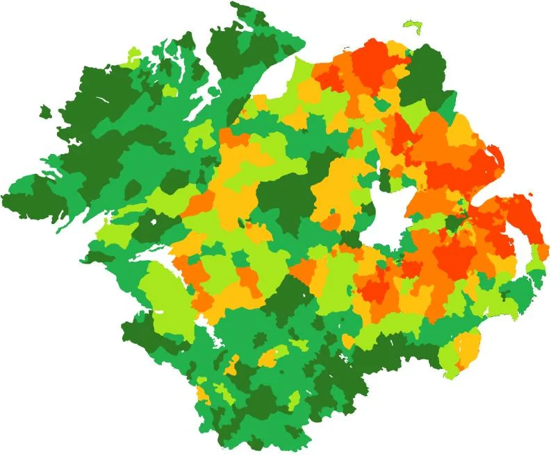
By the 1690s, after the Williamite War and a Scottish famine that drove tens of thousands more Lowland Scots across the North Channel, Presbyterians made up an absolute majority in Ulster. They were excluded from political power by the Anglican Protestant Ascendancy. Their resentment fuelled a second great migration: about 150,000 Ulster Scots emigrated to colonial America between 1717 and the 1770s, settling in Pennsylvania, western Virginia, and the Appalachian backcountry, where their descendants became known as Scotch-Irish Americans. Genetic studies have confirmed what the records suggested: the distribution of southwestern Scottish ancestry in Northern Ireland today still mirrors the pattern of seventeenth-century plantation. The line that became the Northern Irish border in 1921 follows, more or less, the geography that the planters and the natives carved out four centuries earlier.
From the Air
The Plantation of Ulster covered the six counties of Armagh, Cavan, Fermanagh, Tyrone, Donegal and Londonderry, centred around 54.74°N, 6.74°W. Recommended viewing altitude 4,500-6,500 ft AGL to take in the full sweep of Ulster, from Lough Foyle in the northwest to Lough Neagh in the centre to the Sperrins and the Antrim Plateau. Belfast International (EGAA) and City of Derry (EGAE) are the main airfields. The plantation towns - Derry, Coleraine, Enniskillen, Donaghadee, and many smaller settlements - are still visible as ordered street grids amid older Gaelic field patterns. Best visibility in late spring or early autumn, when low sun emphasises hedgerow boundaries and old townland divisions.
Nearby Stories
- Limavady Grammar School 5.6 km away
- Altnahinch Dam 6 km away
- Baronscourt 7.9 km away
- Irish Open (golf) 11 km away
- Flight of the Earls 14 km away
- Maze Prison Escape 14 km away
- 1990 British Army Gazelle shootdown 16 km away
- Enniskillen Lifeboat Station 21 km away