.jpg)
Rye Harbour
Every 15 November at Rye Harbour, the village stops. The names of seventeen men are read aloud at a memorial service, and the small fishing community remembers a sunrise launch nearly a century ago that no one came back from. The Mary Stanford disaster of 1928 still defines this village, two miles downstream from the medieval town of Rye, on a shingle bar that the English Channel has been building up for eight hundred years. The village itself is younger than that lifeboat tragedy by only a hundred-odd years - born around 1805 as a military post, grown into a fishing port, and now an unlikely doorway into one of England's richest coastal nature reserves.
Built on Moving Ground
Rye Harbour exists because the sea kept depositing things. The original medieval port of Rye was an open harbour on tidewater, but shingle and silt steadily built outward over the centuries, leaving the old town stranded two miles inland on its sandstone hill. The new shoreline became the new port. The first permanent structure here was military: a company of dragoons posted in 1805 against the threat of French invasion, followed quickly by the first fishermen's huts. The Martello Tower of 1809 to 1810 still stands - one of a chain built along the Channel coast during the Napoleonic Wars - but it now sits a kilometre inland, the beach having marched on past it like everything else on this coast. The Coast Blockade watch house of about 1825 still has its flagstaff for signalling to passing shipping, a relic from the years when smuggling, peace, and the Royal Navy's spare capacity all converged at once.
The Morning of 15 November 1928
It was just before seven in the morning, with rain driving in and a heavy sea running, when the Mary Stanford launched from the Rye Harbour station to help a Latvian steamer in distress. What the seventeen men of the crew did not know was that the steamer had already been picked up by another lifeboat. The recall signal was either never sent, or never received, or never read - the precise failure is still debated. The Mary Stanford went out into the storm, found no one to rescue, and on her return capsized in the surf with the loss of every man aboard. All but one of the bodies were eventually recovered; the coxswain's son, John Head, was never found. The RNLI lost an entire crew in a single morning. The memorial service held every November is one of the most quietly devastating fixed points in the British lifeboat calendar - not a celebration of a rescue, but a recognition of seventeen volunteers who answered a call that should not have come, and paid the full price for answering.
A Working Coast
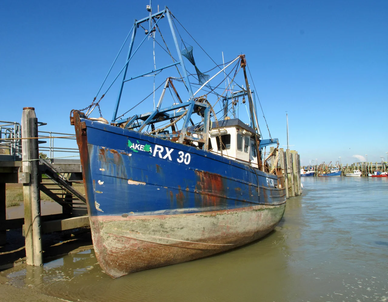
Rye Harbour is still a working village, not a museum. The yacht moorings, the long-established lifeboat station, the small fishing fleet whose boats carry the registration code RX - for Rye SusseX - all share the river mouth with commercial shipping and a holiday park. The River Rother, from Rye seawards, is under the Environment Agency's control. An industrial estate straddles the road in from Rye, with warehousing, light manufacturing, and an oil refinery. The Inkerman Arms and the William the Conqueror are working pubs, not heritage attractions. This is a place where the past sits inside the present, rather than being preserved alongside it. You can walk from the lifeboat memorial to the harbour mouth, past fishing boats whose hulls have been kissed and rebuilt and kissed again by the sea, in the time it takes to drink a pint.
The Reserve Beyond the Shingle
Just behind the working village, the landscape opens into one of southern England's strangest and most ecologically significant places: the Rye Harbour Nature Reserve. Established in 1970, managed by the Sussex Wildlife Trust, the reserve now draws around 360,000 visitors a year - more than the entire population of Hastings. Its shingle ridges, lagoons, and reedbeds hold more than 300 rare or endangered species - little terns, lapwings, marsh harriers, sea kale, sea pea, yellow horned poppy. The reserve has both national and international protected designations. A flat, accessible private road and well-placed birdwatching hides make the central reserve genuinely usable by wheelchair visitors, and in May 2021 the new wheelchair-accessible Discovery Centre opened, a joint project between the Trust and the Friends of Rye Harbour Nature Reserve. It is, quietly, one of the more inclusive nature reserves in the country.
Westling and the Children's Books
Generations of British children met Rye Harbour without knowing it, under another name. The children's author Monica Edwards, writing through the 1940s and beyond, used the village as the model for the fictional fishing community of "Westling" in her long-running Romney Marsh series. The books followed two families across riding ponies, lifeboat launches, and seasons of marsh weather - and although the geography of Westling was fictional, generations of readers who walked into Rye Harbour for the first time recognised the shingle, the masts, and the long view across the levels at once. Children's books rarely get to make a place real this way. Edwards did. Together with the Mary Stanford memorial and the reserve, the books are one of the three quiet reasons why this small village punches so far above its weight.
From the Air
Rye Harbour lies at 50.94 degrees North, 0.76 degrees East, on the East Sussex coast at the mouth of the River Rother. Best viewed at 1,500 to 3,000 feet AGL - the river mouth, harbour entrance, and the green expanse of the nature reserve are clearly visible, with the medieval hilltop town of Rye visible 2 miles inland to the north-west. Camber Castle's octagonal stone footprint lies just to the north. Nearest airfield: Lydd (EGMD) about 6 nautical miles east. Watch for the controlled airspace around Lydd and the busy Channel air traffic.
Nearby Stories
- Herstmonceux Castle 2.2 km away
- Tonbridge Priory 7.1 km away
- HMS Niger (1892) 7.9 km away
- Shrub's Wood Long Barrow 8.9 km away
- Battle of the Narrow Seas 13 km away
- Le Paradis Massacre 88 km away
- Courrieres Mine Disaster 145 km away
- D-Day: The Longest Day 160 km away