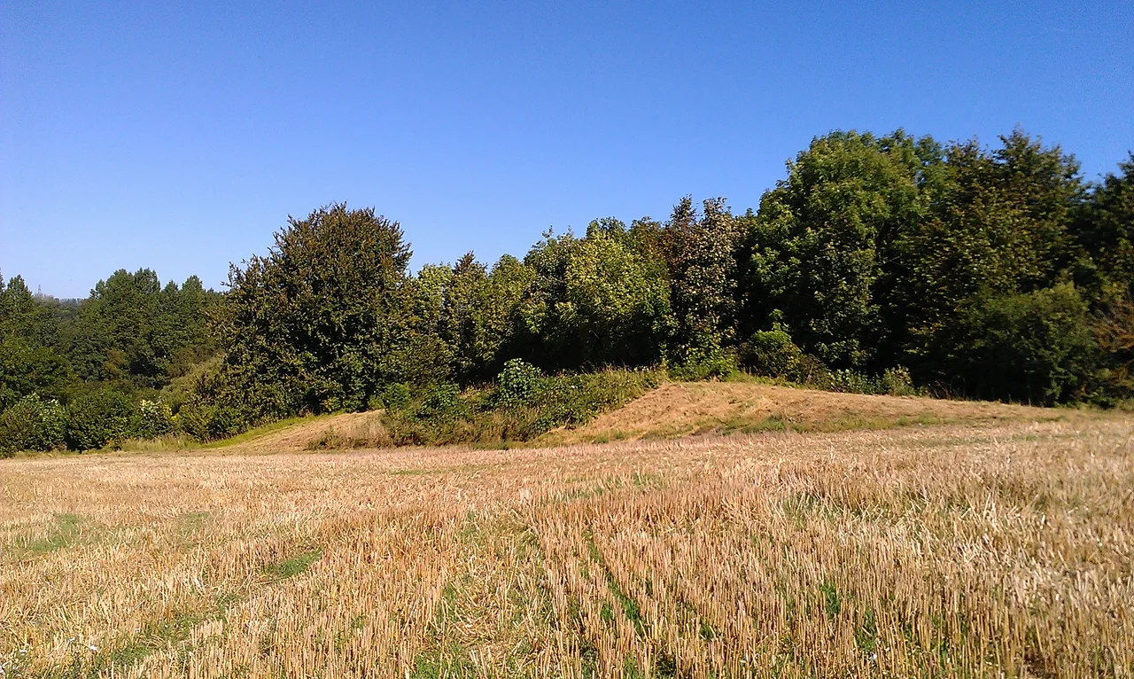

Shrub's Wood Long Barrow
It hides in plain sight. Shrub's Wood Long Barrow - an earthen mound 38 metres long, 19 metres wide, two metres high at its eastern end - has sat in a Kentish wood near the village of Elmsted for nearly six thousand years. Antiquarians knew about Julliberrie's Grave a few kilometres away by the 16th century. Archaeologists discovered Shrub's Wood in the late 1960s; J. Bradshaw published the first formal report in Archaeologia Cantiana in 1970. The mound has never been excavated. The community that built it - some of the first farmers in Britain, working in the fourth millennium BCE - left their dead inside, sealed up the earth above them, and went on living their pastoral lives in a Britain still mostly covered in forest.
The First Farmers
The Early Neolithic - roughly 4500 to 3800 BCE - was a turning point in British history. The hunter-gatherer Mesolithic way of life that had filled the post-glacial millennia gave way to something new: agriculture, brought in either by migrants from continental Europe or learned from them by the Britons already here, or some combination of the two that archaeologists still argue about. Kent, sitting on the Thames estuary and just across the water from the continent, was a natural arrival point. The new economy was largely pastoral - herding cattle rather than cereal-farming - and people lived nomadic or semi-nomadic lives, moving stock between grazing grounds. Britain in their time was still mostly covered in forest; large-scale clearance for arable land would not happen in Kent until the Late Bronze Age, around 1000 to 700 BCE, two and a half millennia after Shrub's Wood was built.
Tomb-Shrines on the Hills
What these communities did do was build monuments. Across Western Europe in the Early Neolithic, humans began for the first time to make permanent structures on the landscape - tombs, sometimes timber, more often stone, to hold the collective dead. Individuals were rarely buried alone. Groups of people, presumably members of the same community, were interred together. The historian Ronald Hutton has called these monuments "tomb-shrines" to capture their dual purpose: places of burial, but also places where other rituals took place. Archaeologist Caroline Malone observed that the mounds would have served as markers in the landscape, conveying information about "territory, political allegiance, ownership, and ancestors." Whether they were boundary markers between tribal groups, waymarks along herding routes, or symbolic claims of permanence over land that the herders only visited seasonally, the long barrows were how Early Neolithic Britons made themselves visible to one another, and to their dead.
The Stour Group
Archaeologists know of around twelve Neolithic long barrows in Kent. The famous Medway Megaliths cluster around the River Medway - the Coldrum Stones, Addington Long Barrow, the Chestnuts Long Barrow, Kit's Coty House and Little Kit's Coty House, Smythe's Megalith now destroyed, and two possible others, the Coffin Stone and the White Horse Stone. All of these used stone for their burial chambers - megaliths in the strict sense. About 38 kilometres east of the Medway group lies the smaller Stour cluster, three known mounds within 8 kilometres of each other on the North Downs between Canterbury and Ashford: Jacket's Field Long Barrow on the west side of the River Stour, Julliberrie's Grave and Shrub's Wood on the east. Unlike the Medway barrows, the Stour group does not appear to have used stone at all. Sarsen stones - the same hard sandstone used at Stonehenge - are present in the local geology and could have been quarried by the builders, but they chose not to. The decision to build in earth alone was deliberate. Why is unknown.
The Mound Itself
Shrub's Wood Long Barrow is roughly oval, aligned east to west, 38 metres long and 19 metres wide at its broadest point. The eastern end stands about 2 metres high; the western end is slightly lower. Side ditches flank the mound, gently curved and between 5 and a few more metres wide each - these are where the builders quarried the soil to pile up the central tumulus. Looking at it today through the trees of Shrub's Wood, near the village of Elmsted, you see a long earth ridge that looks almost natural until you notice the shape is too regular, the proportions too deliberate. The English Heritage listing calls it "amongst the finest surviving oval barrows in the South-East." The barrow sits on sandy sub-soil that is part of the Lenham Beds, with the ancient North Downs trackway running about 2 kilometres to the south-west - a route that may have been in use when the barrow was built, connecting the Stour valley with destinations further west.
Found, But Not Opened
While Julliberrie's Grave - the largest of the Stour barrows - had been known to antiquarians at least since the 16th century and was partly excavated by Ronald Jessup in the 1930s, Shrub's Wood and Jacket's Field were not formally identified until decades later. Jessup himself had suggested back in the 1930s that other long barrows would probably be found in the area, and in 1970 J. Bradshaw reported in Archaeologia Cantiana that Shrub's Wood Long Barrow had been "recently recorded." On discovery it was made a scheduled monument under UK heritage law - protected from disturbance, but not subject to any archaeological excavation. Neither Shrub's Wood nor Jacket's Field has been dug. We do not know precisely who is buried inside or how. We do not know the rituals that took place around it. The barrow has kept its secret for six thousand years, and modern archaeology has chosen, so far, to let it keep it. It can be inspected from an adjacent public path - quietly, respectfully, and at a distance the builders would probably have appreciated.
From the Air
Shrub's Wood Long Barrow is at 51.1735 degrees North, 1.0018 degrees East, in woodland near the village of Elmsted in Kent, on the North Downs between Canterbury and Ashford. Best viewed at 1,500 to 3,000 feet AGL - the mound itself is small and tree-covered, but the surrounding mixed countryside of woodland, downland, and farmland is characteristic of the North Downs Area of Outstanding Natural Beauty, with the River Stour valley visible to the west. Nearest airfield: Manston (EGMH) about 13 nautical miles north-east. Watch for the controlled airspace around Manston and Channel air traffic to the south.
Nearby Stories
- Hadlow Castle 2 km away
- HMS Niger (1892) 3.2 km away
- Rye Harbour 9.3 km away
- RAF Hornchurch 11 km away
- Kursaal Amusement Park 11 km away
- Hellingly Hospital Railway 12 km away
- 2008 Channel Tunnel fire 18 km away
- Maunsell Forts 44 km away