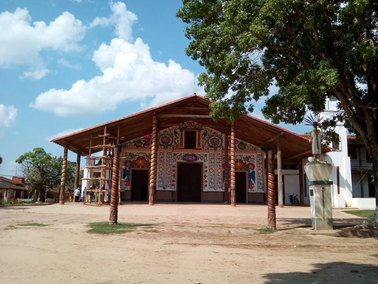

San Ignacio de Moxos
Once a year, the warriors return. They wear towering crowns of feathers, and they move through the streets of San Ignacio de Moxos in slow, deliberate ritual, twelve of them, dancing the story of a battle and a conquest that is not quite the one the Jesuits wrote down. This is the Ichapekene Piesta, and to witness it is to watch a people fold a Spanish saint into their own cosmology, keeping what the missionaries brought while never surrendering what they already knew. San Ignacio is a modest town in the wet heart of the Bolivian Beni. For a few days each year, it becomes the spiritual capital of the Moxeno world.
The Macheteros' Dance
The Ichapekene Piesta unfolds each year between July 30 and August 2, in homage to Saint Ignatius of Loyola, the town's patron. At its center is a retelling of the saint's victory, but performed through indigenous Moxeno eyes. Twelve sun warriors in spectacular plumage battle the guardians of the holy flag, the original owners of the land, in a syncretic drama that fuses Jesuit evangelism with the community's own founding myth. The most iconic dancers are the Macheteros, whose enormous feathered headdresses, radiating like the rays of the sun, have become the visual signature of the entire festival. In 2012, UNESCO inscribed the Ichapekene Piesta on its list of Intangible Cultural Heritage of Humanity, recognizing a celebration that belongs wholly to the people who keep it.
A Mission Reborn as a Town
San Ignacio de Moxos was founded in 1689 by the Jesuit missionaries Antonio de Orellana, Juan de Espejo, and Alvaro de Mendoza, one of the string of reductions the order planted across these wetlands. The first site sat some twenty miles south of where the town stands today. Like much of the Beni, it owes its grid, its church, and its calendar of saints to that colonial project. But the Moxeno people who were gathered here did not simply disappear into the missionaries' design. Their language survives, their music survives, and above all their great festival survives, carrying an indigenous memory forward inside a Catholic frame.
The Language That Endures
Walk the streets and you will hear Camba Spanish, the warm lowland dialect that serves as the town's common tongue. But listen more carefully and another language threads through daily life. Ignaciano, a dialect of the Moxo language family, remains the main indigenous speech of San Ignacio, spoken in homes and woven into the songs and rituals of the festival. Languages like this one are fragile things, easily lost in a single generation. That Ignaciano persists at all is a quiet act of cultural endurance, a refusal to let the old words slip away even as Spanish presses in from every direction.
The Wettest Corner of the Beni
San Ignacio sits in the wettest region of the Beni, perched at just 144 meters above sea level beside Laguna Isiboro, a lake of some twenty square kilometers spreading west of the town. This is borderland in a geographic sense, the seam where the Amazon rainforest of the Chapare meets the monsoonal grasslands, the llanos, of the surrounding lowlands. Rain falls generously through most of the year, and even the short dry season does little to cool the steady tropical heat. The result is a landscape of water and green, of flooded savanna and forest edge, where roughly ten thousand people live in a town that holds tight to the rhythms of both the rains and the ritual calendar.
From the Air
San Ignacio de Moxos lies at 14.99 degrees south, 65.64 degrees west, at an elevation of about 144 meters in the low, wet plains of the Beni Department, roughly 100 kilometers southwest of Trinidad. The broad oval of Laguna Isiboro sits just west of town and makes an excellent visual landmark from the air, a bright sheet of water amid green savanna. A viewing altitude of 4,000 to 6,000 feet AGL reveals the patchwork of seasonally flooded llanos surrounding the settlement. The nearest major airport is Trinidad's Jorge Henrich Arauz Airport (ICAO SLTR) to the northeast; Santa Cruz's Viru Viru International (SLVR) lies farther southeast. Expect heavy cloud and saturated ground through the long rainy season; the clearest flying conditions come in the brief dry window from roughly June to September. Visibility can drop quickly when afternoon storms build over the Amazon margin.
Nearby Stories
- Trinidad, Beni 26 km away
- Mojeños 56 km away
- Isiboro Secure National Park and Indigenous Territory 64 km away
- San Borja 73 km away
- Mamoré River 79 km away
- San Miguel del Bala 153 km away
- San Joaquín 196 km away
- Bala Gorge (Bolivia) 209 km away