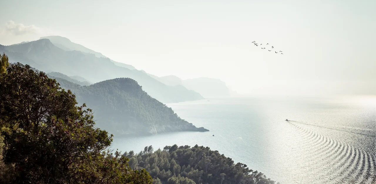

Serra de Tramuntana
UNESCO did not protect the Serra de Tramuntana for its mountains alone. When the range along Mallorca's northwest coast was declared a World Heritage Cultural Landscape in 2011, the honor recognized something built by hand: a thousand years of terraces, water channels, and dry stone walls, mile upon mile of them, stacked without mortar across impossibly steep ground. This is a landscape that people carved. Behind its limestone bluffs and gnarled olive groves lies the patient labor of generations who turned near-vertical slopes into farmland, one balanced stone at a time.
A Range of Contradictions
The Serra de Tramuntana is not one thing. As a comarca, a geographical region, it gathers thirteen municipalities and some of the most contrasting country on the island. Its southern end brushes the outskirts of Palma, Mallorca's busy capital, and its southwestern tip holds the loud package-holiday resorts of Magaluf and Santa Ponsa, where pop music blares into the small hours. Yet turn inland and up, and within a few kilometers the noise falls away into pine woods, terraced orchards, and stone villages that empty out in winter. The single mountain road, the Ma-10, twists the entire length of the range from Andratx in the southwest to Pollença in the north, stitching these opposites together along one dizzying spine.
Chopin's Bitter Winter
The range has drawn artists and exiles for two centuries, not all of them happy. In the winter of 1838, the composer Frédéric Chopin came to Valldemossa with the French writer George Sand, lodging in the cells of the town's former Carthusian charterhouse, once a royal palace, later a monastery. The stay was meant to restore Chopin's failing health; instead the cold and damp worsened his tuberculosis, and the couple left after a few miserable months. Sand later wrote a caustic book about the experience. Farther along the coast at Deià, the English poet Robert Graves made a far more lasting home, living there for decades and lying buried in the village churchyard. The mountains, it seems, keep whoever they choose.
The Human Landscape
To understand why UNESCO cared, leave the congested roads. On the pilgrimage and hiking trails the terraces come into focus: retaining walls of dry-stacked limestone holding narrow shelves of soil where olives and citrus grow, fed by channels and cisterns that manage every drop of mountain water. The gnarled olive trees, some of them centuries old, are themselves monuments. The eight-day Ruta de Pedra en Sec, the GR221 or dry stone route, runs the length of the range from Andratx to Port de Pollença, following the old stone paths built by the people who worked this land. Walking it, you pass through the working memory of the mountains, where labor and landscape became indistinguishable from each other.
Fire, Pirates, and a Vanishing Sun
Local festivals here run to fire and memory. In Sóller the Correfoc, or fire run, sends costumed demons streaming through the streets amid showers of sparks, while the town's Es Firo re-enacts a real Algerian pirate raid repelled centuries ago. These are old rhythms, tied to saints' days and sea-borne threats that once shaped island life. Something rarer is coming too. On the evening of 12 August 2026, a total solar eclipse will sweep across Mallorca, with totality reaching the northwest coast around 20:31 as the sun hangs just a couple of degrees above the sea. For roughly a minute and a half, the mountains will fall dark, the horizon will flare, and the range will witness a sunset and an eclipse at the very same moment.
The Crowded and the Quiet
For all its wildness, the Serra is easy to enter and hard to escape into. A heritage narrow-gauge train rattles from Palma to Sóller, where a vintage tram carries visitors down to the port, and both are packed with tourists for much of the year. The Ma-10 delivers a steady stream of cars to the miradors and hill villages, and residents of Valldemossa, Sóller, and Pollença have grown weary of the summer crush. Yet the crowds cluster tightly around the roads and famous towns. Step onto the trails, into the terraced groves and along the dry stone walls, and the mountains still offer the solitude that made them worth protecting in the first place.
From the Air
The Serra de Tramuntana runs the length of Mallorca's northwest coast, from Andratx in the southwest to the Cap de Formentor headland in the north; its geographic center sits near 39.81°N, 2.79°E. The dominant landmark is Puig Major (1,445 m), the range's highest peak, easily identified by the white military radar dome on its closed summit. A viewing altitude that keeps you well above the 5,000-ft ridgeline shows off the whole corrugated spine dropping into the sea. Note restricted military airspace around Puig Major. The main field is Palma de Mallorca (LEPA) on the island's southeast side, with Son Bonet (LESB) nearby; approach from the southeast, as the coastal cliffs on the northwest side generate turbulence and rapidly shifting mountain weather.
Nearby Stories
- Palace of Marivent 2 km away
- Fundacion Yannick y Ben Jakober 3.4 km away
- Coves dels Hams 13 km away
- Cala de Sant Vicent 69 km away
- Portinatx 93 km away
- Battle of Ebro River 127 km away
- Llobregat Delta 143 km away
- Cosquer Cave 396 km away