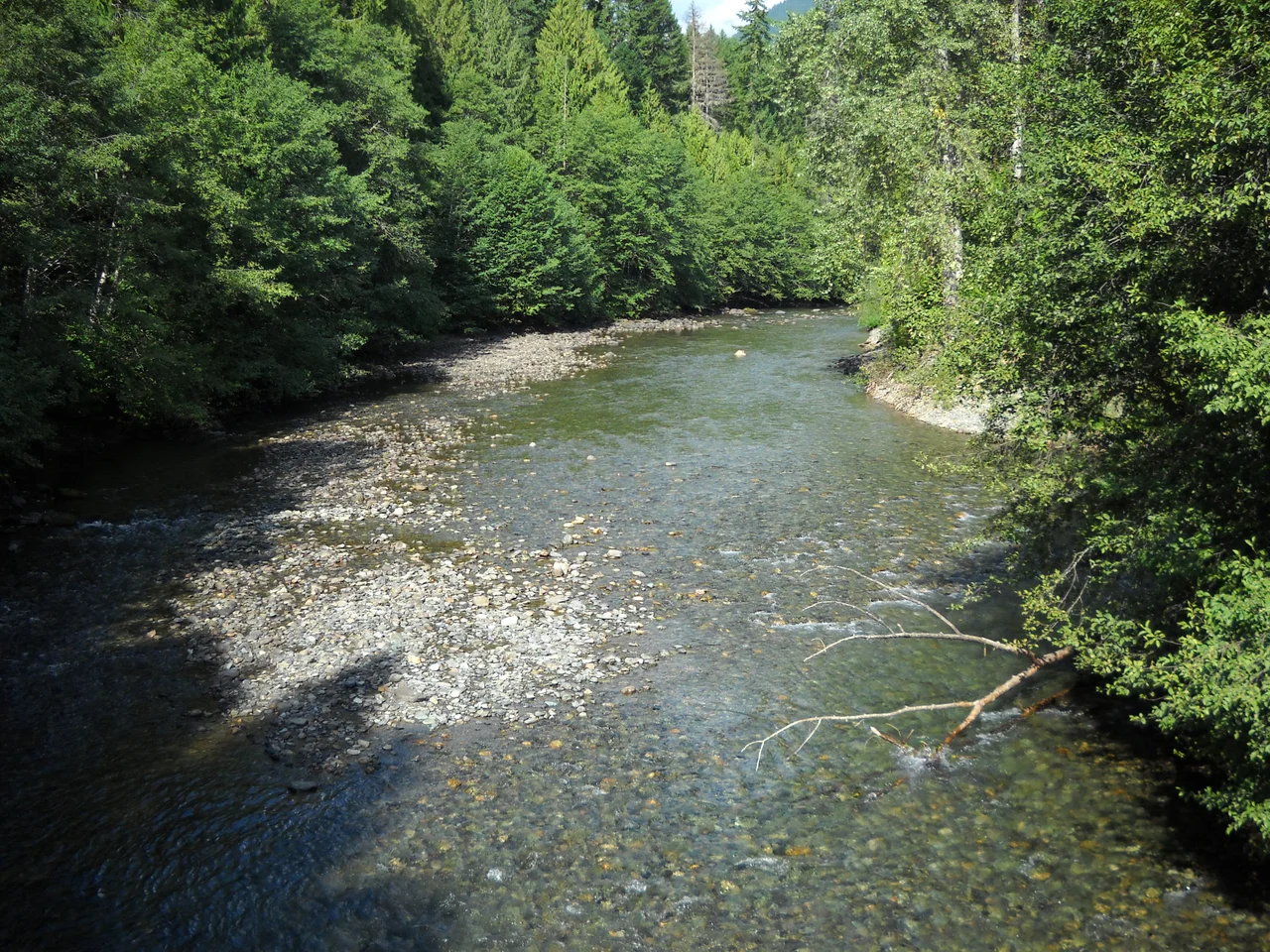

Skagit River
For decades the Skagit simply would not let anyone upstream. Two ancient logjams filled the lower river, and settlers coming in during the late 1800s got no farther than the tip of the delta, where they founded a village called Skagit City. In 1874 a crew of loggers began dismantling the larger jam, about ten miles up from the mouth, salvaging the timber as they went. Three years into the work, a five-acre section broke loose and scattered downriver. The river opened. Mount Vernon was founded at roughly the spot where the jam had been.
From Allison Pass to Skagit Bay
The river rises at Allison Pass in the Canadian Cascades and runs about 150 miles, draining 1.7 million acres of mountain country. It swings northwest alongside the Crowsnest Highway through Manning Provincial Park, turns hard south, gathers the Sumallo and the Klesilkwa, and slides into Ross Lake, crossing into Washington underwater. Below there it is a worked river: Ross, Diablo and Gorge dams in succession, with a stretch past Gorge Dam that often runs dry because the water is inside a penstock instead. Flow returns at Newhalem, a Seattle City Light company town. Then come the tributaries - the Cascade at Marblemount, the Sauk at Rockport, the Baker near Concrete - and a slow agricultural valley through Sedro-Woolley, Burlington and Mount Vernon before the river splits into north and south forks around Fir Island and empties into Skagit Bay.
A River That Changed Its Mind
The Skagit's shape was dictated by ice. The Puget Lobe of the Cordilleran Ice Sheet advanced and retreated repeatedly, and each time its moraines dammed the river, pooling it into lakes and shoving its outflow south toward what is now the North Fork Stillaguamish. When the ice finally withdrew, the river breached the moraine dam near Concrete and found the course it holds today. The Sauk and Suiattle kept draining south until eruptions of Glacier Peak choked them with debris and built an alluvial fan near Darrington, deflecting both north into the Skagit. Above Newhalem the river runs through a startlingly deep gorge that does not match the broad glacial valley below it. One explanation is that the upper Skagit once drained north into Canada, and that successive ice advances blocked it, forced it southward, and let it cut so deep that when the ice was gone for good the river never went back.
All Five, Still Running
The Skagit is the only large river system in Washington with healthy populations of all five native salmon species - chinook, coho, chum, pink and sockeye - along with steelhead and coastal cutthroat trout. That abundance feeds one of the largest wintering bald eagle populations in the contiguous United States. The birds arrive in late October and November for the chum and coho carcasses, stay into February, and peak in January; in a good salmon year, six to eight hundred eagles gather along the river, some of them having come from inland Canada, Alaska and Montana. Downstream, thousands of snow geese winter in the estuary, feeding on intertidal bulrush and on potatoes left in the neighbouring fields, and several hundred trumpeter swans share the valley with them from October through February. The tidal estuary once held beaver dams that flooded over at high tide and sheltered juvenile salmon in their ponds at low.
Wild, Scenic, and Thoroughly Employed
In 1978 Congress created the Skagit Wild and Scenic River System, protecting 158.5 miles of the Skagit and its Sauk, Suiattle and Cascade tributaries for their free-flowing character, water quality, and outstanding wildlife, fish and scenic values. It is an unusually mixed inheritance: half the system is privately owned, 44 percent is National Forest, and the remaining six percent belongs to the state and other agencies, with the U.S. Forest Service managing it through the Mt. Baker-Snoqualmie National Forest. Upstream, the three dams built in the 1920s and 1930s remain a primary power source for Seattle - the Skagit River Railway was constructed by the city just to haul workers and materials to the construction sites. Whitewater rafting and fly fishing now share the water with the turbines.
The River Still Wins Arguments
Floods are not history here. In November 1897 the Skagit flooded severely, and as the water dropped it left two fresh logjams behind - the larger one filling the channel bank to bank for some 800 yards near the mouth. Crews cleared it in about a month using a purpose-built logjam removal boat named Skagit. More recently, November 2017 brought heavy flooding to Mount Vernon and Lyman, and in December 2025 two atmospheric river events produced record flooding on the lower river, cresting just under 38 feet at Mount Vernon on 12 December and drawing federal disaster relief for the state. In May 2013 the river took something else: the four-lane Interstate 5 bridge between Burlington and Mount Vernon collapsed into it. That one was back open within a month.
From the Air
The lower river sits near 48.3872 N, 122.367 W at Mount Vernon. Skagit Regional Airport (KBVS) lies just west of the river between Burlington and Mount Vernon; Bellingham International (KBLI) is about 40 km north, Arlington (KAWO) to the south, and Orcas Island (KORS) west across the water. Fly the delta at 2,000-3,000 ft: the Interstate 5 crossing, the split into north and south forks around Fir Island, and the geometric farm blocks of the Skagit flats are unmistakable, with Mount Baker standing to the northeast. Following the river upstream is a different proposition - the valley narrows past Concrete and Marblemount into North Cascades terrain, and the three reservoirs appear in sequence, Diablo Lake conspicuously turquoise from glacial flour. Expect radiation fog over the delta on calm autumn mornings, fast-changing mountain weather and rising terrain upriver, and large concentrations of wintering waterfowl and eagles at low level from November through February.
Nearby Stories
- Saratoga Passage 1.9 km away
- Glacial Erratic Boulders of the Puget Sound Region 3.1 km away
- San Juan Island 12 km away
- Saturna Island 13 km away
- Mount Baker 16 km away
- Hurricane Ridge 35 km away
- Snoqualmie Valley 54 km away
- North Cascades National Park 80 km away