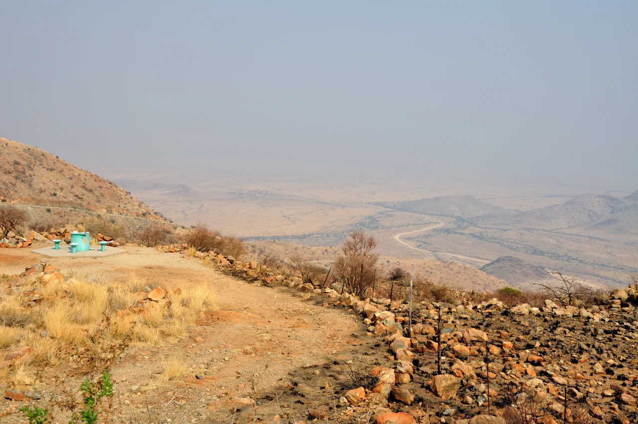

Spreetshoogte Pass
The trucks are not allowed down. Even the graders that keep this road alive climb up Spreetshoogte and leave by another pass entirely, because a vehicle with failing brakes here has nowhere to go but down, fast, into the Namib. This is the steepest pass in Namibia, and it does not pretend otherwise. In four kilometers of dirt and stone, the road sheds almost a thousand meters of altitude, dropping from the cool, grassy roof of the Khomas Highland onto the floor of one of the oldest deserts on Earth. You feel the change in your ears before you see it in the light.
The Edge of the Highland
Southern Africa is cut nearly in half by the Great Escarpment, a long geological step where the high interior plateau breaks away and tumbles toward the coastal lowlands. Spreetshoogte traverses that step at one of its most abrupt points. At the top, the road sits at 1,822 meters, where the air is thin and the grass of the Khomas Highland rolls away in pale gold. Then the land simply ends. Ahead and below, the Namib stretches to a hazy horizon, its gravel plains and distant dune fields lit by a sun that seems closer down there. The gradient runs as steep as one in four and a half, among the most severe of any public road on the continent.
One Farmer, Stone by Stone
The pass carries the name of Nicolaas Spreeth, a farmer who built it during the Second World War. Spreeth owned the farm Ubib at the foot of the escarpment, and his problem was a practical one. Goods bound for him were dropped at a bus stop on the farm Namibgrens, high on the mountain above. To collect them, he could detour roughly thirty kilometers south by way of the Remhoogte Pass, or he could climb the cliff on foot, following paths that zebra had worn into the slope over generations. Spreeth chose a third option. He carved a road down the escarpment himself, by hand, turning the animals' route into something a wagon could manage. The Afrikaans name means simply Spreeth's Heights.
A Road That Demands Respect
Modern Spreetshoogte is no leisurely scenic drive, and the authorities make that clear. Trucks and caravans are forbidden. The road is mostly unpaved, narrow, and unforgiving, and even Namibia's Roads Authority sends its maintenance vehicles up the pass rather than down, returning by the gentler Remhoogte route to keep the risk of runaway brakes to a minimum. Drivers in ordinary cars take it slowly, riding the low gears, watching the temperature of their brakes as much as the view. The road today forms part of the district route from Rehoboth toward Solitaire, passable only for vehicles without trailers, and most of its surface is loose dirt and gravel that punishes speed. For those who make the descent with care, the reward is one of the great transitions in Namibian travel: from highland to hyper-arid desert in a span you could walk in an afternoon.
The View From the Rim
At the summit there is a simple rest place, a viewpoint built where the highland gives way to nothing. From here the desert reveals its scale. Light moves across the Namib in slow washes through the day, and at dawn or dusk the low sun rakes the gravel plains into long shadows and bands of ochre and rose. After the rare rains, as photographers found at the end of the 2006 wet season, the slopes below briefly flush green before the desert reclaims them. It is a place that rewards stillness. Most visitors come for the drive, but the pass is most itself when you stop at the top, cut the engine, and simply look out over the oldest desert on the planet.
From the Air
Spreetshoogte Pass lies in central Namibia at approximately 23.66 degrees south, 16.19 degrees east, on the Great Escarpment between the Khomas Highland and the Namib Desert. The summit sits near 1,822 meters, and the escarpment edge here is a dramatic, knife-clean line where high grassland drops nearly 1,000 meters to the desert floor below. For aerial viewing, this east-facing cliff is best appreciated in early morning light, when the rising sun illuminates the escarpment wall and rakes shadows across the Namib plains to the west; afternoon haze can soften the contrast. The nearest major airport is Hosea Kutako International (ICAO: FYWH) near Windhoek, roughly 150 km to the northeast. Eros Airport (ICAO: FYWE) in Windhoek serves smaller charter and general-aviation traffic. Mountain turbulence and strong thermals off the escarpment are common over midday; expect rising air on the highland side and sinking air over the desert.
Nearby Stories
- Rehoboth, Namibia 22 km away
- South West Africa 73 km away
- Gobabeb Namib Research Institute 79 km away
- Namib-Naukluft National Park 87 km away
- Namib 94 km away
- Heroes' Acre (Namibia) 109 km away
- Fairy Circles 124 km away
- Mukurob 220 km away