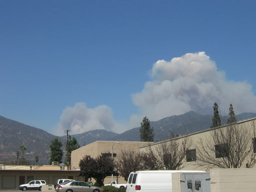
Station Fire (2009)
The fire started near the U.S. Forest Service Angeles Station 11 ranger station on the Angeles Crest Highway on August 26, 2009. Investigators would later determine it was set deliberately. By the time rain extinguished it on October 16, it had consumed 160,557 acres of the Angeles National Forest — the largest wildfire in the modern recorded history of Los Angeles County, surpassing the 105,000-acre Clampitt Fire of 1970. The entire mountain backdrop to the eastern San Fernando Valley and Pasadena was on fire for nearly two months.
Two Firefighters Lost
On August 30, four days into the fire, Captain Tedmund Hall and Firefighter Specialist Arnie Quinones died when their fire truck fell off a steep hillside near Los Angeles County Fire Department Camp 16 by Mount Gleason. They had been supervising inmate fire crews — joint teams operated by the county fire department and the California Department of Corrections — conducting backfire operations to protect personnel and the camp from the advancing fire front. Their deaths triggered a homicide investigation alongside the arson case. The $94.7 million cost of the firefighting effort was a measure of what it took to contain a fire that burned for fifty-one days through rugged terrain.
What Was at Stake
The fire burned on the slopes of Mount Wilson, threatening television, radio, and cellular antennas on the summit that provide service to millions of people across the Los Angeles basin. The Mount Wilson Observatory — which houses historically significant telescopes and astronomical research facilities operated by UCLA, USC, UC Berkeley, and Georgia State University — was directly in the fire's path at various points. The observatory survived. Twelve thousand structures in the national forest and in nearby communities including La Cañada Flintridge, Pasadena, Glendale, Acton, and Altadena were threatened. Many residents faced mandatory evacuation orders.
Aftermath and Policy Change
The Station Fire closed a 40-mile stretch of Angeles Crest Highway until 2010. It left behind charred slopes visible for years on the mountain wall above the San Gabriel Valley, a landscape that slowly recovered through chaparral regrowth but took a generation to resemble its former state. The deaths of Hall and Quinones and the scale of the fire also produced a lasting policy change: the U.S. Forest Service had banned night flights in wildfires since a helicopter pilot died in 1977. In 2012, responding to lobbying led by Representative Adam Schiff, the agency ended that ban — a direct consequence of lessons learned during the Station Fire's difficult containment.
From the Air
The Station Fire burned centered on the Angeles National Forest at approximately 34.251°N, 118.195°W, in the San Gabriel Mountains north of Pasadena and Glendale. Mount Wilson (elevation 5,710 ft MSL) is a prominent landmark and navigation point. The burn scar remained visible from the air for many years. Aircraft should maintain adequate altitude and be aware of mountain wave turbulence and rapidly changing weather in this terrain. The nearest airports are El Monte (KEMT) to the south and Brackett Field (KPOC) to the east.
Nearby Stories
- Amgen 4.9 km away
- Compton, California 8 km away
- Silverado Fire 21 km away
- War Eagle Field 28 km away
- San Bernardino Train Disaster 40 km away
- Santa Barbara Island 54 km away
- Calico: The Ghost Town Walter Knott Saved 99 km away
- The San Andreas Fault at Carrizo Plain 101 km away