
Tatun Volcanic Group
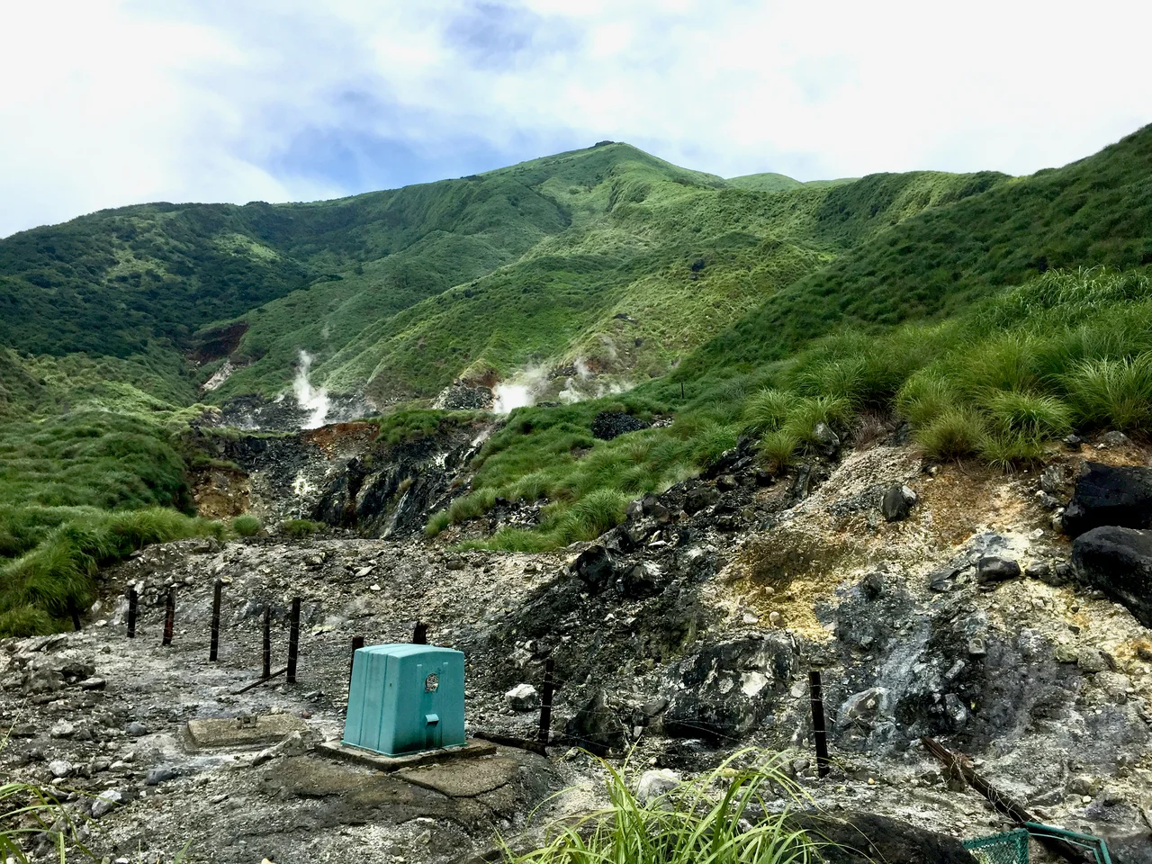
Taipei is a city of ten million people that happens to sit beside a volcano field. The Tatun Volcanic Group — a cluster of andesitic lava domes and craters rising 15 kilometers north of the city center — last erupted in the year 648, which sounds safely distant until you consider that geologists classify anything active within the past 10,000 years as a living system. As of 2005, fumaroles were still venting volcanic gas from the group's slopes. Hot springs heated by the same subsurface energy bubble up through Beitou District at the city's northern edge. The Tatun volcanoes are not erupting. But they have not gone cold either.
Two Million Years in the Making
The Tatun Volcanic Group formed through episodic volcanism spanning roughly 2.8 to 0.2 million years — a geologically recent origin by the standards of mountain building. The volcanism was not a single event but a series of eruptive episodes that built up a complex of peaks, craters, and lava domes across the northern tip of Taiwan, where the island meets the East China Sea.
The group includes multiple volcanic edifices — andesitic lava domes whose material is the same kind of intermediate-composition magma found in subduction-zone volcanic arcs throughout the Pacific Rim. Taiwan's position at the convergence of the Philippine Sea Plate and the Eurasian Plate makes it one of the geologically most active islands on earth, and the Tatun field sits directly above the subduction system that has been building and re-shaping the island for millions of years. The volcanoes are not an anomaly in this landscape. They are the most visible expression of forces operating continuously beneath the surface.
Sulfur, Craters, and the Smell of the Earth
Early visitors to northern Taiwan could hardly miss the evidence. In the early twentieth century, travelers and administrators recognized the North Range of hills — called Daitonzan in Japanese and Twa-tun in Hokkien — for their exceptional sulfur deposits. The sulfurous smell was a navigational feature before it was a scientific one: you knew where you were by what the ground was breathing.
The craters themselves were substantial. In the North Range between Tamsui and what is now Jinshan, there were three craters. The largest, the North Hill crater, measured over 700 feet in diameter and approximately 400 feet deep — a pit large enough to be visible from a distance, sometimes filled with water that took on the colors of mineral-laden volcanic lakes. Those craters are quieter now, but the fumaroles that continued to vent gas as recently as 2005 confirm that the system below is not simply dormant in the way a completely spent volcano is dormant. The heat persists.
Hot Springs at the City's Edge
The most accessible evidence of the Tatun group's continuing geothermal activity is Beitou, the hot spring district at the northern edge of Taipei. Beitou's waters are heated by the same volcanic system, and the district became famous during the Japanese colonial period when the hot spring resorts attracted visitors from across the island and from Japan itself. Today Beitou is a short metro ride from central Taipei, its public baths and private ryokans fed by water that rises from the volcanic heat below.
The Tatun field also underlies Yangmingshan National Park, the protected highland directly above the city, where steam vents appear among the hiking trails and the smell of sulfur follows you on certain routes. The park's landscape — open caldera grasslands, wooded ridges, wildflowers in spring — sits on top of a geothermal system of considerable scale. It is one of the more unusual national parks in Asia: a volcanic landscape within city limits, managed for both recreation and the long-term scientific monitoring of a system that is not fully understood.
A World Heritage Nomination and an Ongoing Watch
In 2002, the Tatun Volcanic Group was listed as a potential World Heritage Site by Taiwan's government — a designation that recognized both its geological significance and the challenge of protecting a volcanic landscape immediately adjacent to one of Asia's most densely populated cities. The nomination reflects what geologists have long argued: the Tatun group is scientifically important precisely because of its proximity to Taipei, making it one of the world's most accessible volcano fields for urban populations to observe and study.
That proximity is also the source of ongoing concern. Research published in 2005 detected active seismic and volcanic signals at the Tatun group, and monitoring networks have tracked the field's subsurface activity since. The last eruption in 648 CE left no record of what the people who experienced it witnessed or survived; the written history of Taiwan does not reach that far back in detail. What the geological record preserves is the event itself, encoded in rock. The volcanoes above Taipei have erupted before. The question scientists continue to study — carefully, with instruments, in a national park full of hikers — is not whether the system is dead, but what it might yet do.
From the Air
The Tatun Volcanic Group is centered at approximately 25.1714°N, 121.5550°E, crowning the ridgeline that forms the northern backdrop of Taipei. From Taipei Songshan Airport (RCSS), fly north-northwest; the volcanic highland is unmistakable — the ridgeline of Qixing Mountain (the highest peak in the group at approximately 1,120 meters) rises clearly above the urban grid. At higher altitudes on a clear day, the caldera landscape, open grasslands, and subtle steam venting from fumarole areas within Yangmingshan National Park may be visible. Taoyuan International Airport (RCTP) lies roughly 35 km to the southwest. The volcanic terrain rises steeply — Qixing Mountain tops out near 3,675 ft — so appropriate terrain clearance is essential when flying north of Taipei. Recommend 5,000 ft MSL or above to clear the ridgeline safely; below that, maintain awareness of rapidly rising terrain.
Nearby Stories
- Sanxia Car Attack 9.6 km away
- Dapu Incident 28 km away
- 2022 Chinese Military Exercises Around Taiwan 45 km away
- North Jiangsu Main Irrigation Canal 960 km away
- General Cliff Rock Paintings 1031 km away
- Sinking of MV Sewol 1042 km away
- Yellow Sea 1091 km away
- Twin Forts of Romblon 1377 km away