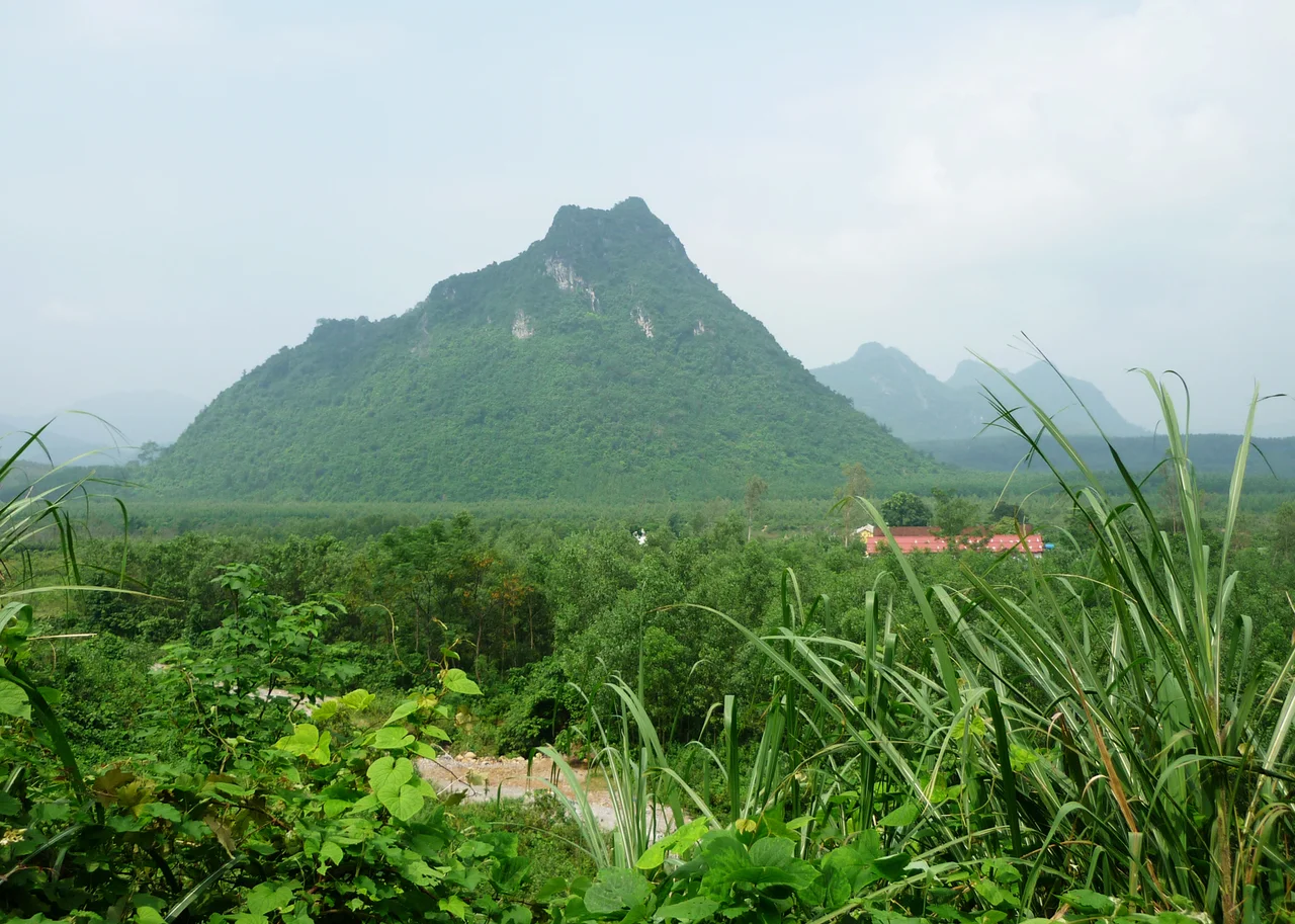

The Rockpile
A Marine reconnaissance team who saw it on July 4, 1966, reached for the most honest description available: a "toothpick-type mountain stuck out in the middle of an open area with a sheer cliff straight up and down." The Rockpile — known in Vietnamese as Núi Một — rises almost 790 feet from the floor of the Cam Lo River valley, a karst tower that looks as though it was placed there by a god with a sense of theater. Its summit is 40 feet long and 17 feet wide, barely larger than a tennis court, flat enough to serve as a helicopter landing pad. And from that improbable perch, on a clear day, you could see ships on the South China Sea twenty miles to the east, and the mountains of Laos to the west.
Stone at the Center of Everything
The Rockpile's strategic importance was written into its geography. It stood at the junction of five major valleys, less than ten miles from the DMZ, one kilometer north of Route 9 — the main highway connecting the coast to the Laotian border. Any force that controlled The Rockpile could watch the network of infiltration routes that North Vietnamese units used to move troops and supplies from the Ho Chi Minh Trail into the coastal lowlands. From the summit, American Army technicians operated sophisticated detection and communication equipment, monitoring PAVN movements across the entire northern I Corps region. The mountain's height meant it was virtually impossible to take by ground assault: the PAVN tried several times in 1966, scaling parties turned back by the sheer faces, mortar rounds ineffective against rock that old and hard. Once the Marines were on it, they stayed.
Life at the Top of the World
A twenty-man contingent — mostly Army technicians with a Marine officer — typically rotated through the summit every thirty days. By the grim arithmetic of the DMZ, it was considered a desirable posting. The fortress-like pinnacle made a ground attack almost impossible, and the small garrison was never seriously threatened once American control was established. Marines called it one of the safest places along the DMZ, which is a testament to the dangers elsewhere rather than any real comfort at 790 feet above a contested valley. Supply came entirely by helicopter; pilots had to abort approaches when fog closed in or winds exceeded fifty miles per hour, which in the monsoon season was often. The main body of troops — the battalion that defended the area at the base — occupied Elliot Combat Base in the valley below, from which they launched operations along Route 9 and into the surrounding ridges.
Eyes Over the Infiltration Routes
What made The Rockpile matter most was what its observers could prevent. Route 9 — running parallel to the DMZ from Dong Ha through Khe Sanh and into Laos — was both a supply artery for American forces and a potential ambush corridor for North Vietnamese units. Mountains on either side of the road near The Rockpile gave the PAVN natural cover from which to hit allied convoys. The Rockpile's observers could spot these preparations from the air and call in artillery or airstrikes before ambushes were sprung. More broadly, American occupation of The Rockpile forced PAVN forces to use more difficult and more exposed infiltration routes further west, closer to Laos. The battle for the terrain around the mountain was thus fought not just at The Rockpile itself but in every kilometer of rerouted North Vietnamese movement it imposed.
The Third Battalion's Mountain
Just as Mutter's Ridge became inseparable from the 3rd Battalion, 4th Marines who fought for it, The Rockpile was the 3rd Battalion, 3rd Marines' mountain. From 1966 to 1969, that battalion rotated through the position repeatedly, defending it, patrolling from its base, absorbing casualties and doing the slow, unglamorous work of holding ground in a war where holding ground was both essential and insufficient. The Marines who served there — some for a week, some for two months — knew the landing pad on the summit, knew the valley below, knew the sound of helicopters fighting the wind to come in with supplies. When the battalion rotated out, another unit came in. The mountain remained. Today it still rises from the Cam Lo River valley, its limestone faces unchanged, its summit empty, visible to travelers on Route 9 below as a distinctive silhouette against the sky of central Vietnam.
From the Air
Located at 16.7805°N, 106.852°E, approximately 16 miles west of Dong Ha in Quảng Trị Province. From the air, The Rockpile is unmistakable — a sharp karst pinnacle rising abruptly from the flat valley of the Cam Lo River, clearly visible just north of Route 9. Recommended viewing altitude: 1,500–3,000 feet to appreciate the dramatic relief of the tower above the valley floor. The relationship between The Rockpile, Route 9, Mutter's Ridge (to the north), and the surrounding valley network is best appreciated from 4,000–5,000 feet. Nearest airports: Phu Bai International Airport (VVPB), approximately 55 km to the southeast near Huế; Đồng Hới Airport (VVDH), approximately 80 km to the north.
Nearby Stories
- Central Coast (Vietnam) 15 km away
- Hoằng Phúc Temple 15 km away
- DMZ Campaign (1969–1971) 19 km away
- Grès supérieurs Formation 30 km away
- Southern Laos 39 km away
- Operation Delaware 48 km away
- Hin Namno National Park 52 km away
- Bach Long Vi Island 347 km away