
2020 Calabasas helicopter crash
The helicopter had flown the same route the day before without incident. The thirty-minute flight from John Wayne Airport to Camarillo was a routine Kobe Bryant commute — a workaround for the two-hour drive between his Newport Beach home and the Mamba Sports Academy in Newbury Park, where he coached his daughter's basketball team. On Sunday morning, January 26, 2020, the fog was different. The hills around Calabasas were inside the clouds, and a 1991 Sikorsky S-76B registration N72EX struck a hillside at an elevation of approximately 1,085 feet. All nine people aboard were killed.
Nine People
The passengers were not strangers. Kobe Bryant, 41, had retired from the Los Angeles Lakers in 2016 after a 20-year career and had turned his attention to coaching. Beside him was his 13-year-old daughter Gianna. John Altobelli — head baseball coach at Orange Coast College — was flying with his wife Keri and their 14-year-old daughter Alyssa, Gianna's teammate. Sarah Chester and her 13-year-old daughter Payton were also on board; the girls were friends. Christina Mauser, an assistant basketball coach at the academy, was in the passenger compartment. Up front was Ara Zobayan, Bryant's preferred pilot, who had been flying him on Island Express helicopters since 2015. The helicopter crashed and caught fire near the intersection of Las Virgenes Road and Willow Glen Street at 9:47 a.m. The fire was difficult to extinguish because of the magnesium in the aircraft, which reacts with both oxygen and water. By 10:30 a.m., the blaze was out. All nine occupants died from blunt trauma.
Into the Clouds
Air traffic controllers first contacted Zobayan at 9:40 a.m. and warned him that at his altitude, they would soon lose both communication and radar contact. They advised him to squawk VFR — to transmit the standard visual flight rules transponder code — until he could reach Camarillo on the radio. The minimum visibility for operating under those rules is two miles. The NTSB later determined that at the moment of impact, visibility in the area was estimated between one and two miles. The helicopter climbed to 1,400 feet, then began a rapid descent. The last recorded ADS-B signal, at 9:45:36 a.m., showed an altitude of 1,295 feet. Ten seconds later, the aircraft struck the hillside. Island Express Helicopters, which owned the helicopter, was not certified to fly in instrument conditions. The NTSB found no evidence of engine failure. The probable cause it ultimately identified was spatial disorientation — the pilot, having flown into thick clouds in violation of VFR requirements, lost his sense of which way was up and could not recover.
What Followed
TMZ confirmed Bryant's death at 11:24 a.m., less than two hours after impact. The news hit the country like a physical event. That afternoon, the FAA imposed a five-mile no-fly zone around the crash site at the request of Bryant's wife Vanessa, to protect the victims' privacy and prevent souvenir hunters from entering the area. Within days, reports emerged that Los Angeles County sheriff's deputies had taken and shared unauthorized photographs of the crash scene. California subsequently passed legislation making that kind of unauthorized photography by first responders a misdemeanor. The legal proceedings that followed stretched for years. A 2022 jury awarded Vanessa Bryant $16 million and co-plaintiff Chris Chester — whose wife and daughter were also killed — $15 million in damages from the county, citing invasion of privacy and infliction of emotional distress. During that trial, testimony described deputies sharing and joking about graphic photographs of the victims' remains.
The Aircraft's History
The helicopter that crashed had its own biography. Built in 1991, the Sikorsky S-76B was owned by Island Express Holding Corporation, based in Fillmore, California. Before 2015, it had been owned by the state of Illinois, which used it to transport governors and other officials. The state flew it as N761LL from 2007 to 2015, then sold it for $515,161. Island Express converted its passenger compartment from a twelve-seat to an eight-seat configuration. It was not equipped with a terrain awareness and warning system — a technology the NTSB had recommended for helicopters of its class after a 2004 crash, though the FAA never enforced that recommendation. The wreckage was transported to Phoenix for analysis. The hillside where it went down is public land at the upper end of Malibu Canyon, managed by the Las Virgenes Municipal Water District and the Mountains Recreation and Conservation Authority — terrain that feels remote even though it sits minutes from a freeway.
From the Air
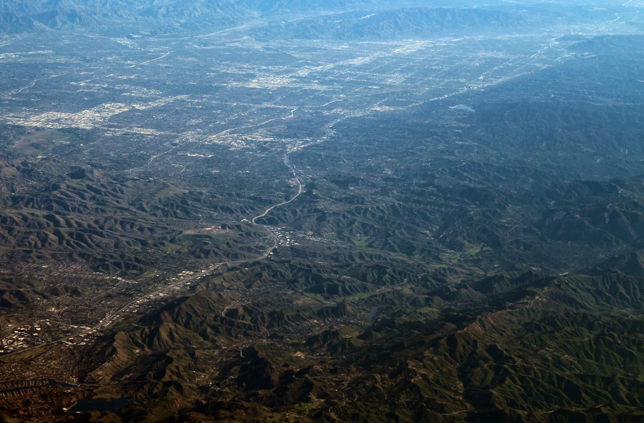
The crash site sits at approximately 34.137°N, 118.692°W in the Santa Monica Mountains near Calabasas, on a hillside above Malibu Canyon. The terrain here rises steeply from the valley floor — hills that regularly trap fog and low clouds during winter mornings. Nearest airports: Van Nuys Airport (VNY) about 10 miles northeast, Camarillo Airport (CMA) about 20 miles west. This was the intended destination of the flight.
Nearby Stories
- Grandma Prisbrey's Bottle Village 4.8 km away
- Battle of San Buenaventura 11 km away
- Historic Wintersburg in Huntington Beach, California 13 km away
- Point Hueneme Light 15 km away
- USS Ingersoll (DD-652) 22 km away
- Mount Lowe Railway 22 km away
- San Nicolas Island 64 km away
- Edwards Air Force Base 73 km away