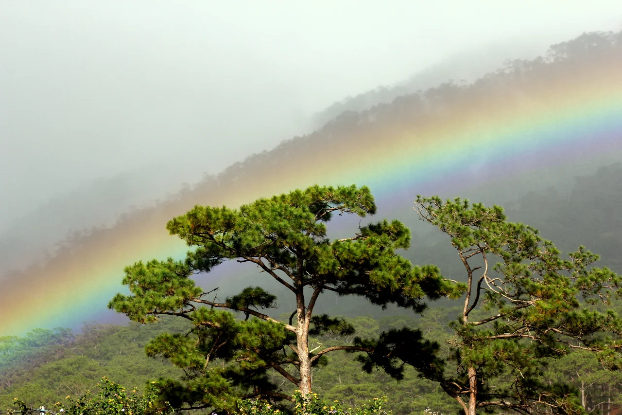

Đà Lạt Plateau
Vietnam is mostly hot. That fact makes the Đà Lạt Plateau — sitting cool and misty above 1,500 meters at the southern tip of the Annamite Range — feel like a different country. The plateau goes by several names: Lâm Viên Plateau, Lang Biang Plateau, Đà Lạt Plateau. All of them point to the same elevated world, spread across parts of Dak Lak, Khánh Hòa, Lâm Đồng, and Ninh Thuận provinces, with the city of Da Lat at its center. The warmest month averages 26.3 degrees Celsius; January drops to 10.5. Clouds drift through pine forests. The plateau's cool stability, while the lowlands sweat through tropical heat, has made it a refuge — for colonial-era French seeking relief from Saigon, for endemic birds that exist nowhere else, and for large mammals that have been pushed from the lowland forests far below.
A Plateau of Many Forests
The Đà Lạt Plateau is not a single habitat but a stacked sequence of them, organized by altitude. Mid-elevation slopes support broadleaf evergreen forest and broadleaf-coniferous mixed forest. Higher up, dwarf forest and mossy forest take over, their trees bent by cloud and wind into shapes that suggest great age. In lower clearings, bamboo and savanna patches open the canopy. October is the wettest month, driving the biological productivity that sustains this variety. The plateau sits at the southern end of the Annamite Range, the long mountain spine that divides mainland Southeast Asia — a position that has allowed species from different ecological traditions to meet and diverge here over millions of years. The result is a place whose biodiversity reflects its history as much as its present climate.
Birds of the Mountain Fog
BirdLife International has designated the plateau an Endemic Bird Area — a recognition that its restricted-range species cannot be found elsewhere. The Vietnamese crested argus, a pheasant of extraordinary plumage, moves through the montane broadleaf evergreen forest with a discretion that belies its size. The short-tailed scimitar babbler, the black-hooded laughingthrush, the white-cheeked laughingthrush, the collared laughingthrush — each occupies slightly different elevations, partitioning the forest by altitude with the precision of specialists who have had centuries to work out the arrangement. The Vietnamese greenfinch prefers pine forest, the grey-crowned crocias rarely ventures above 1,450 meters, the collared laughingthrush regularly reaches 1,500 meters and beyond. The yellow-billed nuthatch creeps along bark. The Vietnamese crested argus stays in the shadows. None of these birds are easy to find. All of them are reason enough to come.
Mammals of the High Forest
The Bidoup Núi Bà National Park, in the plateau's northeastern sector, documents 36 species of small mammals alone — treeshrews, roundleaf bats, horseshoe bats, squirrels, bamboo rats, porcupines. But the large mammals are what command attention. Indochinese tigers still move through the plateau's forests, though in diminishing numbers. Sun bears climb fruiting trees. Clouded leopards, among the most elusive of the world's wild cats, stalk the upper forest. Black-shanked doucs — the same striking primates found in the coastal parks to the east — inhabit the canopy in troops. Gaur, the massive wild cattle of Southeast Asia, graze the forest margins. Yellow-cheeked gibbons call at dawn, their whooping duets carrying across valleys. The Annamese langur, a colobine monkey endemic to the region, moves through treetops in family groups. The plateau functions as a high-elevation refuge for animals that once ranged across a much larger lowland territory.
A UNESCO Biosphere
In 2015, UNESCO designated a portion of the plateau centered on Bidoup-Nui Ba National Park as the Langbiang Biosphere Reserve under its Man and the Biosphere Programme. The designation acknowledges what the biodiversity surveys have long demonstrated: this is a place of global significance, where the interaction between human communities and natural systems has created something worth studying and protecting. The reserve encompasses multiple land use zones — strictly protected core areas, buffer zones where research and light use are permitted, and transition zones where sustainable development is encouraged. The Đà Lạt Plateau has been shaped by human presence for millennia; the biosphere model accepts that reality rather than pretending the landscape can be managed as if people were absent from it.
The City in the Clouds
Da Lat sits at the plateau's heart, a city built by French colonists as a hill station in the early 20th century and still carrying the architectural memory of that origin — villas, French-style churches, pine-lined streets that feel incongruous in tropical Southeast Asia. The colonial impulse that built Da Lat was straightforwardly escapist: the French wanted somewhere cool, somewhere that reminded them of home. They found it here, in a landscape that genuinely is unlike the rest of Vietnam — cooler, quieter, threaded with lakes and gardens. The city has grown far beyond its hill-station origins, but the plateau's mild climate remains its defining characteristic, drawing visitors from the hot lowlands and sustaining a flower and vegetable industry that supplies markets across the country.
From the Air
The Đà Lạt Plateau lies at 12.10°N, 108.43°E, centered on the city of Da Lat. From altitude the plateau is visible as a high, relatively flat highland rising sharply from the surrounding lowlands — its elevation between approximately 1,500–1,800 m creates a distinct topographic signature. Da Lat Lien Khuong Airport (VVDL) serves the plateau, located about 30 km south of the city center. The plateau's conifer forests give the highland a darker green than the lowland tropical vegetation. On clear days the contrast between the plateau's cool misty ridges and the coastal plain of Khánh Hòa and Ninh Thuận provinces to the east is striking, with an elevation drop of more than 1,500 meters over a relatively short horizontal distance.
Nearby Stories
- Vietnam Airlines Flight 474 2.2 km away
- Bidoup Núi Bà National Park 15 km away
- Tà Đùng National Park 17 km away
- Núi Chúa National Park 20 km away
- Duc Lap Camp 31 km away
- Bao Loc 32 km away
- Operation Byrd 36 km away
- Vũng Rô Bay 79 km away