
Núi Chúa National Park
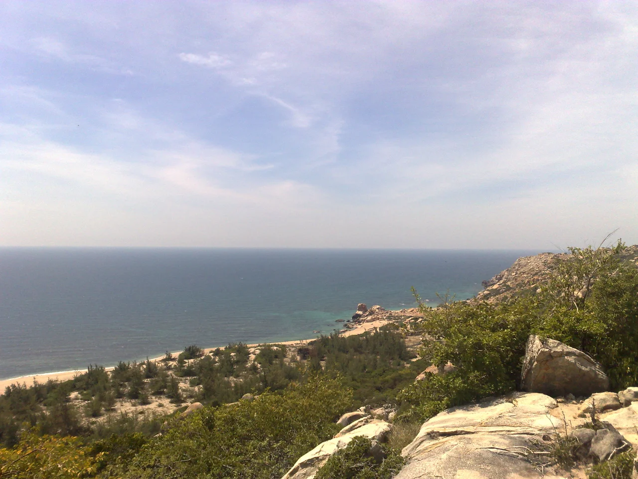
Where do you find coral reefs, sea turtle nesting beaches, and semi-arid scrubland all within a single protected area? At Núi Chúa, a mountainous promontory jutting into the South China Sea between Cam Ranh and Phan Rang bays, that improbable combination is simply the landscape. This is Ninh Thuận Province — the driest, hottest corner of Vietnam — and the park that guards it receives only 650 millimeters of rain per year, less than any other protected area in the country. Eight months of dry season follow one another with a kind of parched persistence, shaping everything that lives here into forms adapted to scarcity.
A Desert by the Sea
Most national parks announce themselves with obvious grandeur — towering peaks, thundering rivers. Núi Chúa announces itself with thorn scrub and silence. At lower elevations, between 150 and 800 meters, the southern slopes are dominated by vegetation that thrives specifically in hot, dry climates: thorny trees, heat-tolerant shrubs, plants that have turned drought into a survival strategy. This habitat type is so rare within Vietnam's protected areas network that Núi Chúa may be its last significant refuge. Above 800 meters, the character of the forest shifts. In the park's northern reaches, lower montane evergreen forest still grows largely undisturbed — the only primary forest to survive a wave of over-exploitation that cleared most of the park's original canopy in the early 1990s. The summit of Núi Chúa peak reaches 1,039 meters, high enough to catch cloud moisture that the coastal flatlands never see.
The Reef Beneath
The park's boundaries extend not just across 24,353 hectares of land but also across 7,352 hectares of protected marine habitat — a fringing reef system that WWF surveys have repeatedly found to be in good to excellent condition. Researchers have recorded 307 coral species within those waters, and the most recent surveys identified 46 species with distribution records new to Vietnam, with a coral community structure distinct from any other reef in the country. Green turtles and other marine turtles on the IUCN Red List still haul out onto Núi Chúa's beaches to nest — one of the last remaining mainland nesting sites in Vietnam. The park also records eleven species of turtles in total, both terrestrial and marine, the highest count for any Special Use Forest in the country. From the promontory cliffs you can sometimes watch sea turtles moving in the clear water below, unhurried shapes from a world that predates the national park, the highway, and the drought.
Animals of the Dry Hills
The forest's mammal list runs to 72 species and its bird list to 181, several of them subjects of active conservation concern. Black-shanked doucs — striking primates with silver legs, russet chests, and faces the color of ripe papaya — move through the canopy in troops. Pygmy lorises emerge at night, their enormous reflective eyes scanning branches for insects. Both Asian black bears and sun bears range through the park, along with the large-antlered muntjac, a deer species that was only formally described by science in the 1990s. The Siamese fireback, a pheasant so elaborate in its plumage it looks designed for a ceremony, picks its way across the forest floor. Each of these species requires intact habitat to persist — the kind of habitat that exists, in this part of Southeast Asia, almost nowhere else.
The People Inside the Park
Conservation maps rarely show what the biodiversity numbers do not: roughly 30,000 people live inside Núi Chúa National Park's boundaries, and another 25,000 in its buffer zone. Most belong to the Kinh majority or to the Cham and Raglay ethnic minorities, the latter making up 21 percent of the park's population. These communities face an average of six months of food shortages per year. The Raglay people's traditional agricultural calendar — rice, banana, cashew, papaya, jackfruit, pineapple — can sustain livelihoods for four months at best. For the remaining months, many households have historically depended on forest products: timber, charcoal, medicinal plants drawn from more than 100 species. Traded forest products account for an estimated 56 percent of annual income for many Raglay families. The tension between conservation and livelihood is not an abstraction here; it is the daily arithmetic of survival in Vietnam's driest province, made sharper each year as climate change intensifies the droughts.
An Island in the Agricultural Sea
Núi Chúa now sits as a biological island: the South China Sea closes it on the south and east, Highway 1 defines its western edge, and agricultural land presses against it from the north and west. The park was formally established on 9 July 2003 by Prime Ministerial decree, upgrading it from a nature reserve, but the threats that preceded protected status have not disappeared. Over 600 hectares of wet rice land, more than 2,500 hectares of shifting cultivation fields, and another 750 hectares of industrial crops sit within the park's nominal boundary. Climate science adds further pressure: studies by Oxfam and Kyoto University have documented that droughts in the region are becoming more frequent and severe, reducing the viability of rain-dependent farming and pushing more families toward forest extraction. The World Wildlife Fund has identified Núi Chúa as one of the four Global Ecoregions in southern Vietnam — a designation that underscores both the park's ecological importance and the difficulty of protecting something so essential and so besieged.
From the Air
Núi Chúa National Park lies at 11.70°N, 109.15°E on a prominent mountainous promontory clearly visible from altitude as it projects into the South China Sea between two bays. Cam Ranh Bay lies to the north and Phan Rang Bay to the south; the promontory's spine reaches 1,039 m at the summit. The nearest airport is Cam Ranh International Airport (VVCR), approximately 20 km to the north. From 5,000–10,000 feet the promontory's topographic contrast with the flat coastal plain is sharp, and the turquoise fringing reef zone is often visible in clear conditions. The dry season landscape (November through July) gives the hills a pale gold-brown color distinct from the greener terrain to the north.
Nearby Stories
- Cam Ranh Base 8.2 km away
- Vietnamese National Military Academy 18 km away
- Phan Rí Cửa 29 km away
- Ca Na 31 km away
- Linh Phước Temple 32 km away
- South-East Asian Theatre of World War II 162 km away
- Kashmir Princess 360 km away
- South China Sea 362 km away