,_Tuy_Phong,_B%C3%ACnh_Thu%E1%BA%ADn.jpeg)
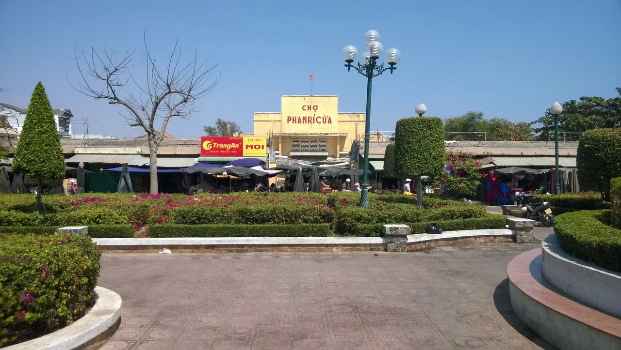
Phan Rí Cửa
The name carries two languages in one breath. *Phan Rí* is Vietnamese for the Cham word *Panrik*, and *Cửa* is the Vietnamese word for port. Two peoples, two tongues, one small coastal town where the Dângrêk foothills meet the South China Sea. Phan Rí Cửa was once the capital of the Principality of Thuận Thành — the last sovereign Cham state, the final ember of a civilization that had illuminated these shores since the second century CE. Today it is a modest township in Bình Thuận Province, recognized as a Class-4 urban area in 2011, but its name still carries the memory of what came before.
A Name Older Than the Town
Linguistics sometimes preserve history better than monuments. The Cham people spoke a Malayo-Polynesian language, traded across the South China Sea, built brick towers that still stand inland from this coast, and left their words embedded in Vietnamese place names throughout the region. Panrik — the Cham original of Phan Rí — likely referred to a geographic feature or a settlement that predated any Vietnamese presence here by centuries. The addition of *Cửa* (port) by Vietnamese speakers acknowledged the town's function: a landing place, a gateway, where boats came in from the sea. This layering of language mirrors the broader history of the coast — Cham civilization overlaid with Vietnamese expansion, overlaid with French colonial administration, overlaid with the administrative reshuffles of the post-1975 Socialist Republic.
Capital of the Last Cham State
For roughly a century and a half — from 1695 until the final annexation of 1832 — the Principality of Thuận Thành was the remnant of Champa, confined to a stretch of south-central Vietnamese coast and surviving as a client state of the Nguyen lords. Phan Rí Cửa served as its capital, a port town governing what remained of Cham political life under increasing Vietnamese suzerainty. The principality's kings navigated between the Nguyen court in Huế and the ever-encroaching Kinh settlement that was redrawing the demographic map of their homeland. By the time Emperor Minh Mang seized Panduranga in August 1832, Cham sovereignty had been nominal for decades. The capital fell not in battle but in administrative decree. What had been a royal seat became simply another village in a Vietnamese province.
Reorganized by the Republic
After 1975, the new unified Vietnam redrew administrative lines across the country, and Phan Rí Cửa was caught in several iterations of that process. Initially a commune of Bắc Bình district, it was elevated to township status in 1979 — a recognition of its size and coastal commercial importance. When Bắc Bình district was divided in 1982, Phan Rí Cửa found itself in the newly created Tuy Phong district. Three decades later, in 2011, the Ministry of Construction formally recognized it as a Class-4 urban area, meaning it met the national thresholds for population density, economic activity, and infrastructure. In 2019 it absorbed the neighboring rural commune of Hòa Phú. These are the quiet bureaucratic rhythms of a living town — growing, reorganizing, adjusting boundaries — far removed from the drama of the Cham kingdoms it once administered.
Coast of Convergence
The landscape around Phan Rí Cửa tells its own story. The Bình Thuận coast here is one of the driest regions in Vietnam, swept by monsoon winds that have sculpted sand dunes just as dramatic as those at nearby Mui Ne. The Ca Ty River and smaller streams drain from the Truong Son mountains inland, reaching the sea near the town and creating the conditions that once made this a natural anchorage. Fishing communities still work these waters, as they have since before any of the place names existed in any language. The Cham towers that dot the hills inland — built from fired brick with techniques that modern engineers still study — are the most visible reminders that this landscape was shaped by a civilization that understood both the land and the sea. Phan Rí Cửa stands at their edge, a port whose name preserves the people who first knew this place.
From the Air
Phan Rí Cửa sits at 11.17°N, 108.57°E on the Bình Thuận coast of southern Vietnam, roughly 35 km northeast of Mui Ne and 45 km southeast of Phan Rang. The coastline here transitions between sandy beaches and rocky headlands. Inland, the dry landscape shows the characteristic pale-buff tones of the Bình Thuận semi-arid zone. Ancient Cham brick towers are visible on elevated ground a few kilometers inland from the coast. Recommended viewing altitude: 2,000–4,000 feet for coastal and inland terrain. Nearest airport: Cam Ranh International (CXR), approximately 65 km northeast.
Nearby Stories
- Phan Rang–Tháp Chàm 15 km away
- Bao Loc 20 km away
- Operation Byrd 21 km away
- Núi Chúa National Park 63 km away
- Phú Quý Island 67 km away
- Cát Tiên Archaeological Site 71 km away
- Ile des Cendres 82 km away
- Battle of Long Tan 83 km away