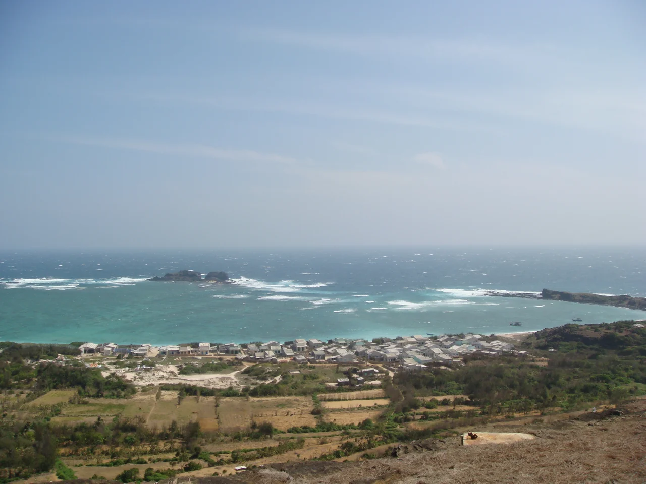

Phú Quý Island
Six hours by ferry from the mainland. That is how remote Phú Quý used to be — a full working day at sea before the island's three fishing communes came into view. The mid-speed ferry that cut the crossing to two and a half hours when it launched in 2010 changed the island's relationship with the Vietnamese coast, and then stopped, and then returned. The rhythm of that connection — extended, interrupted, restored — mirrors something true about Phú Quý: this is a place that has always existed at the edge of easy reach, shaped by its distance from the mainland as much as by what it has found in the sea around it.
A Volcanic Archipelago in the South China Sea
Phú Quý is not one island but ten, the largest of which gives its name to the group. Together they form a cluster sitting 100 kilometers southeast of the coastal city of Phan Thiết, in waters that link Vietnam to the broader South China Sea. The island's highest point is Mount Cam Dat, at 106 meters — modest in elevation but conspicuous on the flat marine horizon. The north of the island is rocky, its shoreline formed from volcanic material that betrays the geological origins of this place. The south consists mostly of sand. The whole island covers a modest area, and its geography divides neatly: three communes, ten former villages, 30,000 residents organized under Phú Quý's special administrative region status.
Poulo-Cécir-de-Mer
During French colonial rule of Indochina, Phú Quý was known as Poulo-Cécir-de-Mer — the Malay word *pulau* meaning island, grafted onto a French place-name, reflecting the layered colonial geographies of the region. That history left two lasting landmarks: a lighthouse at the island's northwestern tip, Phu Quy Lighthouse (Hải đăng Phú Quý), which has guided vessels through the South China Sea shipping lanes for generations, and an abandoned military bunker on the eastern coast, its presence a reminder of the strategic value that remote islands acquire in contested waters. The South China Sea has long been a zone of competing territorial claims, and Phú Quý — positioned within practical distance of Vietnam's coast while also near disputed maritime zones — carries that geopolitical weight quietly, in concrete and rust.
Fishing Village, Rare Seafood, Pristine Shore
The island's identity is anchored in fishing. The communities of Phú Quý have lived from the sea for generations, and the marine life in the waters around the archipelago remains unusually rich — the island actively promotes its rare seafood as one of its primary draws for visitors. The beaches and coastal terrain are largely undeveloped by the standards of Vietnam's more accessible islands. Phú Quý's vision for its own future explicitly centers on sustainable development that preserves the fishing village character rather than replacing it with resort infrastructure. The island has called for investment in airports and hotels, but the emphasis in its own tourism planning is on what has not yet been changed: pristine shoreline, local lifestyle, an honesty of place that over-tourism tends to erase. Whether that vision holds against the pressure of development remains to be seen.
The Crossing
The ferry from Phan Thiết has always been the story of Phú Quý — the six-hour journey during calm seas that limited the island's accessibility for decades, the arrival of the mid-speed ferry in 2010 that cut the crossing to roughly two and a half hours, its suspension in 2015, and its eventual reinstatement in 2018. Getting to Phú Quý remains an act of commitment compared to other Vietnamese island destinations. The weather governs the crossing; rough seas extend travel times and can cancel sailings altogether. That built-in difficulty has preserved something. The island's 30,000 residents live without the infrastructure that near-constant tourist access demands, in a community whose rhythms are still shaped more by the sea's moods than by travel schedules.
From the Air
Phú Quý lies at approximately 10.52°N, 108.93°E, about 100 km southeast of the Vietnamese coast and the city of Phan Thiết. From altitude, the archipelago appears as a small cluster of dark volcanic islands on the blue South China Sea, with the main island's rocky northern coast and sandy southern beaches distinguishable on clear days. The nearest mainland airport is Phan Thiết Airport (PHH/VVPT), which opened in late 2025 with civil operations under development. The island itself does not have a functioning commercial airport as of 2026. The surrounding waters are busy with fishing and commercial shipping traffic.
Nearby Stories
- Ile des Cendres 23 km away
- Principality of Thuận Thành 57 km away
- South-East Asian Theatre of World War II 76 km away
- Operation Byrd 87 km away
- Battle of Long Tan 112 km away
- Trà Vinh province 226 km away
- Vũng Rô Bay 239 km away
- Vũng Rô Bay Incident 268 km away