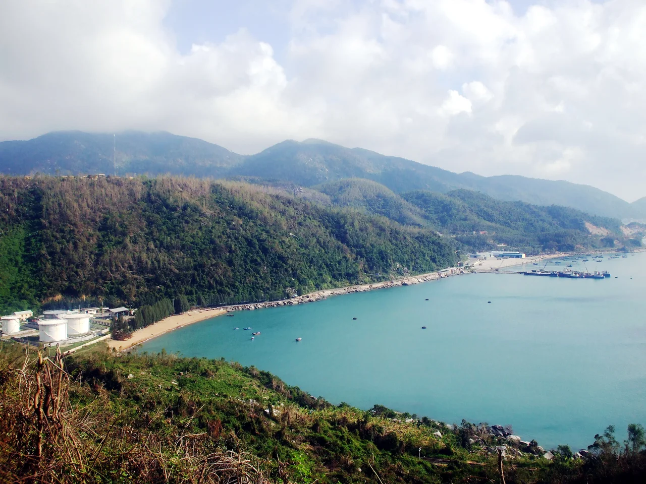

Vũng Rô Bay
Three mountains cup it on three sides. Đèo Cả to the north, Đá Bia to the east, Hòn Bà to the west — and between them, 16.4 square kilometers of sheltered water that the South China Sea barely touches. Vũng Rô Bay, on the coast of Phú Yên Province, sits at the foot of the Cả Pass, tucked into one of the most dramatically scenic sections of Vietnam's central coastline. The bay's isolation is complete enough that for years in the 1960s it made an ideal covert landing site. Today, that same isolation is what draws travelers.
Geography of Shelter
The bay occupies the commune of Hòa Xuân Nam in Phú Yên Province, sitting at the natural boundary between Đắk Lắk and Khánh Hòa provinces — a geographic threshold where the Central Highlands meet the sea. The enclosing mountains aren't distant backdrop; they rise steeply from the water's edge, covered in tropical forest, creating a sense of enclosure unusual for a coastal bay. Below the surface, coral reefs spread across the bay floor, supporting fish communities that have made the area a draw for divers and snorkelers. Fine-sand beaches line parts of the shore. On calm days the water is a layered sequence of blues — shallow turquoise over the reef, deepening to indigo where the bay floor drops away.
The War Years
In February 1965, Vũng Rô's isolation made it the landing point for a North Vietnamese trawler carrying 100 tons of weapons and ammunition for Viet Cong forces in the South. The operation was discovered by a U.S. Army MEDEVAC helicopter pilot flying the coast, the trawler was sunk by South Vietnamese aircraft, and the recovery of the weapons cache — rifles, ammunition, grenades, mortar rounds, explosives — provided what American commanders called "proof positive" of the sea infiltration route. The incident directly triggered Operation Market Time, the sustained naval blockade of the South Vietnamese coast. A year and a half later, in July 1966, the U.S. Army secured the bay as part of Operation John Paul Jones, and the 39th Engineer Battalion built a small port facility here — named Port Lane in honor of Lieutenant Colonel Ernest Lane, killed in action on 18 May 1966.
Port Lane
The construction was substantial for a remote coastal bay. Two concrete LST ramps — designed to accept Landing Ship, Tank vessels — were built into the shoreline. A Navy cube causeway allowed barge offloading. A hardstand area for vehicle staging was carved from the hillside, with the excavated material used as fill for an extended causeway. Two DeLong pier units, the floating pier sections the U.S. military used across Vietnam, were installed at the causeway's end by late December 1966. The whole complex was fully operational by 16 October 1966, providing a logistics alternative to the main port at Tuy Hòa, 25 kilometers to the north, which was already under pressure. Port Lane served as an active facility through the war years; almost nothing of it is visible today.
After the War
The mountains that once made Vũng Rô useful for covert operations now make it scenic for tourists. The drive along the coast road — National Route 1 climbs the Đèo Cả and descends to sea level at the bay — offers views across the water from above before winding down to the shoreline. The bay has developed modestly as a day-trip destination from Tuy Hòa, known for fresh seafood at waterfront restaurants, snorkeling above the coral reefs, and the unusual quietude of a bay that still feels enclosed and apart from the broader coast. The history sits lightly on the surface — there are no monuments at the beach where the weapons were stacked, no markers for Port Lane. What remains is mostly the geography: the mountains, the water, and the peculiar stillness that made this place matter.
From the Air
Vũng Rô Bay is located at approximately 12.87°N, 109.43°E on the central Vietnamese coast, Phú Yên Province. From altitude, the bay is clearly identifiable as a dark, enclosed inlet bordered on three sides by forested mountain ridges — one of the only well-sheltered coastal inlets in this stretch. The Đèo Cả (Cả Pass, elevation ~333 m) is visible as the dominant ridge to the north of the bay. Recommended viewing altitude is 3,000–6,000 ft AGL for coastal detail. The nearest airport is Tuy Hoa (TBB / VVTH), approximately 25 km north along the coast. Cam Ranh International (CXR / VVCR) is about 80 km to the south. The coastline between Tuy Hoa and the bay is dramatic — steep forested terrain dropping directly to the sea.
Nearby Stories
- Ô Loan Lagoon 28 km away
- Po Nagar 55 km away
- Bidoup Núi Bà National Park 58 km away
- Chư Yang Sin National Park 59 km away
- Tây Sơn District 81 km away
- Kashmir Princess 330 km away
- South China Sea 337 km away
- Battle of the Paracel Islands 407 km away