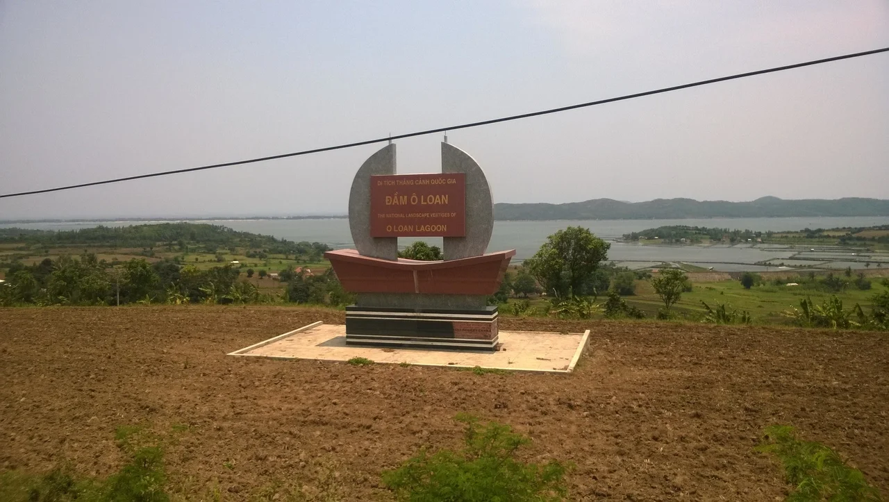

Ô Loan Lagoon
The lagoon got its name from a bird that could not keep flying. In local legend, a fairy named Loan borrowed an ô thước — a mythical black bird, something like a crow or magpie — to fly down from the celestial realm and see the world. She was enchanted by what she found. She kept flying and looking, and the bird grew exhausted. When they passed over the lagoon in Tuy An District, it could go no further and fell. People later combined the bird's name with the fairy's name: Ô Loan. The lagoon did not need a legend to be remarkable, but the story fits — it is the kind of place that makes you forget to turn back.
Separated by a Thread of Sand
Ô Loan Lagoon covers about 15.7 square kilometers of brackish water, held apart from the South China Sea by a narrow sand dune. A small creek connects the two, allowing seawater to flow in and out with the tides, maintaining the brackish conditions that make the lagoon's ecology distinctive. From above, the dune appears almost impossibly thin — a pale line between the dark lagoon water and the deeper blue of the open sea. The lagoon lies roughly 22 kilometers north of Tuy Hòa. Mangroves line portions of the shore, their roots binding the sediment and creating a complex habitat where the land grades gradually into water. This combination of shelter, salinity gradient, and vegetation draws both permanent resident species and migratory visitors.
What the Water Holds
The lagoon's reputation rests partly on what can be pulled from it. Blood cockles — *Tegillarca granosa* — thrive in the brackish sediment here and are considered a local delicacy, typically served simply: boiled or steamed, with salt, lime, and chili. Shrimp, crab, and various fish species round out a menu that visitors to the area have been seeking out for generations. The mangrove fringe that makes these harvests possible is also what makes the lagoon worth protecting: the trees buffer the shoreline from storm surge, filter runoff, and support bird populations that use the canopy for nesting and foraging. Vietnam designated Ô Loan a National Scenic Site on September 27, 1996.
Yellow Flowers on the Green Grass
A 2015 Vietnamese film called *Tôi thấy hoa vàng trên cỏ xanh* — Yellow Flowers on the Green Grass — was shot partly at and around Ô Loan Lagoon. The film, an adaptation of a novel by Nguyễn Nhật Ánh, follows two brothers growing up in a rural Central Vietnamese landscape. Its images of the lagoon, the flat coastal plains, and the particular quality of light in this part of Vietnam reached audiences across the country and drew visitors who recognized the scenery. For a place that had been quietly beautiful for a long time, the film provided visibility. It also cemented Phú Yên's reputation as "the land of yellow flowers on green grass" — a phrase that has since become a regional identity marker.
Time on the Water
Visitors to Ô Loan typically arrive by boat or on foot along the dune path. The lagoon moves slowly: the mangroves filter light into dappled patterns on the water, egrets stand motionless in the shallows, and fishing boats drift with the current rather than against it. The pace is not incidental — it is the point. The lagoon offers the particular quiet of water enclosed by land, sheltered from open-sea swell, with the horizon close enough to see clearly but the restlessness of the ocean held at a distance. In the late afternoon, the sand dune catches the last light while the lagoon water darkens early in the shade of its western shore. The fairy's bird would have found this a sensible place to stop.
From the Air
Ô Loan Lagoon lies at approximately 13.28°N, 109.27°E, about 22 km north of Tuy Hòa along the central Vietnamese coast. From the air, the lagoon is highly visible — its roughly oval outline, the distinctive narrow sand dune separating it from the sea, and the mangrove fringe along its inland shore make it easy to identify. The dune appears as a pale strip; the lagoon water is noticeably darker than the open sea. Nearest airport: VVTH (Tuy Hoa / Đông Tác, ~22 km south). For a view of the full lagoon and dune structure, 2,000–4,000 feet on a clear day; low passes over the dune at 500 feet reveal the lagoon-sea boundary clearly.
Nearby Stories
- Chư Yang Sin National Park 26 km away
- Battle of Thị Nại Bay 27 km away
- Vũng Rô Bay 34 km away
- Central Highlands (Vietnam) 48 km away
- Buôn Hồ 61 km away
- South-East Asian Theatre of World War II 336 km away
- Kashmir Princess 386 km away
- Battle of the Paracel Islands 390 km away