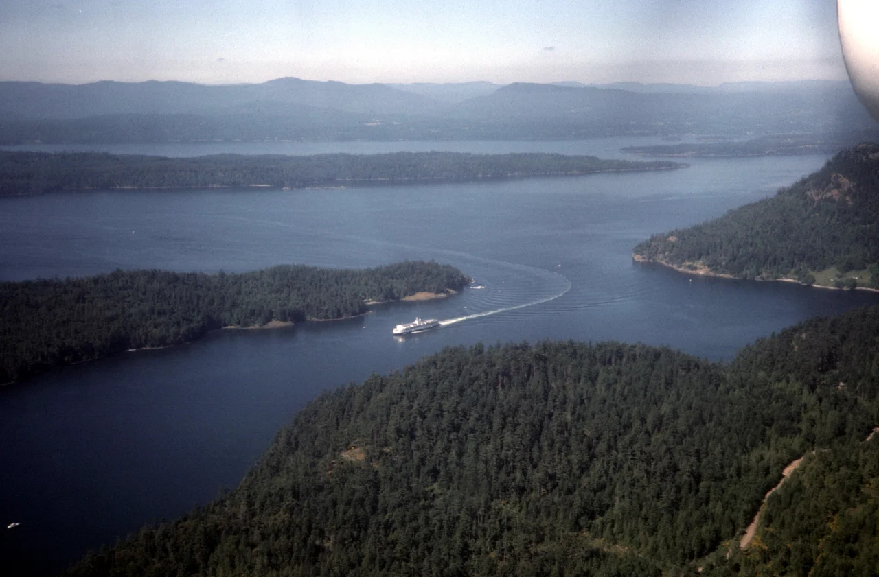

Active Pass
Stand on the beach at Miners Bay on a summer afternoon and a ship the length of a city block will come around the corner at you. Active Pass is 5.5 kilometres long with a roughly right-angle bend at each end, which means a vehicle ferry running between Tsawwassen and Swartz Bay has to turn twice inside a channel with a river's narrowness, passing extremely close to rock on both sides. Passengers crowd the rail for it. People on shore stop what they are doing and watch. It is one of the few places on this coast where the working machinery of a province comes right up to the porch.
SKTAK
In the Saanich language the pass is SKTAK. It separates Galiano Island to the north from Mayne Island to the south, in the southern Gulf Islands, and it links Trincomali Channel in the west to the Strait of Georgia in the east - which is precisely why it matters. Without it, traffic between the mainland and the islands would have to go the long way around. The two bends that make it dramatic are the same two bends that make it useful, because they are what let a channel cut clean through a chain of islands instead of dead-ending in a bay. Geography rarely offers a shortcut this convenient or this tight.
Named for a Steamer
The name is a compliment paid to a ship. The USCS Active, a United States Navy survey vessel, became the first steamer to navigate the pass in 1855, and the name stuck to the water she proved. It has aged unusually well. Most nineteenth-century naval namings on this coast honour officers, patrons or distant royalty, and require a footnote to explain. This one describes exactly what the place is like - a channel in constant use by ferries, pleasure craft, fishing boats, freighters and freight ferries, alive with traffic on any day of the year.
Forty-Four Years of Readings
From 1967 to 2011, the Active Pass light station formed part of the British Columbia Shore Station Oceanographic Program, taking coastal water temperature and salinity measurements for the Department of Fisheries and Oceans. Every day, for forty-four years. There is nothing dramatic about the work and nothing replaceable about the result: an unbroken daily record of what the water in this channel was actually doing, decade after decade, gathered by people whose main job was a light. Records like that only become valuable long after they are taken, which is another way of saying that whoever wrote down the numbers in 1968 was working for someone who had not been born yet.
Fast Water
Strong eddies and tide rips are always present in the pass, and for smaller vessels that makes the corridor genuinely hazardous - a kayak or a runabout can find itself in water moving in several directions at once, with a ferry due around the bend. The same turbulence brings life. Harbour seals and sea lions work the pass, bald eagles watch it from the bluffs, gulls wheel above the rips, and orcas pass through. From the deck of a ferry making its turn, it is possible to see all of them in the space of a few minutes, which is a fair summary of why people ride this route for pleasure rather than necessity.
Three Bad Days
A channel this narrow and this busy accumulates a record. On 8 September 1968 HMCS Saskatchewan ran aground here while transiting in fog; her captain was court-martialled and found guilty of negligence. On 2 August 1970 the Russian freighter Sergey Yesenin struck the BC Ferry Queen of Victoria in the pass. Three people aboard the ferry were killed and the ship sustained close to a million dollars in damage. For a route most passengers think of as a scenic hour, it was a shattering morning. On 9 August 1979 the Queen of Alberni grounded on Collinson Reef and heeled dramatically to one side, wrecking vehicles and injuring the ship; a racehorse in transit was killed. Three dates, eleven years apart at the ends, in five and a half kilometres of water.
From the Air
Active Pass lies at 48.8586 N, 123.3193 W, cutting between Galiano and Mayne islands. From 1,500-3,000 ft the dog-leg is unmistakable: a narrow channel with two sharp bends, Sturdies Bay on the Galiano side and Miners Bay on the Mayne side, opening east into the Strait of Georgia and west into Trincomali Channel. Ferry wakes make excellent traffic indicators. Vancouver International (CYVR) is about 40 km northeast, Boundary Bay (CZBB) roughly 35 km northeast, and Victoria International (CYYJ) about 25 km southwest. The Gulf Islands carry heavy scheduled floatplane traffic at low level, so keep a good lookout below 2,000 ft. Fog is the local hazard - it was fog that put a Canadian warship on the rocks here in 1968 - and it can fill the channel while the island tops stay clear.
Nearby Stories
- Northwest Indian College 6.2 km away
- Anacortes 6.2 km away
- George C. Reifel Migratory Bird Sanctuary 7.3 km away
- Paldi, British Columbia 7.7 km away
- Canadian Museum of Flight 8.1 km away
- Cadboro Bay 8.3 km away
- Cassidy, British Columbia 9.5 km away
- Otter Point, Greater Victoria 15 km away