
George C. Reifel Migratory Bird Sanctuary
The transfer came with terms. When the Reifel family gave up their land in the Fraser River delta in 1972 - part sale, part donation, to the federal government - they wrote two conditions into the agreement. The land would be managed first and foremost for the benefit of waterfowl. And it would continue to carry the name of George C. Reifel, who had bought it in 1927 as a working farm and a place for his family to get out of Vancouver. Both conditions have held. More than fifty years later the sanctuary is still run for the birds, still named for the man, and the Western Hemisphere Shorebird Reserve Network has designated the estuary it sits in a site of Hemispheric Importance.
How a Farm Becomes a Refuge
It happened gradually, and through the second generation. George H. Reifel first leased his father's land to the British Columbia Waterfowl Society in the 1960s, which is the moment the ground stopped being agricultural in purpose even while it kept its dikes and ditches. The federal migratory bird sanctuary was established in 1967. The 1972 agreement made the arrangement permanent. It is a modest-sounding sequence of transactions, but it produced something unusual: a wetland in the most heavily farmed, most heavily diked part of the Lower Mainland that nobody can drain, develop or repurpose.
Managed Water
The sanctuary covers 648 hectares, of which roughly 300 are the part visitors walk - managed wetlands, marshes, and the dikes that hold them in shape. That word, managed, matters. The water levels here are controlled, raised and lowered on a schedule that suits the birds rather than the weather, so that the shallow pools sit at the right depth for a probing bill in the weeks that probing bills arrive. Trails run out along the dikes to bird blinds and lookouts, there is a gift shop, and the gates are open from nine in the morning until four in the afternoon, Tuesday through Sunday, with reservations now required for every visit. It is not wilderness. It is a machine for producing habitat, and it runs well.
The Regulars and the Travellers
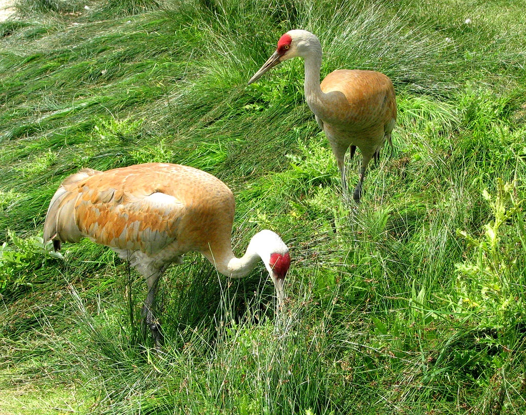
Sandhill cranes nest here - tall, grey, prehistoric-looking birds whose bugling call carries across the entire marsh and startles first-time visitors into stopping mid-path. Bald eagles hold the cottonwoods. Mallards and spotted towhees go about their year-round business. Then there are the ones just passing through, for whom this place is a fuel stop on a journey of continental length: lesser snow geese in white drifts, greater and lesser yellowlegs picking along the margins, long-billed dowitchers working the mud in synchronised sewing-machine motion, and western sandpipers in flocks that turn light and dark together as they bank. Over 250 species have been recorded within the sanctuary.
The Loudest Weeks of the Year
The sanctuary has a season, and it is not summer. When the lesser snow geese come down the coast, the delta changes character entirely. They arrive in white drifts that settle onto the marsh and the neighbouring fields, and the noise they make is less a call than a weather system - a continuous, layered yelping audible long before you reach the dike. Then something spooks them, and several thousand birds lift at once, turning the middle distance into a blizzard moving sideways. It lasts a few seconds. They come back down. Nothing else in the Lower Mainland is quite like standing in the middle of it on a cold, flat, grey December morning with the Fraser running brown a few hundred metres away.
Why the Estuary Matters
Understand what a site of Hemispheric Importance means and the rest of it follows. Shorebirds migrating the Pacific coast cannot fly the whole distance; they need places to land, and the number of places is finite and shrinking. The Fraser estuary is one of the essential ones - a soft, muddy, nutrient-loaded gap in a coastline that is otherwise rock. Lose it and the loss registers thousands of kilometres away, in nesting grounds in the Arctic and wintering grounds in South America. Which returns you to the two conditions the Reifel family attached in 1972, and to how much can turn on the wording of a single agreement about a farm.
From the Air
The sanctuary lies at 49.0974 N, 123.166 W, in the Fraser River delta at Delta, British Columbia, on the low islands inside the river's South Arm. Recommended viewing altitude is 2,000-4,000 ft AGL, and no lower: this is one of the densest concentrations of large birds on the British Columbia coast and it sits close to the approach corridors for Vancouver International. From the air the delta is unmistakable - a vast flat of diked farmland squares cut by the silt-brown channels of the Fraser, with the sanctuary reading as an irregular mosaic of dark ponds and marsh among the regular field geometry. Orient on the two enormous causeways reaching out into the Strait of Georgia to the southwest: Roberts Bank with its coal and container terminals, and the Tsawwassen ferry terminal beyond it. The Fraser's South Arm and the town of Ladner lie immediately north and east, Boundary Bay to the southeast, and the North Shore Mountains rise across the city far to the north. Nearest airports: CYVR (Vancouver International) about 15 km north on Sea Island, CZBB (Boundary Bay) about 12 km east, and CYXX (Abbotsford) about 55 km east. Winter fog settles hard on the delta and can persist all day.
Nearby Stories
- Mudge Island 3 km away
- Mayne Island 4.9 km away
- Canadian Museum of Flight 6.1 km away
- Hovander Homestead Park 8.5 km away
- St. Augustine's Indian Residential School 8.8 km away
- Paldi, British Columbia 11 km away
- Golden Ears Provincial Park 20 km away
- Britannia Mine and the Mountain That Bleeds 25 km away