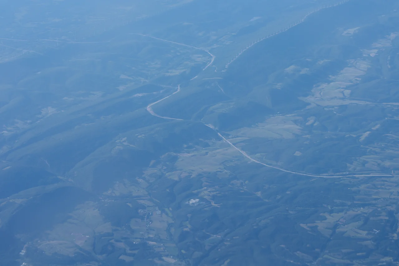

Allegheny Front
For more than a century after the first European colonies took root on the Atlantic coast, this wall held them back. The Allegheny Front - a continuous east-facing escarpment rising from southern Pennsylvania through Maryland, West Virginia, and into Virginia - was the geological reason settlement of the American interior stalled at the eastern Appalachians. No waterway crosses the Front from east to west. None. The drainage flows downhill, and on this ridge, downhill happens to mean two different oceans.
Where the Continent Divides
The Allegheny Front marks the boundary between the Ridge-and-Valley Appalachians to the east and the higher Appalachian Plateau to the west. Just behind the Front's crest, the Eastern Continental Divide separates two of North America's great drainage systems. Water that falls on the eastern slope flows into the Susquehanna, the Potomac, or the James, reaching the Atlantic through Chesapeake Bay. Water that falls a few hundred yards to the west joins the Ohio, then the Mississippi, then the Gulf of Mexico. The divide and the Front are not always the same line - the North Branch of the Potomac, for example, originates at the Fairfax Stone deep inside the Appalachian Plateau, ten miles west of where most people would expect it. But the two features run close together for hundreds of miles, and where they coincide, the geological logic is unmistakable.
Why the Railroads Took So Long
The Front's most dramatic effect was on transportation. Few roads and fewer railroads cross it directly. For most of the 19th century, freight had to be portaged over the escarpment or routed through one of a handful of gentle passes. The Pennsylvania Railroad's solution, completed in 1854, was the Horseshoe Curve west of Altoona - a long curving cut in the slope that allowed freight trains to climb gradually onto the Allegheny Plateau. Engineering the railroad over the Front was a watershed moment in American economic geography. Suddenly the Midwest, with its grain and coal and growing cities, was connected by rail to the Atlantic seaboard. The escarpment that had bottled up settlement in the colonial era still demanded engineering tribute, but it no longer dictated the limits of the American economy.
Dolly Sods and the High Plateau
In northern West Virginia the Front reaches its most spectacular form. East of the Mount Storm coal-fired power station, the escarpment passes along the eastern edge of the Dolly Sods Wilderness - a windswept Pottsville conglomerate plateau at roughly 4,000 feet, capped with sphagnum bogs and one-sided flagged red spruce trees that grow only away from the prevailing wind. From the Sods south, the Front continues as a steep wall west of the North Fork of the South Branch Potomac, with the Roaring Plains West Wilderness extending the high plateau. The escarpment's southern terminus is Mount Porte Crayon at 4,770 feet. The escarpment falls 2,800 feet in some places to the river below - a drop comparable to the rim-to-floor relief in many Western canyons.
Wind, Birds, and the Modern Economy
The same orography that made the Front a barrier to wagons makes it one of the windiest places east of the Mississippi. The NedPower Mount Storm Wind Project lines twelve miles of the Front's crest in Grant County, West Virginia, with 132 turbines built between 2006 and 2008. At full output it generates 264 megawatts - enough to power about 66,000 homes - by harvesting the same prevailing westerlies that for centuries kept settlers heading south to the gentler passes of the Cumberland Gap. The wind also carries birds. The Allegheny Front Hawk Watch, on the Bedford-Somerset county line in Pennsylvania, counted 833 hawks in a single day after Hurricane Isabel passed in 2003. In 2015 the watch recorded a season record of 386 golden eagles, including a single-day eastern flyway record of 74 on October 24. The Allegheny Front Migratory Observatory at Dolly Sods has been banding birds since 1958, making it the only cooperative banding station in West Virginia.
From the Air
The escarpment runs from approximately 41 degrees north in central Pennsylvania to 38.7 degrees north in West Virginia, oriented roughly southwest-northeast. From 8,000 to 12,000 feet AGL the Front reads as a sharp line where the rugged Ridge-and-Valley country gives way to the higher, smoother Allegheny Plateau. Mount Storm Lake and the NedPower wind turbines along Backbone Mountain in Grant County, WV (near 39.07 degrees north, 79.30 degrees west) are obvious visual markers. Nearby airports include Greater Cumberland Regional (KCBE) to the east and Elkins-Randolph County Regional (KEKN) to the west. Expect strong westerly winds aloft and severe orographic turbulence in the lee.
Nearby Stories
- Seneca Rocks 7.8 km away
- Randolph County 9.4 km away
- Barbour County, West Virginia 17 km away
- Battle of New Market 22 km away
- Belle Grove Plantation 40 km away
- Battle of Fort Necessity 56 km away
- Gravity Hill 73 km away
- Whiskey Rebellion 92 km away