
Ammarnäs
Almond potatoes have no business growing at nearly 66 degrees north. The season is too short, the frost comes too early, and the whole definition of the mountain birch zone is that farming stops below it. In Ammarnäs the potatoes come up anyway, in rows climbing the sunlit south face of a gravel hill the village calls Potatisbacken. They have come up there for more than 150 years, tended by a settlement of roughly 110 people at the end of a county road in the largest nature reserve in Sweden, and in 2010 listeners of Sveriges Radio P4 Extra voted the hill the country's eighth wonder.
A Hill the Ice Left Behind
Potatisbacken is one of five moraine formations around the village, and it owes its shape to a hole in a dying ice sheet. Meltwater washed sediment down into a sink in the inland ice; when the ice finally went, the fill stood up as a cone. The result rises about 38 metres, topping out at 439 metres above sea level, and its south face does two useful things at once. It catches whatever sun this latitude offers, and it lets cold air run off downhill instead of settling in the rows. Frost that would flatten a crop on the flat delta below slides past the slope. Nils Johansson, born in 1797 and dead in 1881, is remembered as the first to plant it; he was the Grundfors man who took over the Övre Gautsträsk homestead here in 1827.
Twenty-Three Shares
The hill is not one farm but many. Its cultivated face is split into plots, and 23 properties in the village hold potato ground on it in proportion to their land registration, with a stone at the foot of the slope marking where the boundaries begin. That arrangement is the reason the terraces look the way they do from below: not a single tidy field but a patchwork of strips, each one somebody's business, all of them planted with mandelpotatis, the almond potato that Swedish cooks prize and that has no right to ripen this far north. Nobody grows it here for the money. The hill is worked because it has always been worked, and because a village that can put its own potatoes on the table above the cultivation limit is making a point about where it lives.
Sami Ground, and What Came After
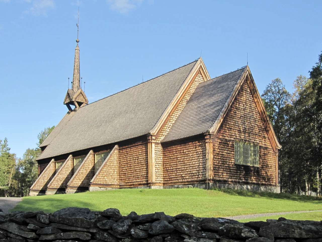
Long before there were potatoes there were reindeer. The Ammarnäs area served as pasture for the Sami communities of Ran and Gran for centuries, and its population was entirely Sami until 1803, when the Övre Gautsträsk homestead was first registered; the claim then sat unused until 1820. The village carries Sami names still, Gävttse or Gávtjávrrie in Ume Sami, Geavtse or Geavtsjaevrie in South Sami, and prehistoric hunting remains ring the settlement. A chapel went up in 1858, replacing the one at Jillesnåle as the summer church site for reindeer-herding Sami, and a kyrkstad of simple wooden cabins grew around it. In the 1930s two North Sami families arrived from Karesuando, part of the state-ordered displacements that moved Sami households hundreds of kilometres south, away from land and relatives they had not chosen to leave. Reindeer husbandry remains a working livelihood in Ammarnäs today, alongside small-scale tourism.
The River That Was Never Dammed
Ammarnäs sits on the ground where the Vindelälven meets the Tjulån, its largest tributary, the two joining at Gautsträsket. In the 1960s engineers drew up a chain of hydroelectric stations for the Vindelälven; the opposition that followed was local, regional and national, and in 1970 the Swedish government decided the river would be left to run. The Riksdag confirmed that in 1993, naming it a national river alongside the Torneälven, Kalixälven and Piteälven. What survives is 445 kilometres of undammed water from the mountains to the Ume River, one of the last big free-flowing rivers in Europe, and since 2019 the spine of the UNESCO Vindelälven-Juhttátahkka Biosphere Reserve. The reserve straddles the Arctic Circle and covers more than 1.3 million hectares.
Where the King's Trail Comes Down
The village is a gateway into Vindelfjällen, established on 25 February 1974 and, at 562,772 hectares, the largest nature reserve in Sweden and one of the largest protected areas in Europe. Kungsleden, the King's Trail, runs straight through Ammarnäs; the stretch to Hemavan is 78 kilometres of forest, wetland, high plateau and alpine peak, usually walked in six days with a mountain cabin at the end of each. A naturum visitor centre explains what you are looking at. Getting here means driving to the end of county road 363, or a bus from Sorsele once or twice a day, or a helicopter over from Hemavan. Char and grayling fill the water, birdwatchers come for the wetlands, and the potatoes go in as soon as the ground allows.
From the Air
Located at 65.958N, 16.209E in Sorsele Municipality, Västerbotten County, at roughly 400-410 metres elevation inside the Vindelfjällen Nature Reserve. The village sits on the low ground where the Vindelälven and its tributary the Tjulån join at Gautsträsket; from the air the giveaway is Potatisbacken, a distinct 38-metre cone on the south side of the village with a terraced, cultivated south face that reaches 439 metres. County road 363 dead-ends here. Recommended viewing altitude 3,000-6,000 ft AGL to read the delta braids and the striped potato slope. Nearest airports: Hemavan Tärnaby (ESUT) about 40 nm west-southwest, Storuman (ESUD) about 75 nm southeast, Arvidsjaur (ESNX) about 90 nm east-northeast, Lycksele (ESNL) about 120 nm southeast. Expect valley cloud, rapid mountain weather changes, and long snow cover; reindeer herding is active across the surrounding fells.
Nearby Stories
- Iraft 12 km away
- Norra Storfjället 26 km away
- Nasa Silver Mine 29 km away
- Matsdal 49 km away
- Joesjö 55 km away
- Kungsleden 84 km away
- Kallak Mine 132 km away
- Gammelstad Church Town 236 km away
Sources
- Ammarnäs - Wikivoyage
- Ammarnäs - Swedish Wikipedia
- Potatisbacken i Ammarnäs - Vindelälven-Juhttátahkka biosfärområde
- Mer om Ammarnäs - Visit Ammarnäs
- Vindelfjällen Nature Reserve - Wikipedia
- Vindel River - Wikipedia / Visit Vindelälven
- Vindelälven-Juhttátahkka - UNESCO Man and the Biosphere Programme
- Kungsleden Ammarnäs-Hemavan - Swedish Tourist Association