.JPG)
Aq Qaya
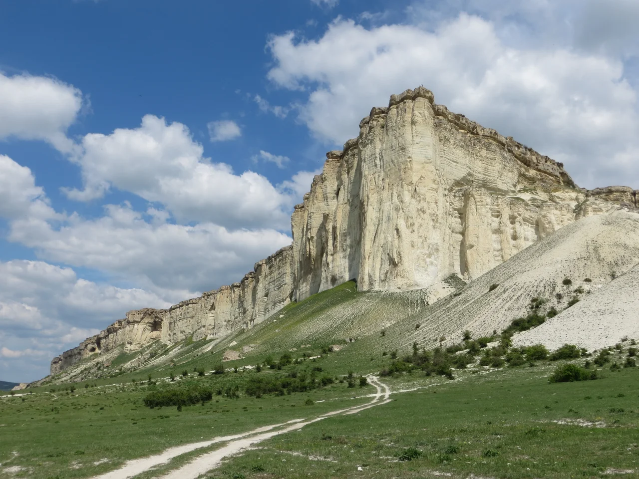
From the floor of the Biyuk-Karasu valley, the wall of Aq Qaya looks less like a hill than a rampart, a vertical face of pale stone that leaps a hundred meters straight into the Crimean sky. Its name says exactly what it is. In the Crimean Tatar language, Aq Qaya means simply White Rock, and on a bright day the chalk-colored cliff glows against the green of the surrounding foothills, visible for miles. It is one of the signature landforms of inland Crimea, a place where the geology of an ancient seabed has been raised up and carved into a monument.
Written by Wind and Water
Aq Qaya is a textbook example of a cuesta, a ridge with one gently sloping side and one steep, cliff-like face. It was built from chalk and the limestones and sandstones of the Paleogene period, laid down when this land lay beneath a warm sea, then slowly lifted and worn away by erosion and weathering. The stone tells the story of that patient carving in its shapes. Along the upper reaches of the cliff, weathering has sculpted pillars, grottoes, and smooth oval niches into the rock face. At the base, the debris of that same erosion piles up in slides and heaps of boulders and shallow hollows. In places the crumbling is held in check by tangled thickets of wild rose and hornbeam that grip the slope.
A Face That Rises 325 Meters
The summit of Aq Qaya stands 325 meters above sea level, but the number that matters when you are standing beneath it is the 100-meter drop between the valley floor and the top of the wall. That sheer difference is what gives the rock its drama, a clean vertical plane of white stone towering over gentle farmland. Rising above the Biyuk-Karasu river in the Bilohirsk district, it dominates its stretch of countryside completely, the kind of landmark that orients everyone who lives within sight of it. Since 1981 Aq Qaya has been protected as a natural monument of national importance, a recognition of both its geological interest and its sheer visual presence in the landscape.
An Ancient Refuge
People noticed Aq Qaya long before it was ever declared a monument. The caves and grottoes weathered into the rock near the nearby town of Bilohirsk preserve evidence of early human occupation, a reminder that this bright cliff, so conspicuous from the valley, made a natural shelter and landmark for the people who came before. It is easy to understand the appeal. A wall of stone like this offers protection, high ground, and an unmistakable point of reference in open country. Standing at its foot, you feel the scale of geological time pressing down: the chalk above you was laid grain by grain beneath a vanished sea, and the pillars and hollows overhead were shaped over ages by nothing more forceful than wind and rain and frost. Today Aq Qaya draws visitors for the same reasons it once drew ancient occupants: the astonishing sight of it, the shade of its overhangs, and the long view from its heights across the folds of the Crimean foothills, where the pale rock, the green thickets, and the ribbon of the river below all fall into place at once.
From the Air
Aq Qaya rises at 45.11°N, 34.62°E above the Biyuk-Karasu river valley in the Bilohirsk district of inland Crimea, its summit reaching 325 m with a sheer 100-m white cliff face. From about 2,000 to 3,000 feet above the valley the pale wall is unmistakable against the green foothills; treat it as terrain and mind mountain winds. The nearest major airport is Simferopol (URFF), roughly 40 km to the west-southwest.
Nearby Stories
- Aeroflot Flight 6515 9.1 km away
- Crimea 13 km away
- Gennadiy Borisov 13 km away
- Otlu Qaya 14 km away
- Valley of Ghosts 20 km away
- Arabat Spit 48 km away
- Swan Islands Nature Reserve 73 km away
- Soviet Destroyer Smyshlyony 126 km away