
Arabat Spit
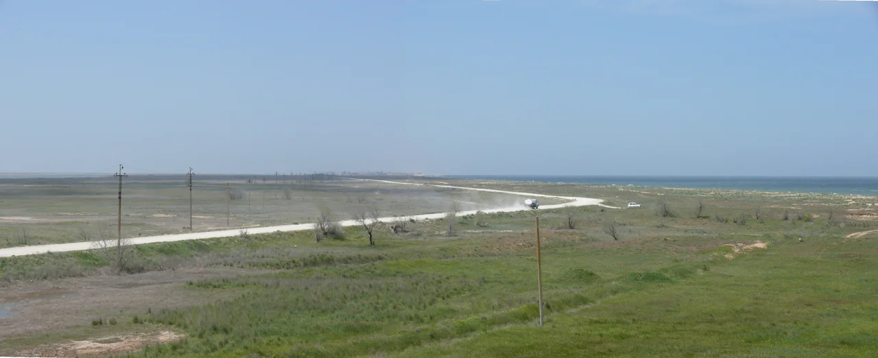
Trace a finger down a map of the northern Sea of Azov and you will find a line so improbably narrow it looks like a cartographer's error. This is the Arabat Spit, a barrier of sand and crushed shell that runs 112 kilometers from north to south while measuring, in places, barely 270 meters across. On one side lies the open Azov, warm and swimmable. On the other broods the Syvash, a maze of shallow, hyper-saline lagoons that locals have long called the Rotten Sea. The spit is the wall between them, and a young one at that: geologists reckon the sea only piled it up around a thousand years ago, between roughly 1100 and 1200 AD. To stand on it is to occupy one of the strangest addresses on the map, a sliver of land with a sea on your left hand and a mirror of salt on your right, and scarcely enough ground between them to turn a wagon around.
The Wall of Salt and Sand
Nature built the Arabat Spit the way a river builds a sandbar, only vast. Currents in the Sea of Azov carried sand and broken shell along the coast, dropping their load until a ridge rose above the waterline and kept growing. The numbers are almost hard to believe: 112 kilometers long, 395 square kilometers in area, and an average width of just three and a half kilometers, tapering in the narrowest reaches to a few hundred meters. The result is startlingly asymmetric. On the Azov side the shore runs low and arrow-straight, which is exactly why Ukrainians and Russians alike have called it the Arabat Arrow since at least the mid-nineteenth century. On the Syvash side the edge twists and frays into inlets and shoals. Two low ranges of brown-clay hills interrupt the sand, one about seven and a half kilometers from the Henichesk Strait, another some thirty-two kilometers down. Grasses, thorn, spear grass, tamarisk, and licorice cling to the dunes, holding the whole thin structure together against the wind that pours off the water almost without pause, and giving the sand just enough grip to resist the sea that made it.
The Salt Road
For most of its history the spit was empty wilderness. That changed in 1835, when a road and five relay stations, spaced at regular intervals, were laid down its length to carry the post. Settlements followed. By the later nineteenth century some twenty-five rural and three military settlements had appeared, along with a village named simply Arabat, after the seventeenth-century Turkish fortress that guards the southern tip; the name itself may come from the Arabic for a military post, or for a suburb. The rural population came to around 235 people. These residents fished, farmed thin ground, and above all made salt, harvesting it from the shallow, evaporating waters of the Syvash. The trade was serious business, a natural fit for a place ringed by some of the saltiest water in the region. In the nineteenth century the Arabat Arrow alone produced something like 24,000 tonnes of salt a year, hauled north along the same routes that once linked Crimea to the markets of Ukraine and Russia. Today the salt pans have given way to a gentler industry, the spit reborn as a health resort with its Azov shore turned over to swimmers and sun.
A Line Drawn Through Two Worlds
The spit belongs, geologically, to Crimea, yet it has never sat neatly inside a single border. Its northern half falls within Kherson Oblast, its southern portion within Crimea, a peninsula internationally recognized as part of Ukraine that came under Russian military occupation in 2014. The whole spit fell under Russian control in February 2022, a day after the full-scale invasion began. History has a way of pressing hard on such narrow places. Yet for the Ukrainian families who came here summer after summer, the Arabat Arrow meant something simpler: shallow warm water, kite surfers leaning into the wind, guesthouses in a line along the first dune, and the particular pleasure of a beach with the sea on one hand and a mirror of salt on the other.
From the Air
Centered near 45.70°N, 35.00°E, the spit reads best from 6,000 to 10,000 feet, where its full hair-thin length resolves against the water. Look for the straight Azov edge on the east and the ragged, silvery Syvash lagoons to the west; the Arabat Fortress marks the southern end. Nearest airports include Simferopol (URFF) to the southwest and Berdiansk (UKDB) to the northeast.
Nearby Stories
- Syvash 25 km away
- Byriuchyi Island 29 km away
- Kazantyp Nature Reserve 31 km away
- Ozbek Han Mosque 37 km away
- Battle of the Kerch Peninsula 39 km away
- Kebir Mosque 52 km away
- Azov-Syvash National Nature Park 55 km away
- Azov Upland 181 km away