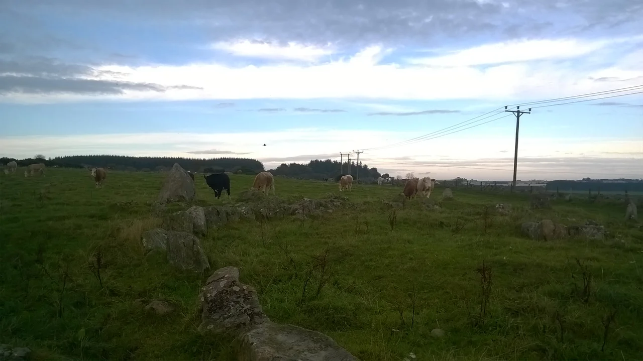

Aquhorthies Stone Circle
In 1692, the antiquarian James Garden walked across a field in lowland Aberdeenshire on the insistence of his English correspondent John Aubrey, looked at a ring of stones, and wrote down a description of the wrong one. The site he meant to describe — Aquhorthies — sits one field away from another circle called Auld Bourtreebush, and the two are easy to confuse. For three centuries since, every visitor has had to begin by sorting out which set of stones is which. The mistake is forgivable. The landscape here is studded with monuments from a vanished world, and even careful men get them tangled up.
How a Recumbent Circle Works
More than seventy recumbent stone circles survive in lowland Aberdeenshire. They share a single defining feature: the largest stone of the ring lies on its side, its long axis aligned between south and southwest, flanked by two upright stones nearly as tall. The arrangement frames a stretch of southern sky — the part where the midsummer moon rides low and bright — and seems deliberately built to watch something. What that something was, archaeologists cannot quite say. Cremated bone has been found at some sites. Pottery sherds. Hints of fire and ceremony. But the precise purpose of these Bronze Age constructions, raised perhaps four thousand years ago, remains one of the quiet mysteries of north-east Scotland. Aquhorthies' nearest cousins are the axial stone circles of southwest Ireland, on the far side of the Irish Sea — possibly the same idea, possibly a coincidence of human geometry.
Two Rings, Fourteen Stones
What makes Aquhorthies unusual, even among its many neighbours, is that it appears to have had two stone rings rather than one, set on a deliberately built platform with a ring cairn at the centre. Fourteen orthostats remain standing today, two of them mere stumps, from an original count of at least eighteen. The recumbent stone itself is large: 2.75 metres wide and 1.4 metres tall, laid out flat to the south. One of its two flankers is missing. Atypically for the type, a small forecourt opens in front of the recumbent — a feature that hints at ritual approach, at processions, at the recumbent being used as a kind of altar or window. The cairn that once stood at the centre has been plundered down to its kerb. Whoever dug into it in earlier centuries left behind only the outline.
A Procession of Antiquarians
After James Garden's confused 1692 visit, Aquhorthies attracted a steady stream of investigators. James Skene and James Logan sketched the stones in the 1820s. In 1858 a small expedition — James Dyce Nicol, Charles Dalrymple, Captain James Burnett, the Reverend Harry Stuart, and Alexander Thomson — excavated the cairn, only to find that someone else had got there first. They recovered burnt bone fragments and a few sherds of pottery. The late 19th century brought another wave: William Collings Lukis, Christian Maclagan, Robert Angus Smith, and Frederick Coles. In 1934 the archaeologist Alexander Keiller noted that the heights of the stones alternated in an atypical pattern. Alexander Thom surveyed the circle in 1955 looking for astronomical alignments, and Clive Ruggles did the same in 1981 with more modern methods. The site was made a scheduled monument in 1925, and a geological survey followed in 2006. Each generation has asked the stones the same question. The stones keep their answer.
Standing in the Field
Visiting Aquhorthies today means walking out across rolling farmland near Portlethen, just inland from the Causey Mounth — the medieval drovers' road that once funnelled all north-east traffic between Stonehaven and Aberdeen. The recumbent slab still lies where it was placed, broad and pale, watching the southern horizon. The forecourt opens in front of it. Behind, the ring of upright stones leans at various angles, as stones do after four millennia of frost and cattle and wind off the North Sea. Auld Bourtreebush stands in the next field over — the one James Garden accidentally described — and together the two circles mark this corner of Aberdeenshire as a Bronze Age place, even now, even when the cattle wander between them and the planes from Aberdeen pass overhead.
From the Air
Aquhorthies stone circle sits at approximately 57.058°N, 2.164°W, in farmland near Portlethen, about 6 nautical miles south of Aberdeen. Recommended viewing altitude is 2,000–3,500 feet AGL — the circle is small and visible only against open pasture. The site lies within the Aberdeen TMA, with EGPD (Aberdeen International) immediately north. The coastline runs just east; Stonehaven (EGQK area) lies about 10 nm south. Best viewing is in raking light early or late in the day, when the recumbent's shadow makes the ring readable from the air.
Nearby Stories
- Battle of Inverurie (1308) 3.9 km away
- Tomnaverie Stone Circle 9 km away
- Montrose Air Station Museum 12 km away
- Restenneth Priory 14 km away
- Auchindoun Castle 21 km away
- German submarine U-58 (1938) 104 km away
- Longstone Lighthouse 126 km away
- Farne Islands 158 km away