
Arrondissement of Cherbourg
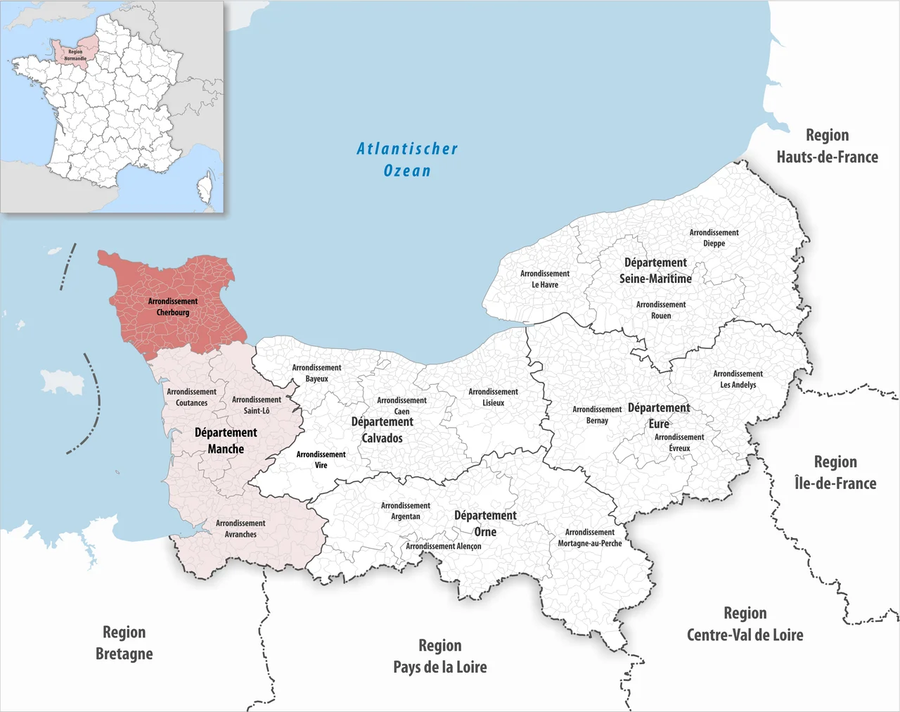
Look at a map of the Cotentin Peninsula - that stubby thumb of land pointing north into the English Channel - and you are looking at the Arrondissement of Cherbourg. The whole northern half of the peninsula, 144 communes from coastal fishing villages to inland farming hamlets, is bound together administratively under a city most of them rarely visit. The arrondissement was drawn by Napoleon's surveyors in 1811 and has been redrawn many times since, but the basic idea has held: everything north of a certain line on the Cotentin is Cherbourg's hinterland, whether the people of Barfleur or Valognes much care for the label or not.
What an Arrondissement Is
France's administrative geography is layered like a cake. The whole country is divided into régions, the régions into départements, the départements into arrondissements, and the arrondissements into communes. The arrondissement is the middle layer - a creation of Napoleon's empire-era reorganization, originally designed so a sous-préfet could keep tabs on a manageable slice of the larger département. The Cotentin Peninsula sits inside the département of Manche, which is part of the région of Normandie. Manche has four arrondissements, and Cherbourg's is the one that covers the peninsula's northern tip. The borders shift now and then; in January 2017 two communes from the neighbouring Arrondissement of Coutances were transferred north, a reminder that even on a country lane in Normandy, lines on maps can move without warning.
144 Names
The list of communes reads like a tour of every place name on the Cotentin. There is Cherbourg-en-Cotentin itself, the great port city that swallowed five smaller communes in 2016. There is Barfleur on the eastern cape, where William the Conqueror's flagship the Mora was built and gifted to him before the 1066 invasion of England. There is Sainte-Mère-Église, the village where American paratroopers descended on the night of 5-6 June 1944, including John Steele, who hung from the church steeple by his parachute. There is Barneville-Carteret on the west coast, with its lighthouse and ferries to Jersey. There is La Hague at the tip of the peninsula, where the famous nuclear reprocessing plant sits beside cliffs that look like Cornwall. Saint-Vaast-la-Hougue, on the east coast, gave its name to the 1692 naval battle that followed the Action at Cherbourg. Orglandes, with its German war cemetery. Quinéville, Picauville, Étienville, Quettehou - the names roll on, mostly old Norse or old French, each attached to a village green and a war memorial.
The Cantons Question
Until 2015, the arrondissement was subdivided into cantons - smaller groupings of communes used for elections to the conseil départemental. The Cherbourg arrondissement had fifteen of them: Cherbourg-Octeville split into three sectors (Nord-Ouest, Sud-Est, Sud-Ouest), Équeurdreville-Hainneville, Tourlaville, plus rural cantons named for Bricquebec, Barneville-Carteret, Beaumont-Hague, Les Pieux, Montebourg, Quettehou, Saint-Pierre-Église, Saint-Sauveur-le-Vicomte, Sainte-Mère-Église and Valognes. Then in 2015, France redrew the cantons nationwide and untethered them from the arrondissement borders. The result is the kind of bureaucratic mismatch only the French could love: cantons and arrondissements overlap awkwardly now, like two transparencies laid slightly askew. The locals carry on regardless. The communes are what matter, and the communes are old.
A Peninsula That Forgets It Is One
Driving the Cotentin, you do not always feel as if you are on a peninsula. The land is large enough, the hedgerow farmland deep enough, that you can lose sight of the sea for an hour at a time. Then you come around a bend near La Pernelle or Vicq-sur-Mer and the English Channel opens up suddenly to the north, slate-grey and vast. The 144 communes of the arrondissement live within that geography: cidre orchards and Norman dairy cows inland, oyster beds and lighthouses on the coast, the Bay of the Seine to the east leading down to the D-Day beaches, the Channel Islands faintly visible to the west on clear days. Cherbourg-en-Cotentin sits in the middle of all of it - the only real city for fifty kilometres, the place where the ferries from England arrive and the trains from Paris terminate.
What a Map Does Not Show
An arrondissement is not the kind of geography that produces postcards. There is no Arrondissement of Cherbourg flag, no anthem, no team. The sous-préfet's office sits in the city, processing paperwork. But the boundary still matters - for tax assessments, for school catchments, for the way a Norman farmer fills out his census return. And it matters for storytelling, because the unit gathers under one name a slice of France that has played the same role for a thousand years: the place where invasions land. Norse longships in the 9th century. William's fleet sailing the other way in 1066. Edward III in the Hundred Years' War. The English fireships of 1692. The Americans of June 1944. The arrondissement of Cherbourg is, more than anything, a list of places that have been fought over.
From the Air
The arrondissement covers the northern half of the Cotentin Peninsula, roughly bounded by 49.2-49.8°N latitude. Cherbourg-en-Cotentin (49.64°N, 1.63°W) sits at the centre of the northern coast. From cruising altitude the peninsula's distinctive thumb shape is unmistakable - flat farmland in a sea of hedgerows, the Channel on three sides, the great artificial harbour of Cherbourg standing out as a man-made arc on the north coast. Nearest airports: Cherbourg–Maupertus (LFRC), Carentan (LFAD), Caen–Carpiquet (LFRK). Sainte-Mère-Église and the D-Day landing beaches are within the arrondissement on the east coast.
Nearby Stories
- Abbey of Saint-Sauveur-le-Vicomte 4.3 km away
- Alderney Society Museum 9.3 km away
- Channel Islands 18 km away
- Operation Donnerkeil 31 km away
- German Submarine U-672 31 km away
- D-Day: The Longest Day 59 km away
- Fishbourne Roman Palace 103 km away
- Basilica of Sainte-Therese, Lisieux 110 km away