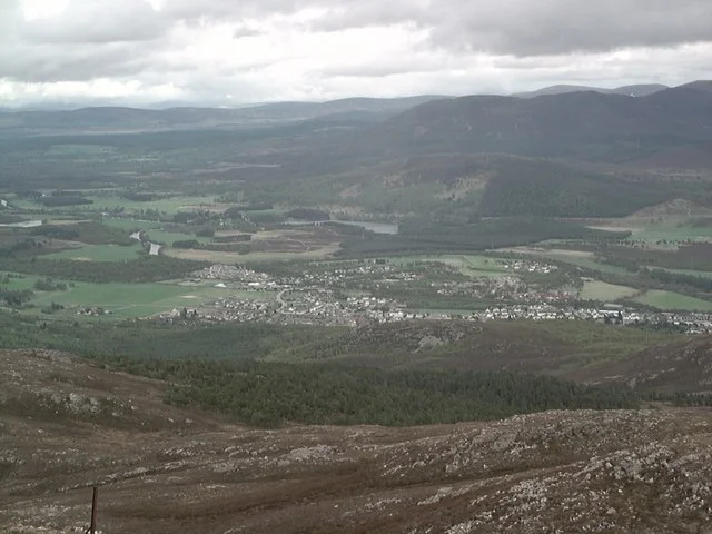

Aviemore
Spring comes late here. Snow lingers on the summits long after lowland Scotland has moved on, and the crags and birch woods around Aviemore — at 214 metres elevation, in the broad sweep of Strathspey — feel more Nordic than Scottish, in a country whose climate is mostly defined by the warmer south. The town has 3,230 residents as of 2020, which makes it less a town than a base camp: the main settlement on the western side of Cairngorms National Park, the place skiers and hill-walkers and steam railway enthusiasts pass through on their way to something else. But that something else is one of the most concentrated outdoor playgrounds in Britain, and Aviemore is honest about its role. Most of what is here exists to refuel people who have just come down from a mountain, or who are about to go up one.
The Brutalist Resort That Wasn't
Highland tourism took off in the 19th century with Queen Victoria's enthusiasm for Scotland, but the modern shape of Aviemore was poured in concrete in the 1960s. Ski lifts went up on Ben Macdui's slopes 12 miles east. A purpose-built resort village rose in the middle of town to accommodate the new winter crowds. It was, by most accounts, a brutalist monstrosity — a charmless block of accommodation and concrete plaza that delivered thousands of first ski experiences while looking, externally, like a multi-storey car park. The ski area itself proved unreliable: small, often crowded, and increasingly vulnerable to weeks of poor snow cover. The resort's character drove a generation of locals to despair. Eventually it was demolished and replaced with more congenial buildings, and in 2001 a funicular railway opened on Cairn Gorm to support the ski lifts in high winds. The funicular failed structurally in 2018, sat closed through the pandemic, and reopened in 2023 after a substantial taxpayer-funded repair. Skiing alone was never going to sustain Aviemore. The town has had to expand its offer to year-round outdoor recreation — hill-walking, mountain biking, kayaking, rafting, pony trekking, wildlife spotting — and that is what it now sells.
Stone Circles, Lochs, and an Islet Castle
There are Bronze Age monuments hiding in the housing estates here. The Aviemore Stone Circle sits inside a modern subdivision, a Clava-type annular burial chamber roughly 5,000 years old, with the cairn at its centre grassed over for preservation. A similar circle stands two miles north in the woods near the heritage Strathspey Railway, with the ruins of its cairn left uncovered. The most evocative day-walk near Aviemore is the five-mile circuit around Loch an Eilein in Rothiemurchus Forest. A ruined 14th-century castle perches on an islet in the loch — reached by causeway before water levels were raised in the 18th century — and in 1690 it saw the last action in Scotland of the original Jacobites. The forces of the ousted King James II, fleeing the double drubbing at Cromdale, tried to seize the castle but were repulsed by the widow holding it. They scattered before the Hanoverian troops behind them. The Stuart cause moved underground and would fall to James's son and grandson, the Old and Young Pretenders, to attempt twice more before final defeat at Culloden in 1746. The castle on its islet is now half-collapsed, photogenic, completely silent.
A Munro Half a Mile from the Top Station
Cairn Gorm summit, at 1,245 metres, is the sixth-highest mountain in Britain and only half a mile south of the funicular's top station. Skiers and lift-pass holders have the easiest access: park your kit at the Ptarmigan station at 1,080 metres, then stride out. Walkers must ascend on foot from the base car park — the funicular's environmental compromise prevents non-skiers from exiting the top station — though they are permitted to ride down again. The Windy Ridge route, straight up alongside the funicular, is the simplest and shortest. The North Corries route, taking in the rims of the glaciated valleys, has the views. Ben Macdui, at 1,309 metres the highest in the Cairngorms range, is an 11-mile, 6-to-8-hour walk from the same base, swinging west of Windy Ridge and returning via Cairn Gorm. Queen Victoria climbed Ben Macdui in 1859 by pony from Balmoral to Loch Etchachan, then hiking the rest. Without a car, the modern version is tricky: the last bus back to Aviemore leaves before most hikers can make it down.
Steam, Sand, and Sleeper Trains
The Strathspey Railway runs steam excursions from Aviemore Station Platform 3, ten miles north to Boat of Garten and Broomhill, where the line dies in the fields and the train reverses. Council plans to extend to Grantown have stalled on the cost of moving the A95. April through October, Wednesday through Sunday, three round trips a day, each taking just under two hours including the long stop at Boat of Garten where the workshop holdings are kept. Loch Morlich, in the woods between Aviemore and Cairn Gorm, has — improbably — a sandy beach at 300 metres elevation, popular for warm-day water sports. Below the sand are broken glass and wartime military remnants from when Norwegian commandos trained here in exile. The Caledonian Sleeper leaves London Euston around 9 PM on Friday through Sunday nights, arriving Aviemore at 7:45 AM, continuing to Inverness. It is the slowest and possibly most civilised way into the Cairngorms — a way to fall asleep in central London and wake up where Bronze Age stone circles sit inside subdivisions and the mountain railway re-opens, closes, and re-opens again.
From the Air
Aviemore: 57.194°N, 3.823°W, elevation 214 m, on the A9 corridor 28 nm south of Inverness in the Spey valley. The town sits on the western edge of Cairngorms National Park; Cairn Gorm and its ski area lie 5 nm east. Strathspey Railway runs north from the town through the Spey valley. Best viewed at 3,000–5,000 ft AGL. Nearest airport is Inverness (EGPE), 28 nm north; alternatives are Dundee (EGPN, 60 nm south) and Aberdeen (EGPD, 50 nm east). The A9 and main rail line provide clean north-south visual navigation through the Spey valley toward Drumochter Pass.
Nearby Stories
- Dalwhinnie distillery 1.9 km away
- Battle of Mons Graupius 11 km away
- Black Isle 12 km away
- Battle of Auldearn 13 km away
- Keith, Moray 14 km away
- Kildrummy Castle 16 km away
- Boleskine House 16 km away
- Siege of Blair Castle 22 km away