
Black Isle
Start with the name, which lies twice. The Black Isle is not black - in winter, when snow lies thick on the surrounding hills, this peninsula stays green and dark by contrast, which is the most cited explanation for the colour. And the Black Isle is not an island, even though the Cromarty Firth borders it on the north, the Beauly Firth on the south, and the Moray Firth on the east. Only on the west does it cling to the mainland, and even there a tributary of the River Beauly does most of the boundary work. The Encyclopaedia Britannica's eleventh edition called the original Gaelic name Ardmeanach - height of the monk - after an old religious house on the wooded ridge of Mulbuie. The Black Isle is one of those places where the name is the smallest thing wrong with what people think they know.
Three Firths and a Ridge
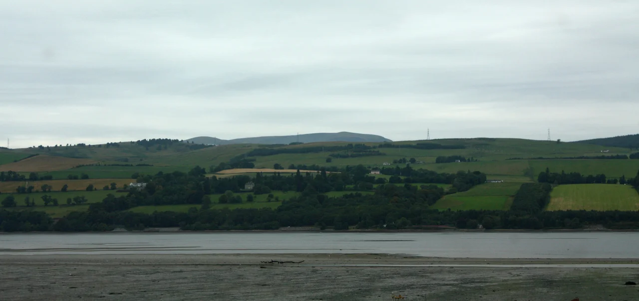
Geography first, because everything else flows from it. The Black Isle is a fat green peninsula about 20 miles long, ribbed down its centre by the wooded ridge of the Mulbuie. The Cromarty Firth to the north is a deepwater anchorage where decommissioned North Sea oil rigs queue against the skyline at Invergordon. The Beauly Firth to the south runs back toward Inverness. The Moray Firth opens east to the North Sea. Two modern road bridges - the Cromarty Bridge of 1979 and the Kessock Bridge - carry the A9 trunk road across the firths and through the heart of the peninsula. There used to be a ferry across to Nigg; only a summer service from Cromarty survives. About 12,000 people live in the seven civil parishes that make up the peninsula: Killearnan, Knockbain, Avoch, Rosemarkie, Cromarty, Resolis and Urquhart.
Dolphins at Chanonry Point
On a strip of shingle between Rosemarkie and Fortrose, where Chanonry Lighthouse marks the narrowest part of the Moray Firth, the resident bottlenose dolphins come within yards of the beach. They surf the tidal funnel, hunting salmon that have been forced into a narrow channel by the geography. It is reckoned one of the best places in Europe to see wild dolphins from land. The same point is where the Brahan Seer, the most famous of Highland prophets, was supposedly murdered in the seventeenth century - burned in a barrel of tar after his predictions exposed an affair involving the Countess of Seaforth. The story is folklore at best. The Seer himself may not have existed as a single person. The dolphins are entirely real. So is the wind off the firth, which on most days has come straight from Scandinavia.
Castles, Clearances, and Hugh Miller's Cottage
The Black Isle wears its history in pieces. Castlecraig and Redcastle survive in part; Kilcoy Castle still stands; the tower house of Kinkell was rescued from ruin in the late 1960s by the sculptor Gerald Laing. Tarradale, Chanonry and Ormond castles have left only mounds. Hugh Miller, the self-taught Cromarty geologist whose Old Red Sandstone fossils helped found Scottish palaeontology, was born in a thatched cottage in Cromarty that the National Trust for Scotland still keeps as a museum. Alexander Mackenzie, who crossed Canada overland in 1793 and gave his name to the Mackenzie River, is buried in the churchyard at Avoch. The peninsula was also one of the earliest places in the northern Highlands to experience the Clearances - the systematic eviction of crofting tenants to make way for sheep - and many lowland farmers and shepherds were brought in to replace the displaced families. Bobby Hogg of Cromarty died in October 2012; with him went the last fluent speaker of the Black Isle's distinctive North Northern Scots dialect.
Kites in the Hill, Wells in the Trees
Between 1989 and 1994, 93 red kites of Swedish stock were released on the Black Isle as part of a reintroduction project to bring back a raptor extinct in Scotland for more than a century. They thrived. The forked tails and rust-red wings are now a regular sight wheeling over the Mulbuie ridge. The peninsula also holds three of Scotland's surviving Clootie Well sites - at Munlochy, Jemimaville and Avoch - where for centuries pilgrims have tied strips of cloth to the trees beside spring-fed wells as offerings, asking for the healing of an illness as the cloth weathers and rots. The custom has fallen off but the cloth still hangs at Munlochy, layer on layer, slowly fading. The Black Isle has always been like this: a peninsula that pretends to be an island, a forest of cloth-hung trees beside an old saint's well, a green ridge between three salt firths where dolphins surf the tide.
From the Air
The Black Isle is centred near 57.59°N, 4.24°W. The peninsula is unmistakable from the air: a fat green wedge between the Cromarty Firth and the Beauly Firth, with the Moray Firth opening east. Inverness Airport (EGPE) sits 5 miles south of the Kessock Bridge at Dalcross. Recommended viewing altitude 3,000-5,000 ft AGL gives a good sense of the three firths and the central ridge of the Mulbuie. The deepwater oil-rig anchorage at Invergordon dominates the northern shore. Watch Chanonry Point on the south-east tip where the firth narrows - dolphins are often visible from low and slow passes. Marine haar (sea fog) can roll in off the Moray Firth on warm summer days, obscuring the coast while the ridge stays clear.
Nearby Stories
- Nairn 1.7 km away
- Portmahomack Sculpture Fragments 2.4 km away
- Loch Ness Monster 3.4 km away
- Ardgay 5.8 km away
- Glen Affric 5.9 km away
- Strathspey Railway (preserved) 9.2 km away
- Battle of Leckmelm 11 km away
- Corrieshalloch Gorge 22 km away