Aweil, South Sudan
On 21 December 1989, an Aviation Sans Frontieres aircraft carrying two Medecins Sans Frontieres workers and a World Food Programme technician was shot down over Aweil. The three Frenchmen on board - Yvon Feliot flying, Jean-Paul Bescond the doctor, Laurent Fernet the logistician - died alongside a Ugandan technician named Frazer Ariyamba. Their only error was flying relief supplies into a starving town during a war. MSF has not forgotten them. Aweil has not forgotten much. This is a place whose memory stretches backwards through civil war, famine, nineteenth-century slave raids, and still further, to when the confluence of the Lol and Pongo rivers was simply home.
The Slave Century and the War Century
Aweil was affected by the slave trade in the nineteenth century. That sentence, pulled from a brief Wikipedia entry, compresses decades of violence. Slave raiders from the north - Arab-identified groups backed by Ottoman, then Egyptian, then Mahdist authorities - rode south into Dinka country to capture human beings for markets in Khartoum and Cairo. The Dinka of the Aweil region were among those most affected. Then the twentieth century brought Sudan's two civil wars, which together killed around two and a half million people and sent perhaps five million more into exile. The Lost Boys of Sudan - the tens of thousands of unaccompanied children who fled the fighting in the late 1980s and walked hundreds of kilometres to refugee camps - included many boys from Aweil. William Kolong Pioth, who founded the Pan Aweil Development Agency in 2009, was one of them.
Where Two Rivers Meet
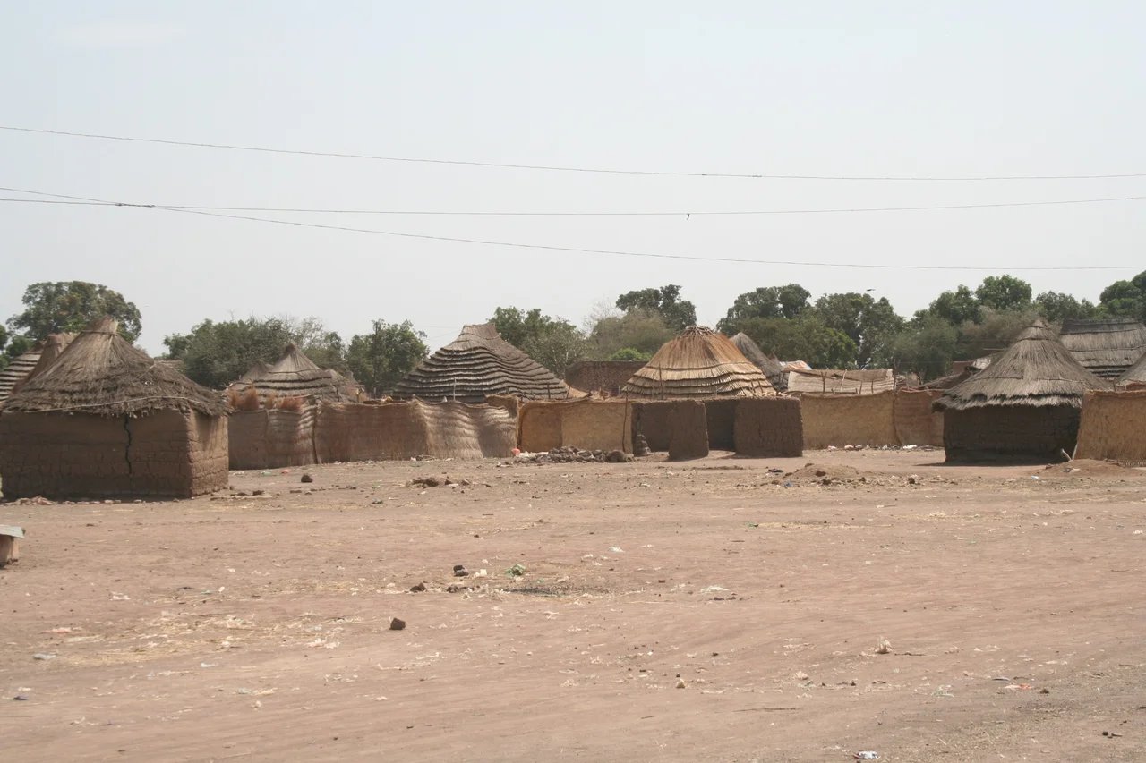
The town sits in the flat northwest of South Sudan, on the A43 highway, about 100 kilometres south of the international border with the Republic of Sudan. The disputed Abyei region lies to the east. The topography is flat and prone to flooding, but Aweil itself rests at 425 metres above sea level - just high enough to stay dry when the surrounding plains become seasonal lakes. The confluence of the Lol and Pongo rivers is close by. Agriculture built the town: cattle, sorghum, groundnuts, sesame. Fishing the rivers supplements the diet. In a difficult environment, the harvest is never guaranteed. Food insecurity is a polite term for what happens when the rains fail or the war returns.
A Railway Line Rebuilt
The Khartoum-Aweil-Wau railway was laid down in 1961. For decades it lay disused, damaged by fighting and neglected by the governments at both ends of the line. In 2010, the section from Aweil to Wau - and Aweil's station itself - was restored to use. The airstrip northwest of town carries the ICAO identifier HSAW and a 2,000-metre packed-dirt runway. Four aviation accidents have occurred there since 1973; three involved military aircraft, two of which were attributed to surface-to-air missile attacks. In 2024, Badr Airlines flew in once a week carrying NGO passengers and cargo. Boda-boda motorcycle taxis and regular taxis move passengers around town. The transport reality is improvised around whatever works.
Unity in Diversity
In April 2023, Northern Bahr el Ghazal's Ministry of Culture held a peace celebration in Aweil under the theme Unity in Diversity, supported by UNMISS. In August 2024, national culture day was celebrated at the Dr. John Garang Mausoleum - the memorial to the SPLA leader who died in a 2005 helicopter crash just months after Sudan's peace agreement made him South Sudan's vice president - with the theme Our Culture, Our Coexistence. The Aweil Stars FC plays at the local sportsground. Fans follow Real Madrid with a devotion that would be unsurprising anywhere on Earth. St Mary's Girls Secondary School, administered by the Episcopal Church of the Sudan's Aweil Diocese, keeps teaching. Aweil Civil Hospital is one of three referral hospitals in the whole of South Sudan.
The Tropic of Saharan Rain
Aweil sits in a tropical savanna climate, usually dry in winter and often dry in summer too, despite being in the tropics. The annual high averages just over thirty degrees Celsius; the annual low sits at twenty-three. Annual precipitation comes in at about 95 millimetres spread across 125 rain days. The two main ethnic groups are the Dinka and the smaller Luwo community. Arabic is used in some households and some public places but not widely - more often you hear Dinka or Luwo in the markets, and more English than anyone would have predicted a generation ago. In 2024 the population was estimated at 38,745. In 2008 MSF had put it at roughly 100,000. The truth lies somewhere in between, shifted by displacement, return, and the seasonal movement of cattle keepers who do not pause to be counted.
From the Air
Aweil sits at 8.77 degrees N, 27.40 degrees E in Northern Bahr el Ghazal, South Sudan, at an elevation of 425 metres. Aweil Airport (ICAO HSAW) lies 4.4 km northwest of the city centre with a 2,000-metre packed-dirt runway. Confirmation of runway condition is essential before approach. The nearest major hub is Juba International (HSSJ) 637 km south. From altitude Aweil is identifiable by the confluence of the Lol and Pongo rivers to the south, the A43 highway, and the restored Khartoum-Wau railway line passing through the town. The terrain is flat and floods extensively in the wet season.
Nearby Stories
- Aweil West County 27 km away
- Warrap 53 km away
- Abyei 73 km away
- Dār Fertit 80 km away
- Bahr el Ghazal (region of South Sudan) 82 km away
- Wau 115 km away
- Liffi 119 km away
- 1987 Dhein massacre 285 km away