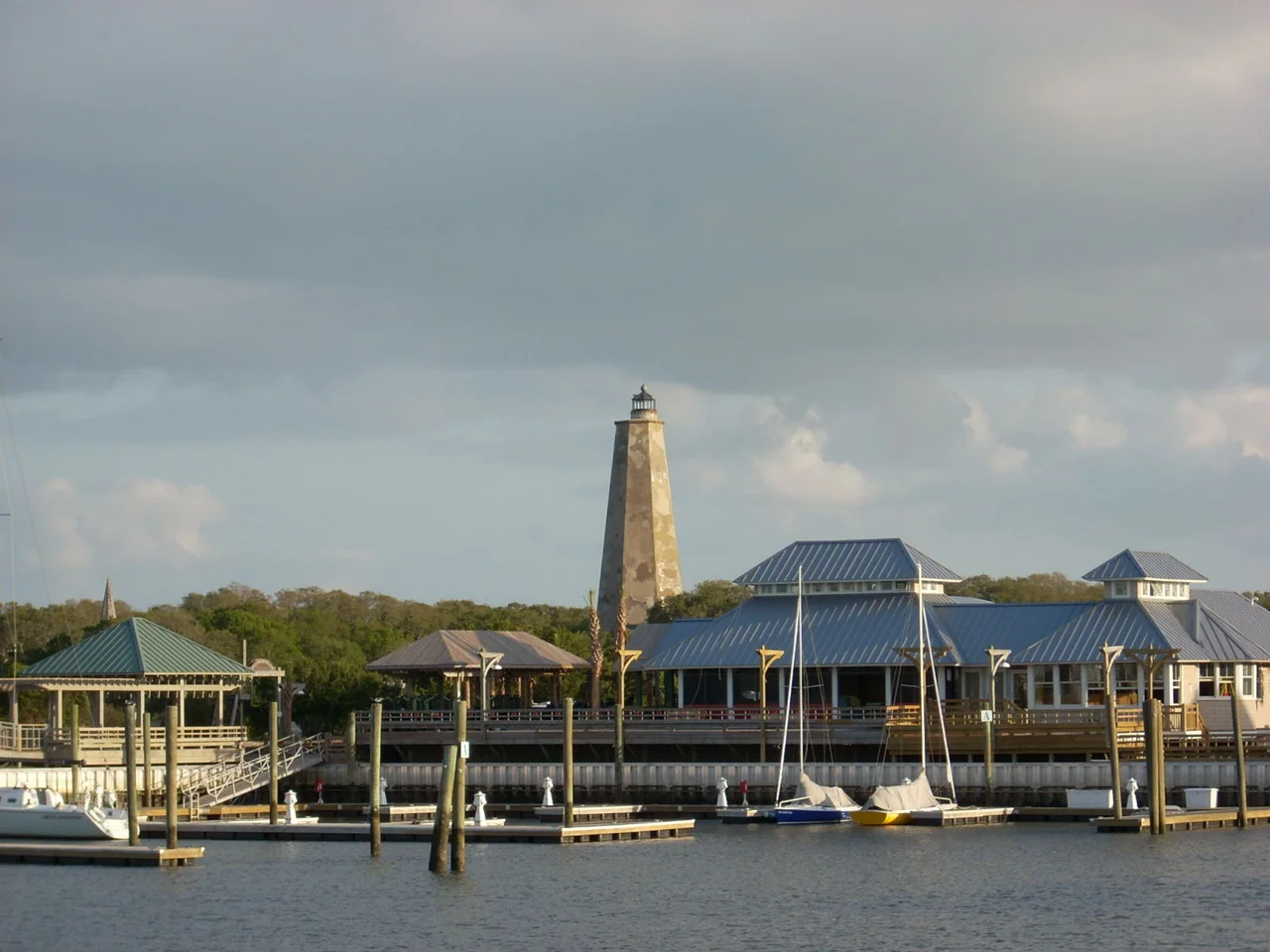

Bald Head Island
There are no cars on Bald Head Island. Golf carts roll quietly down sand-dusted lanes, bicycles lean against picket fences, and people walk in flip-flops past oaks bent sideways by centuries of salt wind. About 220 people live here year-round. In summer, thousands more arrive on the twenty-minute ferry from Deep Point Marina in Southport. The biggest tradition is the July Fourth Golf Cart Parade, an absurd, beloved procession that says more about the island's personality than any brochure could.
Old Baldy, Watching Since 1817
Just a short walk from the ferry landing stands North Carolina's oldest standing lighthouse, called Old Baldy by the people who live in its shadow. Built in 1817, the tower has weathered hurricanes, Civil War shelling, and the slow shift of the river mouth itself. The Cape Fear is a finicky waterway, dangerous for ships, and Old Baldy was the answer to that danger for more than a century. It is now a museum, but it still anchors the view from almost everywhere on the south end of the island. Climb the spiral stairs and you can see the same Atlantic horizon that lighthouse keepers tracked through telescopes when their fuel was whale oil and their nearest neighbor was the river pilot.
Twelve Thousand Acres, Ten Thousand Untouched
Bald Head Island covers 12,000 acres. Of those, 10,000 are preserved as beach, salt marsh, and maritime forest. The Bald Head Island Conservancy runs the Barrier Island Study Center near the ferry landing, where you can learn how loggerhead sea turtles nest on the south beach in summer and how the dunes shift each storm season. The interior of the island holds one of the largest remaining maritime forests on the East Coast, with live oaks draped in Spanish moss, sabal palmettos, and a quiet that makes the bird songs sound louder than they should. Captain Charlie's Station, three restored lighthouse keepers' cottages from 1903, sits at the south end, looking out at the shoals.
How You Get Here
The Bald Head Island Transportation passenger ferry runs from Deep Point Marina in Southport. For most of the year, ferries leave the mainland on the hour and the island on the half-hour, starting at 7 a.m. The crossing takes about twenty minutes across the Cape Fear River. Round-trip tickets cost around $23 for adults and around $12 for children ages 3 to 12. Children two and under ride free. Once you arrive, you can rent a golf cart or a bike from Riverside Adventure Co. near the ferry landing. There are no traffic lights, no chain stores, and no rental cars. That is the point.
Fourteen Miles of Beach
Bald Head's beaches wrap around the island for fourteen miles. The east-facing beach catches sunrise; the south-facing beach looks out toward Frying Pan Shoals, where the Atlantic shallows reach more than twenty miles offshore. Between the two is the corner where the river meets the sea, and the waves do strange things at that meeting. The seaside golf course threads between dunes and salt marsh. Sailing, surfing, and paddling trips run out of Riverside Adventure Co. for visitors who want to be on the water rather than beside it. Most people end up doing very little. The porch of a rented cottage, with the Atlantic visible through the live oaks, has a way of slowing the day.
Where Time Slows
Bald Head Island Limited Property Management handles most of the vacation rentals, from oceanfront cottages large enough for extended families to small homes tucked deep in the maritime forest. There are restaurants and a few shops, but the island deliberately stays small. The general information number, 800-234-1666, will not get you a concierge in a high-rise. It will get you someone who probably knows the ferry captain. The island sells the absence of things: no cars, no rush, no neon. What it offers instead is the sound of wind in palmettos and the slow turn of Old Baldy's beacon when the light fades and the river settles for the night.
From the Air
Bald Head Island sits at 33.86 degrees N, 77.99 degrees W, at the mouth of the Cape Fear River where it spills into the Atlantic. Cape Fear Regional Jetport (KSUT) on Oak Island is the nearest GA field, about seven miles west; Wilmington International (KILM) lies 25 miles north. From cruising altitude, the island is unmistakable: a triangular wedge of dense maritime forest framed by white beach, with Old Baldy lighthouse visible as a small white pillar near the north end. Frying Pan Shoals extends nearly 30 miles southeast and is a major hazard for low-level marine routing. Crossing tides at the river mouth can be turbulent for low-altitude flights.
Nearby Stories
- Ocean Isle Beach house fire 6.5 km away
- New Hanover County, North Carolina 8.8 km away
- Lake Waccamaw, North Carolina 26 km away
- Marine Corps Base Camp Lejeune 55 km away
- Huntington Beach State Park 62 km away
- HMT Bedfordshire 71 km away
- Atalaya Castle 111 km away
- Mercury-Redstone 4 688 km away