
Baleshare
In a single night during the storms of 2005, up to fifty metres of Baleshare's coast disappeared. The Atlantic took it, just like that, the way it has been taking pieces of this tidal island for centuries - quietly when it can, in sudden enormous bites when the wind aligns. Baile Sear in Gaelic means "east village," though the name implies a twin that the sea has already finished eating.
A Flat Place in a Hilly Country
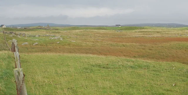
By Hebridean standards Baleshare is shockingly flat. Twelve metres is the highest point - barely above the spring tides that occasionally remind the island who is in charge. The Outer Hebrides are usually a land of gneiss and ridges, but here the geology gave up and let the wind pile sand instead. The result is mile after mile of one of the longest beaches in the islands, backed by machair grassland where wildflowers bloom in such profusion in early summer that the air thickens with their scent. Samhla sits at the east end, Teananachar at the west. Between them stretches farmland that crofters work much as their grandparents did, on land that may not be there in another hundred years.
The Causeway Year
Before 1962 you reached Baleshare by walking across the sands at low tide, watching the clock and the sky. Then William Tawse Ltd built a 350-metre causeway from North Uist, and the island stopped being an island in the practical sense. Children could go to school without coordinating with the moon. Doctors could come. Goods could move. The Exchequer Rolls of 1542 had already noted that Baleshare's rental value was falling because the sea was encroaching - a polite Tudor way of saying the island was shrinking. The causeway did not stop that process. It just meant the people who remained could leave more easily when they finally had to.
What the Storms Reveal
Coastal erosion is destructive, but it is also generous to archaeologists. Two prehistoric settlements have emerged from Baleshare's vanishing dunes: the remains of circular stone houses, pieces of patterned pottery, bone, metal, the daily clutter of people who lived here three or four thousand years ago. In 2005 Baleshare became a pilot project for Shorewatch, training community members to record sites before the waves erased them. Between August and December that year alone, up to four metres of archaeological layers were lost. Each storm is a small disaster and an unwilling excavation. The island offers up its history because it has no choice.
Notable Departures
John Fergusson, the Nova Scotia politician, was born here in the years when leaving was a more common life choice than staying. His career in Canadian colonial politics ran through the mid-nineteenth century, when so many Uist families crossed the Atlantic that Cape Breton still carries Hebridean place-names and Gaelic surnames in disproportionate numbers. The Hebridean Way trail brushes the island now, hikers and cyclists pausing to photograph the lone telephone box that has become Baleshare's most-photographed structure - a small red rectangle against a sky and a sea that go on forever.
From the Air
Located at 57.53N, 7.37W on the southwest coast of North Uist. From altitude the island appears as a bright sand-pale slab tied to the larger island by the thin line of the 1962 causeway. The vast white-sand beach of Traigh Bhaleshare on the west side is a distinctive landmark in clear weather. Nearest airport is Benbecula (EGPL) about eight nautical miles south. Tidal flats around the island can dramatically change shape and colour with the tide cycle; aerial photography is best at low tide when the full extent of exposed sandbanks reveals itself.
Nearby Stories
- Trumpan Church 2.7 km away
- Eilean Glas Lighthouse 3.6 km away
- South Uist 7.8 km away
- Talisker 14 km away
- Amhuinnsuidhe Castle 19 km away
- St Kilda, Scotland 58 km away
- German submarine U-516 155 km away
- The Laki Eruption: The Volcano That Changed World History 893 km away