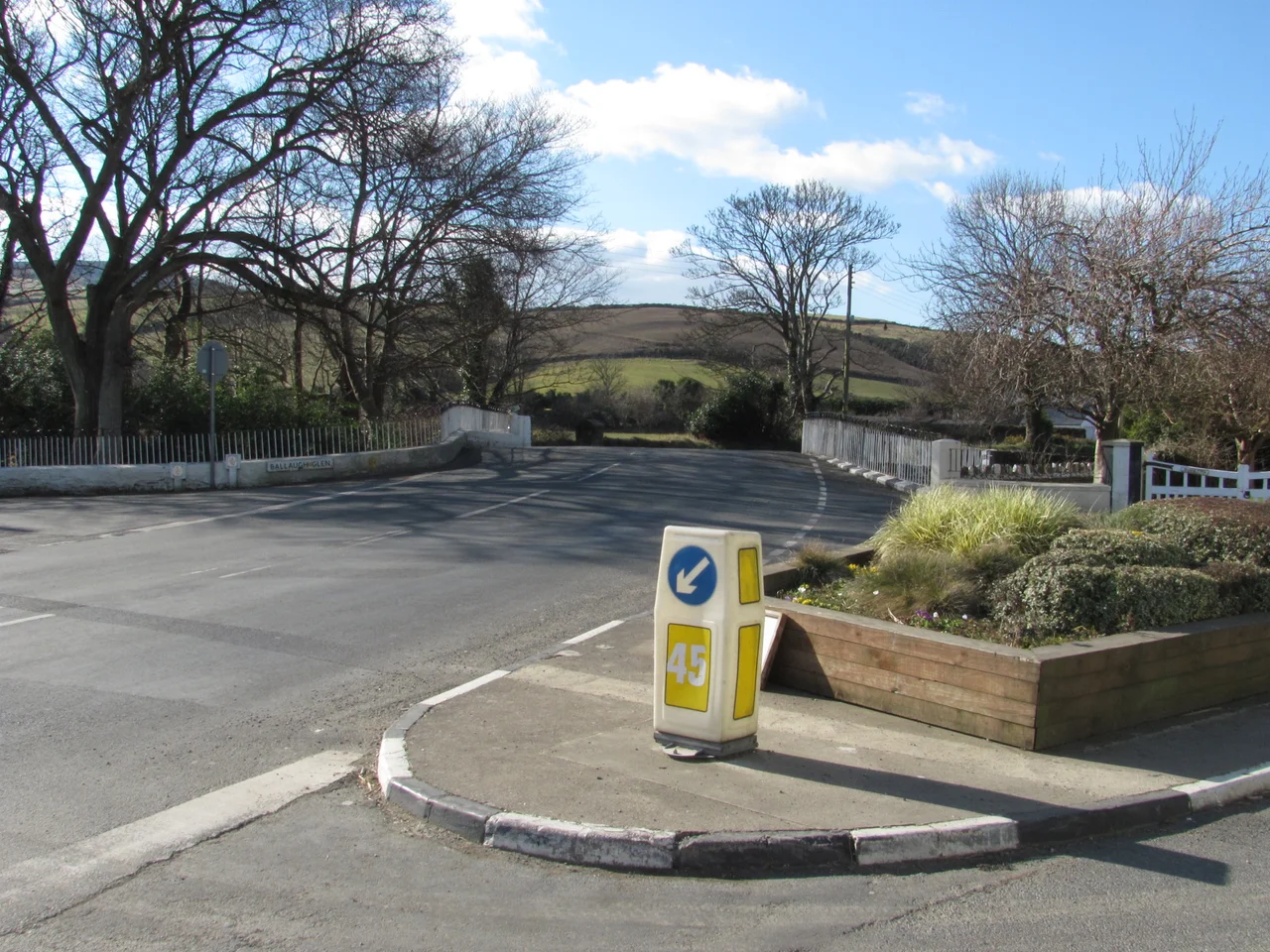

Ballaugh Bridge
Approach Ballaugh Bridge at racing speed and the road simply stops being flat. The hump rises in a sharp arch over the Ravensdale River, and a motorcycle taking it at any reasonable pace leaves the ground entirely - front wheel first, then the bike, then the rider hanging on as the suspension extends fully and the whole machine briefly flies. The photograph of that small leap, taken at the same spot every TT, is one of the iconic images of the Isle of Man TT. The bridge itself looks unremarkable. It is a small humpback stone span on a Manx country road. What it has accumulated, in just over a century, is a racing history denser than that of almost any other piece of public infrastructure in the British Isles.
Before the Motorcycles
Long before the bikes arrived, the cars came. Ballaugh Bridge formed part of the Highland Course, a 52.15-mile circuit used for early motor racing on the island - amended to 40.38 miles in 1906 - and of the 37.50-mile Four Inch Course used for the 1904 Gordon Bennett Trial and for the RAC Tourist Trophy car races that ran between 1905 and 1922. In the very earliest configuration, the bridge was the western edge of something called the Sandygate Loop, used for the 1904 Gordon Bennett British Eliminating Trial and the 1905 Tourist Trophy. By 1906 the loop had been abandoned in favour of a route running the A3 Castletown-Ramsey road from Ballacraine corner all the way to Ramsey. The story of British motorsport in its first two decades passed across this bridge before motorcycles entered the picture at all.
1911 and the Mountain Course
In 1911, the Auto-Cycling Union adopted the Four Inch Course for the Isle of Man TT motor-cycle races. Ballaugh Bridge was inside the route. That same course - or rather, what it has evolved into - is now the 37.73-mile Isle of Man TT Mountain Course, used continuously for the TT since 1911 and for the Manx Grand Prix since 1923. The Mountain Course is unusual in nearly every respect. It runs across closed public roads, climbs over 1,300 feet of mountain, passes through several villages, and has approximately 264 corners over its lap. Riders memorise it in sections, learning the cambers of individual stretches of tarmac the way a violinist learns a concerto. Ballaugh Bridge is one of the corners they cannot afford to misjudge. Land flat and the bike's frame can be damaged; land badly tilted and the rider can be thrown.
1953 and the Last Humpback
The bridge has not survived unchanged. Over the winter of 1953-1954, in preparation for the 1954 TT, the road was widened and the bridge profile altered. The garden wall of the adjacent Ballaugh Railway Hotel - now the Raven Hotel, named for the river - was removed to give racing motorcycles a wider line. Even after that adjustment, Ballaugh Bridge remains the only humpback bridge left on the TT Course. Sulby Bridge was removed in the 1920s. Ballig Bridge went in 1935. The Manx racing authorities have, over the decades, made the course faster and safer by smoothing out the most dangerous geometry - but they kept Ballaugh's hump. The leap has become part of the identity of the race.
Karl Gall's Roadside
Just by the bridge stands a small memorial to Karl Gall, an Austrian motorcycle racer who was part of the pre-war BMW works team. During evening practice for the 1939 Isle of Man TT, Gall crashed near the bridge and died from his injuries. The roadside marker remembers him by name. He was one of the many riders the Mountain Course has claimed over its long history - more than 270 since 1911, including spectators and officials - and the memorials scattered along the route are part of how the island carries that weight. The Manx public roads become a racetrack for two weeks each year. The same hump-backed bridge that launches motorcycles into the air also carries the grocery vans of Ballaugh for the other fifty weeks. The contradiction is fundamental to what the TT is, and Karl Gall's memorial is one of the small honest reminders that the cost of running motor races on real roads has always been real.
From the Air
Coordinates 54.3094 N, 4.5411 W in the village of Ballaugh on the north coast plain of the Isle of Man. Ballaugh Bridge is a small humpback stone span over the Ravensdale River on the A3 Castletown-Ramsey road. From altitude during TT week (late May to early June) the closed road sections are visible as cleared corridors. Isle of Man-Andreas (EGNA) is about 7 nautical miles northeast. Ronaldsway Airport (EGNS) is about 18 nautical miles south. Recommended altitude 1,500-2,500 ft AGL. The Ballaugh Curragh wetland lies immediately east of the village.
Nearby Stories
- St Bees Lighthouse 15 km away
- Celtic Array 22 km away
- Kirkmaiden 23 km away
- Isle of Whithorn 23 km away
- Seascale Lifeboat Station 31 km away
- German submarine U-1024 36 km away
- SS Georgetown Victory 40 km away
- Blackpool Illuminations 56 km away