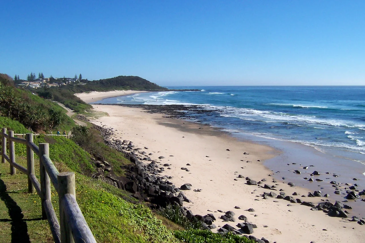

Ballina, New South Wales
A 35-tonne prawn made of concrete and fibreglass stands nine metres tall beside a hardware store car park, and the people of Ballina would not have it any other way. The Big Prawn is the town's most famous landmark, a survivor of a 2009 demolition vote and a star of an only-in-Australia rivalry: there is another giant prawn in Exmouth, Western Australia, and the two towns argue cheerfully over which is bigger and which is more realistic. (Ballina's is larger; Exmouth concedes nothing.) But the prawn is a recent joke layered over a much older place. Ballina sits at the mouth of the Richmond River on Bundjalung Country, a coast that has been welcoming arrivals - by foot, by sea and by air - for thousands of years.
Place of Many Oysters
The Bundjalung people are the traditional owners of this Country, and archaeological evidence shows they have lived along the Richmond for at least 6,000 years. The town's name carries that history, though its exact root is debated. One reading traces Ballina to a Bundjalung word, often given as bullinah, meaning 'place of many oysters' - or, in other tellings, 'fighting ground', or a word for where the river meets the sea. It is also possible the name was settled by the largely Irish newcomers of the 1840s, after the Irish town of Ballina, Beal an Atha, 'mouth of the ford'. Two peoples, two languages, and a name that sits on the seam between them - a fitting emblem for a river-mouth town.
The River and the Newcomers
European Ballina began in the 1840s on the north shore of the Richmond, twenty kilometres south of Cape Byron, the most easterly point on the Australian mainland. HMS Rainbow under Captain Henry Rous had first crossed the river bar in 1828, and settlers followed - some overland from the Clarence, others by sea on the ship Sally in 1842, founding what is now East Ballina on Shaws Bay. For its first century the Richmond River was the region's highway, carrying timber and produce out and supplies in. The river still defines the town. Its estuaries teem with marine life, the beaches draw surfers and fishers, and Ballina has grown into the seat of its shire, an urban area of more than 46,000 people and a gateway to nearby Byron Bay.
Where the Sky Came Down
Ballina has a habit of catching famous arrivals. In 1928 Charles Kingsford Smith's aircraft, the Southern Cross, crossed the coast over Ballina at the end of the first flight across the Pacific - a feat so celebrated the town later named a festival and a school for it. Then, in 1973, came an arrival from sea level: the Las Balsas expedition, three balsa-wood rafts that had drifted roughly 14,000 kilometres from Ecuador across the entire Pacific. Currents pushed them past their Queensland target, and local trawlers towed two of them up the Richmond to a heroes' welcome. One of those rafts survives today at the Ballina Naval & Maritime Museum, the relic of the longest raft voyage ever recorded - a journey nearly twice the length of the famous Kon-Tiki.
Rain, River and Reinvention
Ballina is one of the wettest towns on the New South Wales coast, soaking up around 1,765 millimetres of rain a year, most of it falling in the first half - March is the soggiest month of all. Blame the geography: jutting out near Cape Byron, the town stands squarely in the path of moisture-laden systems rolling off the Tasman Sea. That same coastal setting feeds the marine life, the surf and the subtropical green that draw visitors year-round. Once a river port, then a sugar-and-fishing town, Ballina has reinvented itself around tourism and its airport, the Ballina Byron Gateway, now the busy front door to the whole Byron hinterland. Through every change, the river mouth and that improbable concrete prawn remain - the practical and the playful sides of a town entirely at ease with both.
From the Air
Ballina lies at the mouth of the Richmond River, 28.84 degrees S, 153.56 degrees E, on the NSW north coast between Sydney and Brisbane. From the air the river mouth, training walls and Shaws Bay are the key landmarks, with the town spread along the north bank and the Big Prawn marking the highway approach. Ballina Byron Gateway Airport (YBNA) sits just 5 km from the town centre and is the region's main field, served by several carriers - making the town an everyday visual reference on approach and departure. Cape Byron, the easternmost point of the Australian mainland, lies about 20 km north. Recommended viewing altitude 2,000 to 4,000 ft. This is a notably wet stretch of coast; expect clear conditions much of the year but rapidly building storms and heavy rain, especially from December to March.
Nearby Stories
- Minyon Falls 7.9 km away
- Iluka, New South Wales 27 km away
- Susan Island Nature Reserve 56 km away
- Washpool National Park 76 km away
- Spicers Gap Road 81 km away
- HMS Porpoise (1799) 731 km away
- Wreck Reefs 761 km away
- SS Elingamite: Gold, Fog, and a Captain Wrongly Blamed 1793 km away