
Barra Head
Locals corrected outsiders for centuries. The island is Berneray, they would say, from the Old Norse for Bjorn's island. Barra Head is only the southernmost headland. But maps have a way of winning these arguments, and now the entire island answers to both names. Berneray sits at the southern end of the Outer Hebrides, a square of windswept gneiss with cliffs that drop hundreds of feet straight into the Atlantic. Eighty-three archaeological sites are scattered across an island that today holds no permanent residents at all.
Five Thousand Years of Settlement
Historic Scotland has catalogued eighty-three archaeological sites on this small island. Four chambered tombs, five cists, five more burial cairns suggest a substantial Neolithic and Bronze Age population. The Iron Age fort of Dun Briste, the broken fort, stands on the northwest. A second Iron Age site was largely destroyed when the lighthouse was built in the 1830s. Near MacLeans Point, just east of the landing place, archaeologists found an incised cross tentatively dated between the sixth and ninth centuries, marking what was likely a chapel. Boat-shaped stone settings nearby may be Norse graves. Between twenty and fifty people lived here through most of the historic period, peaking in the nineteenth century before the cliffs and the weather and the falling fishing economy emptied the place out.
The Macneil Years
From 1427 Berneray was part of the lands of Clan MacNeil of Barra. Martin Martin, visiting in the 1690s, recorded the islanders' practice of not fishing while the MacNeil chief or his steward was on the island. The reason was simple. If the laird saw how abundant the catch could be, he might raise the rent. The islanders crofted barley, potatoes, oats, turnips and cabbages. They kept sheep, cattle, ponies and goats. They fished white fish, and they took seabirds at industrial scale. In 1868 a single fowler caught six hundred birds in six to eight hours. The cliffs were a larder. They were also a workplace, and a deadly one.
Where the Atlantic Lands
There is no shallow water to the west of Berneray. The Atlantic strikes the cliffs at full speed, unchecked, year after year. In 1836 Sir Archibald Geikie recorded a forty-two-tonne block of gneiss moved five feet by a single storm. Small fish are sometimes flung onto the cliff-top grass, hundreds of feet above the surface they swam in. The Barra Head Lighthouse on the western cliff, built by Robert Stevenson in 1833, has its lamp 208 metres above the sea, the highest focal plane of any lighthouse in the United Kingdom. The light still flashes. The keepers have been gone since 1980. The cliffs do what cliffs have always done here, which is take what they can from anything that touches them.
Pàdraig Mòr, the Barra Giant
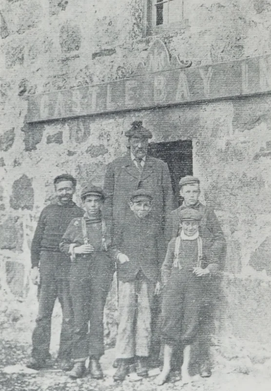
The island's best-known former resident was Peter Sinclair, known in Gaelic as Padraig Mor, the Barra Giant. He stood 2.03 metres at age seventeen in 1866, six feet eight inches. He joined a travelling show but disliked the publicity that came with being a curiosity. He returned home. Summers he ran a dairy in Castlebay on Barra. Winters he kept to himself on Berneray. Sinclair's story is one of dignity reclaimed. He was tall, and that was a fact. He was not a spectacle, and he refused to be one. He chose the island silence over the show ring, and lived out his life among neighbours who knew him as a man, not a measurement.
Birds, Seals and Solitude
Berneray and neighbouring Mingulay together host about a hundred thousand pairs of breeding seabirds. The two islands hold at least two percent of the United Kingdom's razorbill breeding population. Puffins, kittiwakes, guillemots, shags and fulmars nest in the cliffs. Grey seals haul out near the landing cove. The maritime grassland is dotted with primrose, violet, yellow flag iris and celandine. The National Trust for Scotland bought the island in 2000 and removed the last sheep in 2009. Berneray is now entirely uninhabited, a Special Protection Area where the cliffs keep their birds and the wind keeps its memory of two thousand years of human voices.
From the Air
Located at 56.7849 N, 7.6359 W, the southernmost island of the Outer Hebrides. The highest point is Sotan, and the island measures roughly 2.5 km north-south. The lighthouse on the west cliff is the easiest landmark, with its focal plane 208 m above sea level. Recommended altitude 2,000-3,500 ft for cliff perspective. Approach from the north over the Sound of Berneray to view the cliffs side-on. Nearest airports: Barra (EGPR) approximately 25 nm north, Benbecula (EGPL) approximately 70 nm north. Atlantic exposure is total; expect strong westerlies.
Nearby Stories
- German submarine U-722 7.3 km away
- Cladh Hallan 10 km away
- HMS Sturdy (1919) 13 km away
- SS Polonia 28 km away
- Canna 36 km away
- SS Athelstane (1941) 78 km away
- St Kilda, Scotland 82 km away
- German submarine U-516 102 km away