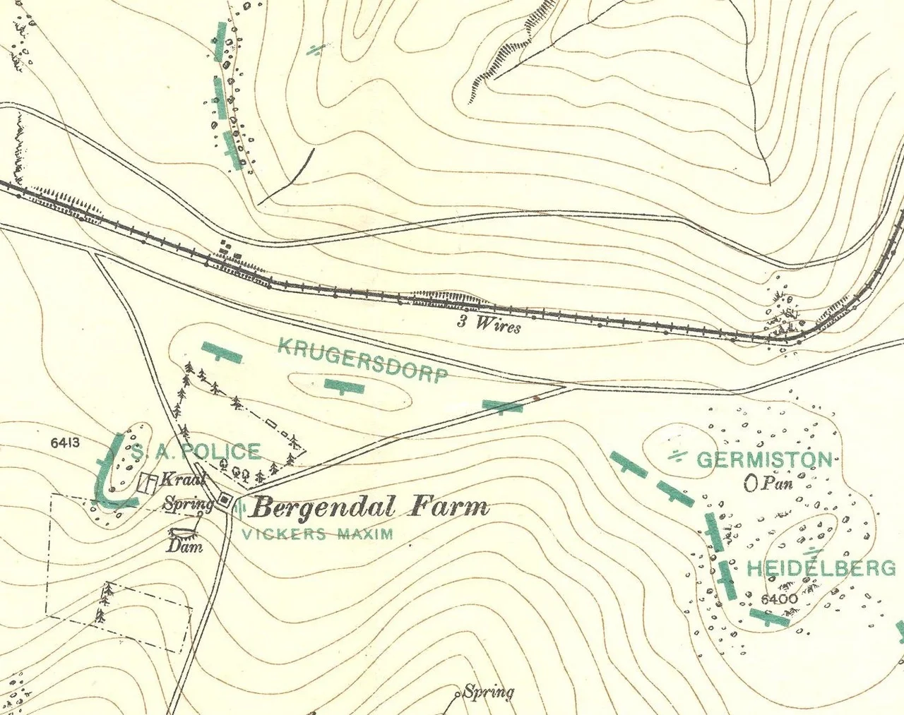

Battle of Bergendal
For three hours on 27 August 1900, thirty-six British guns hammered a single low hill outside the Mpumalanga town of Belfast. On that rocky kopje, fewer than eighty men of the Zuid-Afrikaansche Republiek Politie lay among the boulders and waited it out. They were the tip of General Louis Botha's line, and they had been left dangerously exposed, their position jutting out like the end of a nose with no one able to support them. When the shelling finally lifted and the Rifle Brigade charged, the last set-piece battle of the Boer War was decided in the space of a few savage minutes.
The Last Line in the Open
By the summer of 1900 the war was going badly for the Boer republics. The British had taken Bloemfontein and then Pretoria, and the government of the South African Republic was retreating eastward along the railway toward the Mozambique frontier. The country around Belfast offered Botha the one thing he needed: ground wide enough and high enough to stand and fight a conventional battle. He stretched roughly five thousand burghers across the hills, anchored on four enormous Creusot "Long Tom" guns. Against him came Lieutenant-General Redvers Buller and a converging force of over twenty thousand men with forty guns. It was the last time those four Long Toms would fire together in a single battle, and the last time the Boers would meet the British army head-on in the open field.
The Salient at Bergendal
For nearly a week the two sides probed and dueled with heavy artillery across the farms with names like Geluk and Frischgewaagd. Scouting at dawn on 27 August, Buller saw the flaw in Botha's line. The Boer position swung sharply back on itself, leaving the farm Bergendal sticking out as a salient. The trenches on either side faced away from the tip, so the defenders there could expect no covering fire if the British came straight at them. That tip was held by about seventy policemen of the ZARPs under Commandant P.R. Oosthuizen. Buller found high ground some three thousand yards off, perfect for his guns, and resolved to break the whole Boer line at its single weakest point.
Three Hours of Shellfire
The bombardment opened at eleven in the morning and did not let up. For three hours the kopje was raked by shrapnel and high explosive, the boulders splintering around the men pinned among them. That the ZARPs held at all, through a weight of fire that disparity made almost unanswerable, became the thing the battle is remembered for. When the Rifle Brigade and the Inniskilling Fusiliers finally rose and charged, they burst clean through. The defenders had stood their ground rather than run; the attackers found the dead among the rocks and took nineteen prisoners, Commandant Oosthuizen among them. The salient was carried, and with it the hinge of Botha's entire position gave way.
A Battle Won, a War Unfinished
British losses for the whole engagement came to about 385; the Boers lost roughly 78. The next day Buller marched into Machadodorp, the republican government fled on to Nelspruit, and on 1 September Lord Roberts proclaimed the South African Republic British territory. Yet the proclamation settled nothing. The breakthrough at Bergendal had cracked the line but not the army behind it. Botha's main force slipped away intact into the hills around Lydenburg and Barberton, and the war simply changed shape, dissolving into a grinding guerrilla campaign that would drag on until May 1902. On the battlefield two memorials now stand together: a tall pylon to the Boers and the ZARPs who fell, and a modest stone cairn to the men of the Rifle Brigade, enemies in 1900 resting on the same windswept ground.
From the Air
The Bergendal battlefield lies at 25.73 degrees South, 30.09 degrees East, just east of Belfast (eMakhazeni) on the Mpumalanga highveld at about 1,900 metres elevation. The town and the old Pretoria-Maputo railway line are the clearest landmarks; the memorials sit on open grassland a few kilometres east of town. Nearest major airfields are Nelspruit / Kruger Mpumalanga International (FAKN) about 100 km east and O.R. Tambo International (FAOR) near Johannesburg about 200 km west. Recommended viewing altitude 4,000 to 6,000 feet AGL; the high grassland is clearest in the dry winter, with summer thunderstorms common.
Nearby Stories
- Sudwala Caves 18 km away
- Bokoni 30 km away
- Ngwenya Mine 49 km away
- Barberton Greenstone Belt 49 km away
- Secunda CTL 70 km away
- Battle of Bronkhorstspruit 80 km away
- Bushveld Igneous Complex 85 km away
- Mbabane 112 km away