
Battle of Burton Bridge (1643)
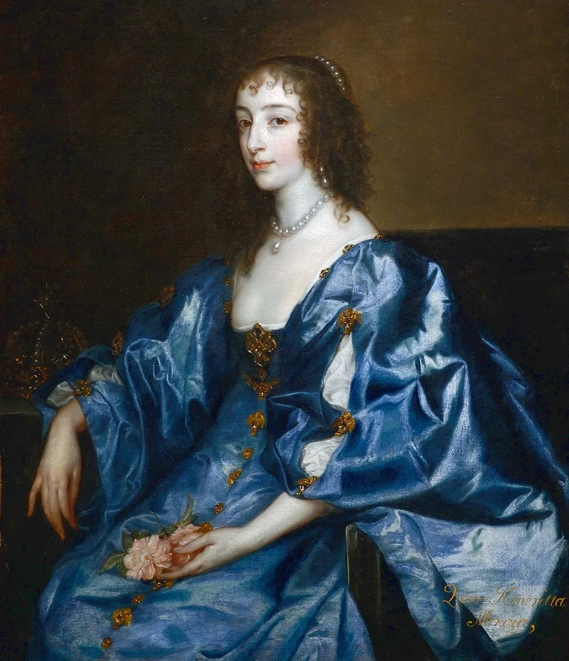
Queen Henrietta Maria had been gone from her husband for almost a year. The Catholic French queen of a Protestant English king had spent that year raising arms and supplies on the continent, and in summer 1643 she was returning south leading a convoy from Yorkshire to her husband Charles I at Oxford. The route ran through Burton upon Trent, and Burton's medieval bridge, a 36-arched stone structure described as "the only passage over the Trent and Dove to the North," was held by Parliamentarian troops. The queen's convoy could not pass while they remained. On 4 July 1643 a Royalist cavalry under Colonel Thomas Tyldesley charged across the bridge to clear them out. The bridge that had carried Edward II's pursuit of Lancaster three centuries earlier became, briefly, a battlefield again.
A County That Did Not Want to Pay
Staffordshire had been resisting royal taxation for decades before the war began. Several days' travel from London, the county had a long-standing reluctance to fund military adventures it did not understand. James I's Privy Council had been forced to write to the local Justices of the Peace in the 1620s because the county had failed to raise even a single penny toward the campaign to reclaim the Palatinate in Germany for the king's son-in-law Frederick V. A decade later Charles I's ship money, levied in defiance of Parliament on the inland counties from 1634, met the same resistance. Riots broke out in Uttoxeter, where an armed guard had to be formed to prevent the levy from deserting. When the Civil War finally came in 1642, Staffordshire was a divided and reluctant county, with Royalist garrisons at Lichfield, Tutbury, and Ashby-de-la-Zouch facing Parliamentarian strongholds at Stafford and Derby.
Burton in the Middle
Burton's location was its curse. Unfortified, possessing few natural defences, the town sat exactly between Royalist and Parliamentarian zones, and the bridge across the Trent made it strategically essential. The town changed hands at least a dozen times during the war. The Earl of Chesterfield used it as a rendezvous for Royalist forces in late 1642 before withdrawing to garrison Lichfield Cathedral for the winter. In February 1643 the Parliamentarian Sir John Gell, county committee leader in Derby, placed a garrison at Burton under the Dutch Major Johannes Molanus. Within a month Gell withdrew the men to help attack Newark. The town's brief peace was interrupted by a gunpowder explosion that destroyed the roof of St Modwen's Church, a reminder that even unfortified towns full of military stores were inherently dangerous places. Lord Brooke, Parliament's regional commander, had already been killed at the siege of Lichfield in March 1643. Gell was appointed his replacement. The Royalist commander Henry Hastings, the future Lord Loughborough operating out of Ashby-de-la-Zouch, was tightening his grip on the surrounding garrisons.
Tyldesley's Charge
By July 1643 Gell's garrison at Burton was under Captain Thomas Sanders and the town's military governor Colonel Richard Houghton. Gell summoned the Staffordshire and Nottinghamshire associations for support. They refused to muster. When Tyldesley's Royalists arrived ahead of the queen's convoy, the Parliamentarians stood essentially alone. The cavalry charge across the bridge succeeded swiftly. Five Royalists died in the assault. Gell later claimed he lost no men, but the Parliamentarians said something darker had happened: that thirty of their men had been forced into the church, had offered to surrender, had been refused, and had been killed by Cavaliers in the night. The accounts cannot be reconciled, and the truth is now buried with the men. What is not in dispute is that Sanders and Houghton were captured, the Parliamentarian forces were decisively beaten, and Gell's own description of the town's fate was that it had been "most miserably plundered and destroyed." Tyldesley secured 20 barrels of powder, 300 muskets, 60 carbines, 60 cases of pistols, and a troop of horses. The queen's convoy moved on toward Oxford.
After the Battle
Henrietta Maria delivered her supplies safely. Tyldesley received a knighthood for the action and a promotion. Burton, miserably plundered, would change hands several more times before finally settling under Parliamentarian control in 1646. The town's role in the war was the role of any unfortunate town in the wrong place: stripped of food, looted of valuables, set against itself, then occupied by whichever army arrived next. Burton remembered its second bridge battle because it was unusual to fight over the same stretch of stone twice. A local legend insists that Oliver Cromwell himself rode through during the fighting and tied his horse to a nail in St Michael and All Angels Church at Tatenhill, three miles from the bridge. Like most Cromwell-was-here stories the evidence is thin, but the village still points out the nail. The medieval Burton Bridge was eventually replaced. The river runs the same way it did when Tyldesley's horsemen thundered across in 1643, and when Edward II's army crossed at Walton-on-Trent three centuries earlier. Some places fight the same battle in different costumes.
From the Air
Located at 52.81N, 1.62W, in central Burton upon Trent at the modern bridge crossing the River Trent. From the air the river, the town centre, and the line of the old medieval bridge are all clearly visible. The Parliamentarian garrison sat in the town itself, with the Royalist forces arriving from the south. East Midlands Airport (EGNX) lies 14 nm east-northeast, Birmingham (EGBB) 20 nm south-west, Tatenhill airfield (EGBM) 4 nm west, very close to the church where Cromwell's horse is said to have been tied. A 1,500-foot circuit on a clear day shows the river crossing, the medieval town layout, and the surrounding ridges that determined the strategic value of the bridge.
Nearby Stories
- Broad Eye Windmill 1.9 km away
- Cromford Mill 3.1 km away
- Murder of Naomi Smith 5.5 km away
- Grantham Canal 6.5 km away
- Round Oak Steelworks 8.1 km away
- Nottinghamshire 9.7 km away
- Battle of Naseby 16 km away
- Sandbach Crosses 18 km away