
Bear Rocks Preserve
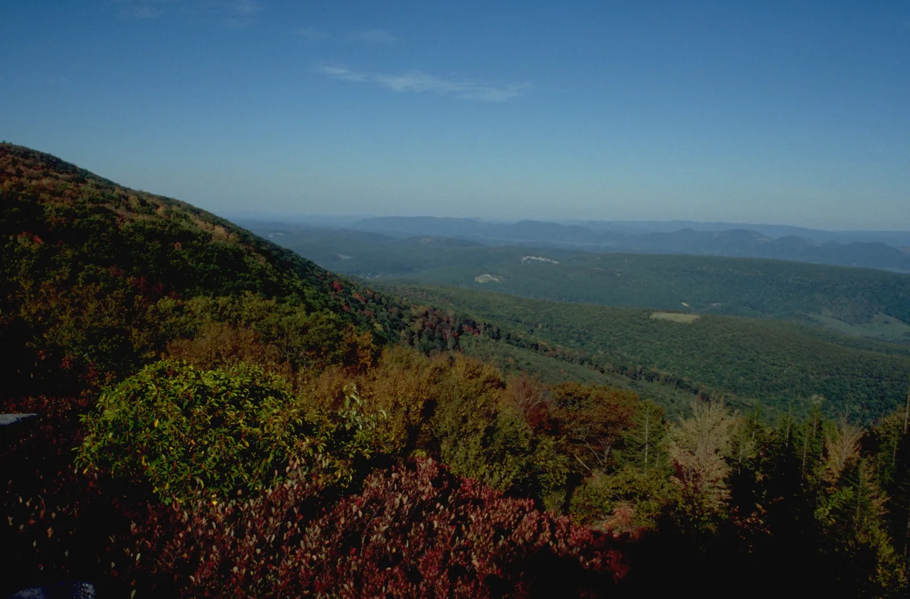
Look at the red spruce trees on Bear Rocks and you can read the wind. Their branches grow only on the eastern side, flagged out in the direction the prevailing westerlies push them. Anything that tries to grow into the wind gets stripped by ice and rime frost. The result is a forest of one-sided trees standing on the lip of a 2,000-foot escarpment, watching seven mountain ridges roll out toward Virginia.
The Most Photographed Cliff in West Virginia
Bear Rocks is a group of sandstone outcroppings on the crest of the Allegheny Front, on the eastern edge of the broad plateau that contains the Dolly Sods Wilderness. The Nature Conservancy owns and protects 477 acres of it as the Bear Rocks Preserve. On a clear day the view from the rim reaches 35 miles - seven distinct mountain ridges fading southeast toward the Blue Ridge. On the very clearest days you can see Hawksbill Mountain and Stony Man, the highest peaks of Shenandoah National Park, more than 50 air miles away. To the west, where the plateau drops gently toward Red Creek, water that falls on this side of the divide will eventually reach the Gulf of Mexico via the Dry Fork, Black Fork, Cheat, Monongahela, Ohio, and Mississippi rivers. Two ridges, Stack Rocks and Haystack Rocks, continue the cliffline northward.
Tundra in West Virginia
Bear Rocks looks more like a piece of subarctic Canada than the central Appalachians. The combination of altitude - around 4,000 feet - and constant strong wind creates a microclimate where boreal and even ice-age tundra species hold on. Snowshoe hare move through the heath barrens. Northern saw-whet owls hunt in the gnarled spruce groves. Boreal red-backed voles and fisher work the edges. The understory is huckleberry, blueberry, mountain laurel, azalea, mountain holly, speckled alder - a waist-high heath that locals have called the huckleberry plains for centuries. In some places the heath opens into natural grass balds dominated by mountain oat grass that predates the catastrophic logging and slash fires that swept the West Virginia high country in the late 1800s. The winter of 2003 dropped 290 inches of snow on the area. A more typical year sees 160.
Rocks That Hold Water
The signature features of Bear Rocks are the boulders themselves: large, striking white sandstone and quartz outcrops, sculpted by wind and freeze-thaw cycles into bowl-shaped depressions. Many of these depressions hold water - or in winter, ice - and small algal communities live in the pools. The boulders are part of the Pottsville conglomerate, a hard silica-cemented sandstone that resists weathering and explains why the Allegheny Front stays high while softer rocks erode around it. Beyond the carved boulders are rock streams, lines of frost-shattered debris up to 50 feet wide and hundreds of feet long, left behind by Pleistocene freeze-thaw cycles. Geologists also find polygonal and circular ground patterns - features more common in genuine Arctic terrain than mid-latitude mountains.
Surveyed in 1746
Bear Rocks has been on Western maps longer than most of the country around it. In 1746 a survey party that included Peter Jefferson - father of Thomas Jefferson - recorded the natural heathlands and grass balds while running survey lines across the Allegheny Front. The grass balds the surveyors saw predated European contact, meaning the openings were already old when British colonial governments first sent men to map them. Informal trails weave across the preserve today, connecting to the extensive trail system on the adjacent Monongahela National Forest land and into the Dolly Sods Wilderness. The Nature Conservancy keeps Bear Rocks lightly managed, which is most of the point. The wind, the ice, and the dry hardness of the rock do the work.
From the Air
Located at 39.07 degrees north, 79.30 degrees west, on the crest of the Allegheny Front in Grant and Tucker counties, West Virginia. From 6,000 to 9,000 feet AGL the cliffs read clearly as a sharp drop from the 4,000-foot Dolly Sods plateau to the deeply incised North Fork South Branch Potomac valley. The NedPower Mount Storm wind farm just to the north and the broad opening of the Dolly Sods plateau help with navigation. Nearest airports are Grant County (W99) at Petersburg and Elkins-Randolph County Regional (KEKN). Expect strong westerly winds and severe lee turbulence on the east side of the Front.
Nearby Stories
- Seneca Rocks 7.8 km away
- Randolph County 9.4 km away
- Barbour County, West Virginia 17 km away
- Battle of New Market 22 km away
- Belle Grove Plantation 40 km away
- Battle of Fort Necessity 56 km away
- Gravity Hill 73 km away
- Whiskey Rebellion 92 km away