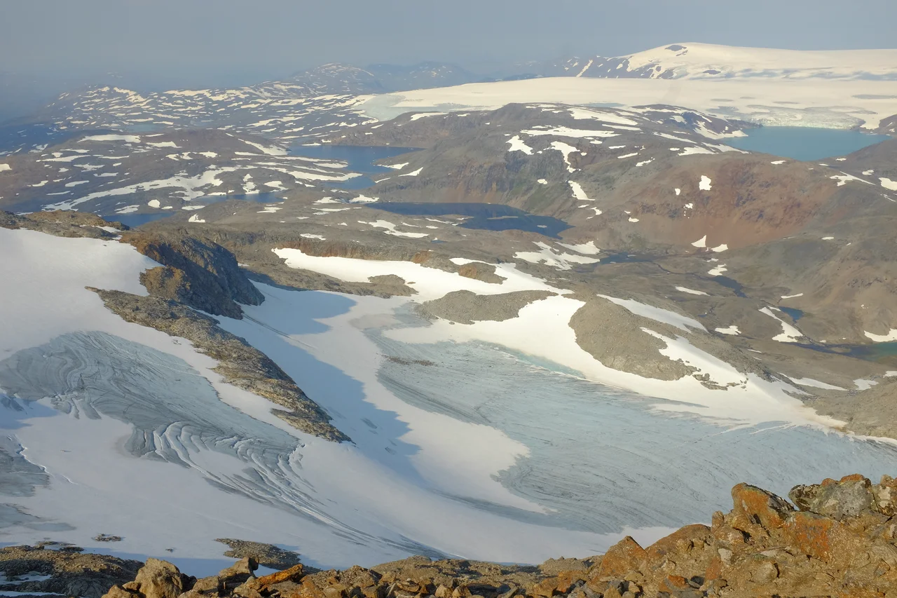

Blåmannsisen
In 2001 the ice let go. On the northern flank of Blåmannsisen sits a lake called Øvre Messingmalmvatn, held in place not by rock but by the glacier itself, and that August the seal failed. Around 40 million cubic metres of water came out of the mountain at once. Several kilometres away, the level of Sisovatnet rose two and a half metres in thirty-six hours. It has happened again in 2005, 2007, 2009, 2010, 2011, 2014 and 2016 — always in August or September, always with somewhere between eleven and thirty-five million cubic metres behind it. Icelandic has the word for this: jökulhlaup, a glacier burst. Blåmannsisen is one of the few places on the European mainland that needs it regularly.
The Blue Man
The glacier is named for a nunatak — a peak that stands clear of the ice — which from a distance reads blue-black against all that white, and which older eyes saw as a figure walking with a pack on its back. Its apparent size changed through the season as the snow rose and fell around it, and people in the valleys below used to read the change as a forecast for the coming grain harvest. Blåmannen, the Blue Man, gave his name to the whole icecap: Blåmannsisen, the Blue Man's ice. In Sami the glacier is Ålmåjalosjiegŋa. Both names point at the same thing — a dark human shape in an otherwise featureless white field, the one landmark on a surface that offers almost none.
Fifth Largest, and Getting Smaller
Blåmannsisen is the fifth-largest glacier on the Norwegian mainland, straddling the boundary between Fauske and Sørfold municipalities just two kilometres west of the Swedish border. Its high point, the Blue Man himself, stands at 1,560 metres; the lowest ice reaches down to about 810. The area is the part that keeps moving. In 1961 the icecap covered 87.8 square kilometres. By 2011 it was down to roughly 80. Along the southern margin the ice has pulled back far enough to expose a forefield — bare ground uncovered since the Little Ice Age maximum — with a well-formed end moraine still marking where the front used to stand. The equilibrium line, the altitude above which more snow falls than melts, sits around 1,100 metres on the eastern side. Satellite imagery shows a great deal of old firn exposed above it, which is what a glacier looks like when it is spending more than it earns.
Three Ways Down
Three outlet glaciers run off the icecap, and each behaves differently. To the east, the largest of them descends toward the lake Leirvatnet and calves into it, breaking off ice at the snout. To the west, another drops steeply and is torn open by the gradient. To the north, a small outlet spills across a buried ridge and dams the lake that periodically empties itself. The glacier also calves into Blåmannsisvatnet, and the ice above that lake is shattered accordingly. Crevassing at every margin makes a traverse genuinely dangerous — most of all in late spring and early summer, when a smooth cover of snow is still lying over gaps it is no longer strong enough to bridge. The middle of Blåmannsisen is a plateau. The edges are not.
Water With a Job
Almost none of this meltwater is allowed to find its own way to the sea. Tunnels take roughly a quarter of Blåmannsisen's runoff into Sisovatnet to feed the Siso power station; the rest drains into the Norwegian networks operated by Elkem and Saltens Kraftsamband, or eastward across the border into the Lule River system in Sweden. That arrangement is why the outburst floods are measured so carefully — a sudden 40 million cubic metres is a hydrological event, but it is also a reservoir management problem. There is a particular northern logic to it: an icecap that has been shrinking for six decades is still, for now, one of the region's most reliable sources of power, and the more it melts the more it delivers. That bargain has an end date. Everyone involved knows roughly what it is.
From the Air
Blåmannsisen lies at about 67.25°N, 16.07°E, on the Fauske–Sørfold boundary and only two kilometres west of the Swedish frontier. It is one of the clearest features in this part of Nordland from 9,000 to 14,000 feet: an unbroken white plateau of some 80 square kilometres, high point 1,560 m, with the dark nunatak of Blåmannen breaking the surface and three outlet tongues running east, west and north. Leirvatnet and Blåmannsisvatnet sit at the calving fronts and make good visual anchors; the Sisovatnet reservoir lies to the northwest. Nearest airport is Bodø (ENBO), about 90 kilometres west; Gällivare (ESNG) and Arvidsjaur (ESNX) are the Swedish options. Glare off the icecap is severe in clear conditions, and lenticular cloud over the plateau signals strong mountain wave activity — give the surface generous clearance.
Nearby Stories
- Junkerdal National Park 13 km away
- Blood Road Museum 15 km away
- Laponia 47 km away
- Kungsleden 52 km away
- Nasa Silver Mine 56 km away
- Árran Lule Sámi Centre 61 km away
- Lofoten Fishery 72 km away
- 2012 Norwegian Air Force C-130 Crash 95 km away