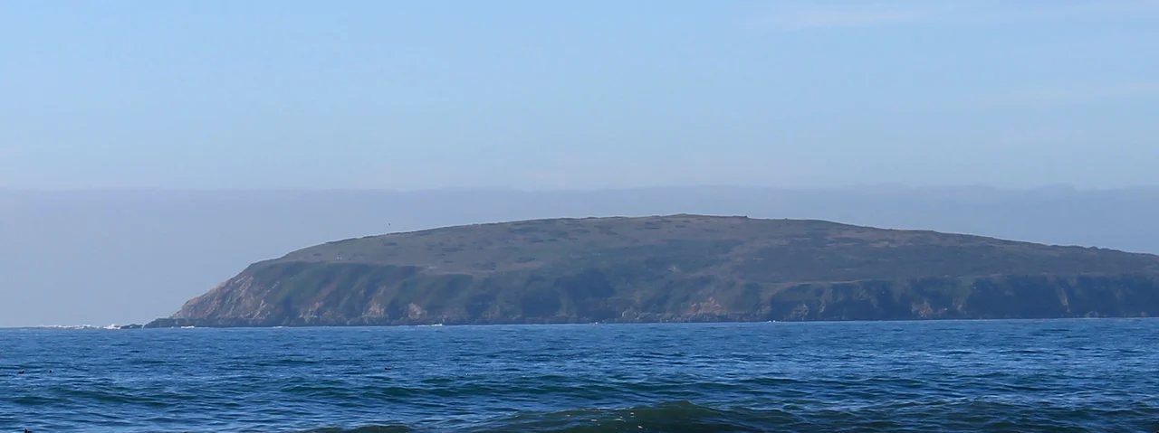
Bodega Head: Where Two Plates Meet
The granite under your feet does not belong here. Bodega Head is made of rock torn from the same geological province as the Sierra Nevada Mountains, ripped away when the San Andreas Fault came into existence roughly 20 million years ago and carried hundreds of miles northward on the Pacific Plate. The mainland just across the harbor -- visible, close enough to shout to -- is made of entirely different rock, oceanic crust from the Franciscan Complex. The San Andreas Fault runs between them like a seam in the earth, and this small, wind-battered promontory on the Sonoma Coast sits squarely on the wrong side of it. During the 1906 San Francisco earthquake, Bodega Head lurched northward relative to the town, dragging the harbor with it. It is still moving.
A Fragment of the Sierra
Bodega Head is the northern tip of the Salinian Block, a vast geological province whose core shares its origins with the Sierra Nevada. The same continental granite that forms Yosemite's walls and Half Dome's face is exposed here on this windswept headland, hundreds of miles from where it started. The Salinian Block was severed from the continent as the San Andreas Fault opened, and the Pacific Plate has been dragging it northward ever since. Point Reyes Peninsula and the Farallon Islands are other pieces of the same displaced province. The rocks on Bodega Head -- hard, crystalline, unmistakably continental -- sit directly adjacent to the soft, dark, ocean-floor rocks of the Franciscan Complex on the mainland. The juxtaposition is so stark that geology students have been coming here for decades to see one of the cleanest exposures of a tectonic boundary anywhere in the world.
Sharks, Whales, and the Red Triangle
Bodega Head is one of the three vertices of the Red Triangle, the stretch of Pacific coast between Bodega Bay, the Farallon Islands, and Monterey Bay where more great white shark encounters occur than almost anywhere else on Earth. The sharks are drawn by the colonies of pinnipeds -- harbor seals, elephant seals, sea lions -- that haul out on the rocks and beaches along this coast. But the headland is also one of Northern California's premier whale-watching points. Gray whales pass close to shore during their annual migration between Alaska and Baja California, and humpback whales feed in the nutrient-rich waters offshore during summer and fall. From the bluffs at the tip of the headland, the spouts are sometimes visible without binoculars, white puffs against the dark Pacific.
Drake's Possible Landfall
Campbell Cove, tucked into the eastern side of Bodega Head where the promontory shelters Bodega Harbor, is a candidate for Sir Francis Drake's 1579 landing site. Drake spent five weeks somewhere along the Northern California coast, careening his ship the Golden Hind and claiming the territory for England as Nova Albion. The exact location has been debated for centuries, with Drake's Bay at Point Reyes as the leading contender, but Campbell Cove's sheltered waters and the headland's prominent profile have kept Bodega Head in the conversation. Before Europeans arrived, the peninsula was likely inhabited by the Coast Miwok, whose territory stretched along the Sonoma and Marin coastlines. Their relationship with this landscape predates Drake and every subsequent visitor by thousands of years.
A Laboratory at the Edge
The University of California, Davis operates the Bodega Marine Laboratory on the headland, part of the UC Natural Reserve System's Bodega Marine Reserve. The location is ideal for marine biology: the rocky intertidal zone, sandy beaches, mudflats, and open ocean are all within walking distance. Researchers study everything from the effects of ocean acidification on shellfish to the behavior of intertidal invertebrates under changing climate conditions. The reserve also encompasses the upland habitats of the headland itself -- coastal prairie, dune scrub, and seasonal wetlands. Sonoma Coast State Beach stretches along the south side of the promontory, its beaches and dunes popular with hikers despite the cold water and dangerous currents that make swimming inadvisable. The trails along the headland's spine offer views of the open Pacific to the west and Bodega Harbor to the east.
The Reactor That Never Was
In the late 1950s, Pacific Gas & Electric proposed building a nuclear power plant on Bodega Head. The site seemed promising: remote, sparsely populated, with access to ocean water for cooling. But the San Andreas Fault ran directly beneath the base of the headland, and the 1906 earthquake had already demonstrated what the fault could do. Local fishermen, dairy farmers, and environmental groups fought the proposal for six years. The Sierra Club joined the opposition. In 1964, after the Atomic Energy Commission issued a negative review, PG&E abandoned the project. The excavation pit dug for the reactor's foundation was never filled in; it partially flooded and became a pond that locals call the Hole in the Head. Protected marine reserves now surround the headland's waters, and the trails where protesters once gathered are walked by hikers who may never know what almost rose here.
From the Air
Bodega Head is a prominent headland at approximately 38.31N, 123.07W on the Sonoma Coast, easily identifiable from the air as a narrow peninsula sheltering Bodega Bay and Harbor to the east. The San Andreas Fault trace is visible in the low ground between the headland and the mainland. The nearest airport is Sonoma County Airport (KSTS) in Santa Rosa, about 30 nautical miles east. At 1,000-3,000 feet AGL, the headland's shape, the harbor, and the contrast between ocean and bay are clearly visible. Coastal fog is common in summer. To the south, Point Reyes National Seashore and the Farallon Islands -- other fragments of the Salinian Block -- are visible on clear days.
Nearby Stories
- Fort Ross 2.7 km away
- Pacifica Foundation 4.2 km away
- The Museum the Students Built 4.3 km away
- The Petrified Forest 8.3 km away
- The Farallon Islands: California's Forbidden Rock 36 km away
- Pixieland 726 km away
- Neskowin Ghost Forest 764 km away
- ʻAkaka Falls State Park 3632 km away