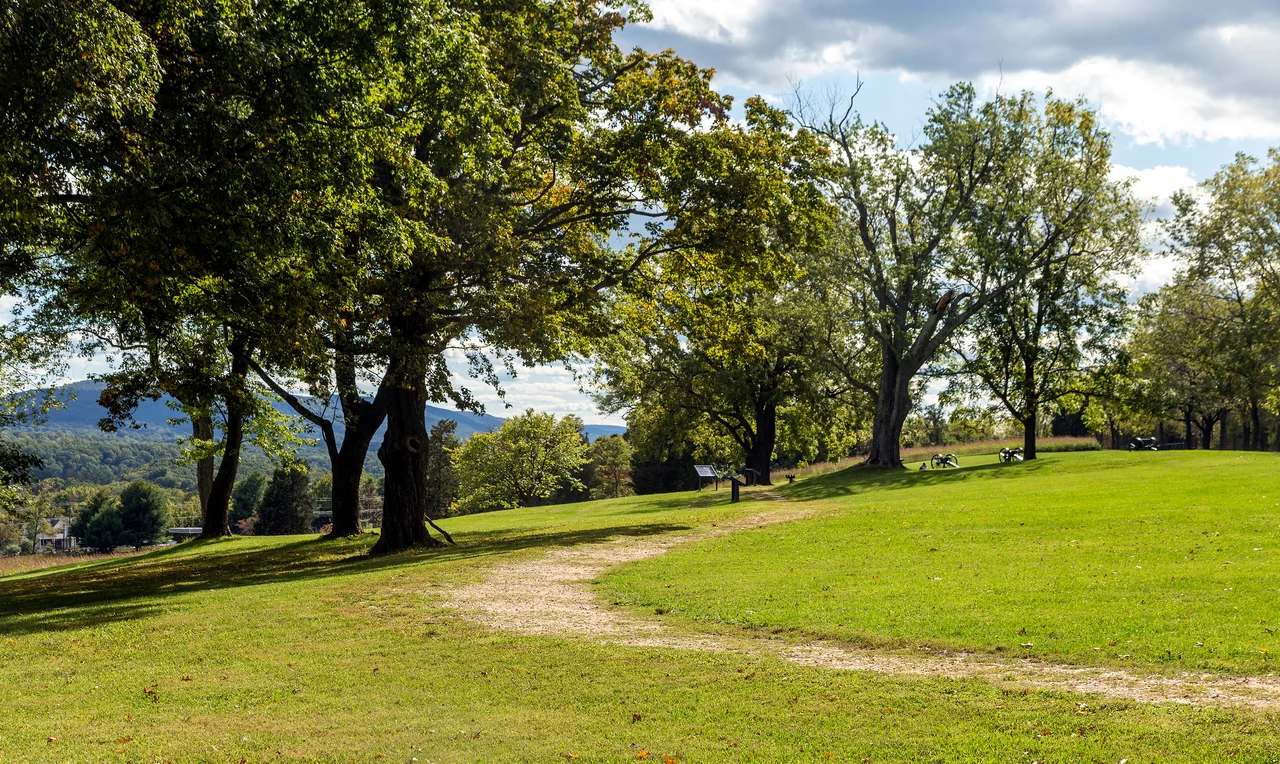

Bolivar Heights Battlefield
On September 15, 1862, Colonel Dixon Miles raised a white flag over Bolivar Heights and surrendered 12,419 Union soldiers to Stonewall Jackson. It was the largest mass surrender of United States troops the country had ever seen, and it would remain so for eighty years - until Bataan in 1942. Miles never lived to see how badly he had been beaten. A Confederate shell killed him before the formal surrender was complete. The plateau where it all happened sits 669 feet above sea level, lower than the two other heights that flank Harpers Ferry, and that was its problem: it was the easiest one to come at, and the hardest to defend if you lost the others. Five times during the Civil War, armies fought over this ridge. Today the trenches the Union dug here are still visible in the grass, and the cannons still point west, as if expecting Jackson to come back through the gap one more time.
The Three Heights
Harpers Ferry sits in a bowl carved by two rivers. The Potomac flows south past Maryland Heights, the Shenandoah flows north past Loudoun Heights, and the town itself huddles where they meet. To the west, blocking the only landward approach, rises Bolivar Heights - a long, easy plateau that stops just short of the village of Bolivar, West Virginia. Together the three heights form a triangle. Hold all three, and Harpers Ferry is safe. Hold only one, and the artillery on the other two will pulverize you. Stonewall Jackson understood this from his first visit, in the spring of 1861, when he drilled the 1st Virginia Brigade on Bolivar Heights and watched it evolve into the Stonewall Brigade. Eighteen months later he would return to take advantage of an enemy who had not understood it at all.
Miles' Mistake
When Lee crossed into Maryland in September 1862, the United States garrison at Harpers Ferry stood under the command of Colonel Dixon S. Miles. His orders were to hold the town and defend all places to the last extremity. Miles read the first instruction and apparently forgot the second. He concentrated 7,000 men on Bolivar Heights and left Maryland Heights and Loudoun Heights only thinly held. Jackson, who had drilled on this ground himself, could not believe his luck. His forces seized the two undefended heights almost without effort, then turned their artillery on the Federals trapped on Bolivar Heights below. The bombardment came from above and behind. There was no cover. McClellan had sent a courier promising relief if Miles could hold out, but the courier never arrived. After consulting his senior officers, Miles raised the white flag. A Confederate shell struck him before he could deliver the surrender in person. He died the next day. The capture netted Jackson 13,000 small arms, 200 wagons, 73 cannons, and 12,419 prisoners - paroled on their oath not to fight again until exchanged. Lee called Jackson east to Sharpsburg. Antietam was two days away.
Earthworks and a Balloon
After Antietam the Federals returned to Bolivar Heights determined not to repeat Miles' mistake. The entire 2nd Corps of the Army of the Potomac - nearly 15,000 men - bivouacked here for six weeks in the fall of 1862. They dug trenches the length of the ridge and built earthworks that survive today as low green ripples in the meadow. From the camp, the balloonist Thaddeus Lowe sent a gas-filled observation balloon aloft to watch Confederate movements in the Shenandoah Valley below. It was one of the earliest sustained uses of aerial reconnaissance in war. The camp broke up in the first week of November when the corps marched south to join the Fredericksburg Campaign. Bolivar Heights would see two more military engagements - in June 1863 as Lee moved toward Gettysburg, and in July 1864 during Jubal Early's raid on Washington - but neither was as bloody as Miles' surrender. Both times the outnumbered Federals fell back to Maryland Heights and let the siege guns there do the fighting for them.
Wagons, Mules, and Graves
By 1864 the strategic value of Bolivar Heights had shifted from battlefield to logistics depot. During Philip Sheridan's Shenandoah Valley Campaign that autumn, the easy slopes became the largest Union corral and wagon yard in the valley - thousands of mules, hundreds of quartermaster wagons, all the unromantic machinery that moved an army. Hundreds of Union soldiers who had died at Harpers Ferry from disease rather than bullets were buried on the heights during these years; their remains were later disinterred and reburied at Antietam National Cemetery, just across the Potomac. The battlefield is now part of Harpers Ferry National Historical Park. A short walk from the parking area takes you onto the plateau where Miles' troops dug in, past replica cannons and interpretive signs, to the western edge where School House Ridge falls away toward the Shenandoah. From that edge you can see exactly what Jackson saw - the easy ground, the unhindered field of fire, the trap that closed on a colonel who had not read his orders carefully enough.
From the Air
Bolivar Heights crowns at 669 feet above sea level at roughly 39.32 degrees N, 77.76 degrees W, immediately west of Harpers Ferry, West Virginia. From 3,500 to 5,000 feet AGL the three heights surrounding Harpers Ferry - Maryland, Loudoun, and Bolivar - frame the river confluence in dramatic relief. The Potomac and Shenandoah meeting point is one of the most photographed scenes in the eastern United States. Nearby airports include Frederick Municipal (KFDK) 20 miles east, Hagerstown Regional (KHGR) 25 miles north, and Winchester Regional (KOKV) 25 miles southwest. Watch for restricted airspace over Camp David north of the area.
Nearby Stories
- Great Falls, Virginia 4.6 km away
- Battle of Middleburg 11 km away
- Gettysburg: The Three Days That Decided America 31 km away
- Literary Hall 31 km away
- Great Falls Park 33 km away
- Camp David: Where Presidents Escape and History Gets Made 36 km away
- Bryce Resort 39 km away
- Gravity Hill 54 km away