
Brunswick Heads
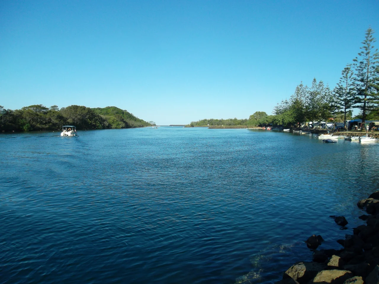
Just up the coast from the glossy bustle of Byron Bay, a quieter kind of seaside town has refused to change its pace. Brunswick Heads sits where the Brunswick River meets the sea, its fishing boats moored along the southern bank, its timber bridges crossing slow tidal water to a sheltered beach inside the breakwater. While the rest of this coast boomed and gentrified, Brunswick held on to something older - the unhurried atmosphere of a traditional Australian seaside village, the kind of place a 1990s television series went looking for when it needed somewhere that felt like the world had gently slowed down.
A River Named for a Princess
The Brunswick River was charted in 1828 by Captain Henry Rous, surveying the northern New South Wales coast aboard HMS Rainbow. He named it for Caroline of Brunswick, the estranged wife of King George IV - an odd, faintly scandalous namesake for such a peaceful waterway. This was, and is, the country of the Bundjalung nation; the area takes in lands of the Arakwal people and parts of Minjungbal and Widjabal territory, and near the beach a picnic area now displays Bundjalung words and their meanings, a small act of return. Rous's charts were followed two decades later by cedar getters, whose camps in 1849 grew into the first town in what is now Byron Shire.
The Busy Port That Slowed Down
By the 1880s Brunswick Heads was a working port with a small commercial centre, shipping the timber and produce of the hinterland out through the river mouth. It was proclaimed the village of Brunswick in 1885, though the name Brunswick Heads stuck so firmly in everyday use that it was not made official until 1971. The bustle did not last. As railways redrew the region's trade routes, the port's importance ebbed, and the town settled into the gentler role it plays today. The river that once carried cargo now shelters a marina of fishing boats and small craft, while the northern bank guards a pocket of protected rainforest - a working harbour and a wild edge sitting side by side.
Bridges to the Beach
Brunswick Heads is a town defined by the way it crosses its own water. Timber footbridges link the riverside to both the calm river beach and the open surf, and the most beloved of them - the footbridge that opened in January 1937 to draw the holidaymakers - is now a local landmark in its own right. Within the breakwater lies Torakina Beach, sheltered and shallow; to the south, a white sand surf beach runs along the open coast. The combination is the town's quiet genius: a safe river beach for the children and a proper surf beach for everyone else, both reachable on foot across the timber spans, both a world away from the crowds a few kilometres south.
An Old Cinema and a Former Church
For a village of its size, Brunswick Heads keeps a lively cultural pulse. The Brunswick Picture House, run out of an old cinema and reborn in its current form in 2016, stages a roving bill of film, circus, cabaret, comedy and live music. The town library occupies a former church, one more example of the local habit of keeping good old buildings and simply giving them new lives. The poet and painter Edwin Wilson started school here, later writing about his Northern Rivers childhood in his memoir The Mullumbimby Kid. It all adds to the sense of a town with more going on beneath its sleepy surface than a first glance suggests.
The Town Television Found
Brunswick Heads has a certain knack for the screen. In the 1980s it lent its name to Brunswick Heads Revisited, a cult ABC comedy that sent up Evelyn Waugh's Brideshead Revisited. More famously, in 2019 the revived fourth series of the gentle Australian drama SeaChange was filmed here - and the choice was no accident. SeaChange is a story about escaping the city for a slower coastal life, and the producers needed a town that genuinely embodied that idea. They found it at the mouth of the Brunswick River, in a village that hosts its small community festivals, keeps its fishing fleet, walks its timber bridges to the beach, and has spent a century proving that not every beautiful stretch of coast has to surrender to the rush.
From the Air
Brunswick Heads lies at roughly 28.56 degrees south, 153.54 degrees east, on the New South Wales north coast about 17 km north of Byron Bay. From the air, the defining feature is the mouth of the Brunswick River curving to the sea between rock breakwaters, with the sheltered Torakina Beach inside the wall, a white surf beach running south, and a patch of protected rainforest on the northern bank. The town's timber footbridges and small fishing-boat marina mark the southern side of the river. The nearest commercial airport is Gold Coast Airport (YBCG), about 50 minutes north, with Ballina Byron Gateway Airport (YBNA) roughly 30 minutes south. Best viewed in clear coastal conditions; expect sea breezes and occasional morning haze along the shore.
Nearby Stories
- Richmond River Massacres 7.2 km away
- Fingal Head Light 16 km away
- Spicers Gap Road 56 km away
- Allan Cunningham Monument 78 km away
- Washpool National Park 83 km away
- HMS Porpoise (1799) 693 km away
- Wreck Reefs 722 km away
- SS Elingamite: Gold, Fog, and a Captain Wrongly Blamed 1809 km away