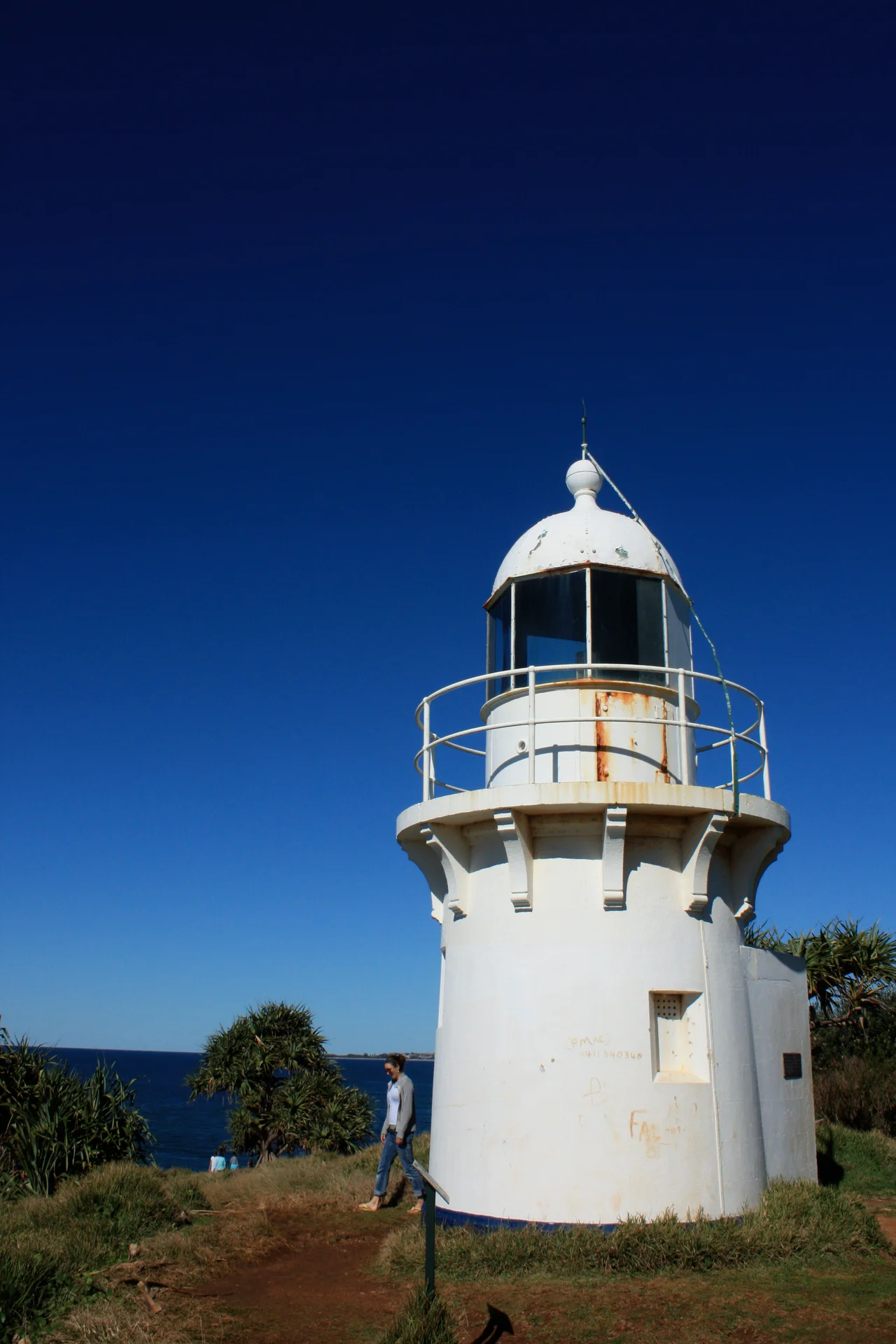

Fingal Head Light
Before there was a lighthouse, the keeper rowed. Every evening William Arnold pulled his boat across from the Tweed Heads pilot station, climbed the headland, and lit a lantern that his own daughter remembered as looking like a large meat safe perched on a wooden frame resembling a pigeon loft. That was 1872. The contraption did its job, warning ships off a treacherous river mouth, but it was no match for the place it stood on - a knuckle of black rock at Fingal Head where an ancient volcano left behind something extraordinary, and where a proper stone tower would soon take the rower's place.
The Giant's Causeway of the South
Walk to the edge of the headland and the ground organises itself into geometry. Hundreds of basalt columns, many close to hexagonal, step down toward the sea in interlocking ranks - a formation so like the famous Giant's Causeway in Northern Ireland that early visitors borrowed the name outright. When John Uniack landed here in 1823, he wrote that the columns were inferior only in extent to the Causeway itself. The rock is the cooled blood of the Tweed Volcano, lava that contracted as it chilled and cracked into these clean-sided pillars roughly twenty-three million years ago. They do not stop at the waterline. The columns march out beneath the waves toward Cook Island, the rocky islet about half a kilometre offshore that James Cook charted in 1770.
Booninybah, Home of the Echidna
Long before any of those European names, this was - and remains - the country of the Bundjalung people, the Minjungbal and Ngandowal speakers who are the traditional custodians of the Tweed. They knew the headland as Booninybah, the home of the giant echidna, and the basalt place carries cultural significance that predates lighthouses and charts by thousands of years. The beach curving south below the point is still called Dreamtime Beach. It is worth holding both truths at once: the lighthouse is a genuine piece of colonial maritime history, and it sits on a landscape that was named, known, and storied by people who were here long before a keeper ever rowed across the river.
A Barnet Lighthouse
In October 1878 the Maritime Board decided the meat-safe lantern would not do. The new tower, completed in 1879, came from the drawing board of James Barnet, the prolific colonial architect whose stamp is on much of nineteenth-century New South Wales. Fingal was the third of five near-identical lights Barnet designed between 1878 and 1880, siblings to the towers at Richmond River, Tacking Point, Crowdy Head and the now-demolished Clarence River light. The circular brick tower, rendered in cement, is capped by an oversailing bluestone platform on shaped corbels and topped with a domed lantern housing a fourth-order catadioptric lens. A four-room keeper's cottage once stood beside it. The tower is modest - barely taller than the trees around it - but precise, and unmistakably of its era.
Still Burning, Still Warning
The light has outlived its keepers. In 1920 it was converted to an automatic acetylene apparatus and the station was demanned; by 1923 the cottage and outbuildings had been demolished, leaving the tower to work alone. Electricity arrived in 1980, and today a compact electric beacon turns inside the old lantern, flashing white every five seconds with a red sector thrown to the east - a warning aimed squarely at the submerged rocks running out to Cook Island. The tower itself is closed to the public, but the headland is not. A short walk from the car park brings you to the lighthouse, the columns, a picnic area and a beach, and a view back across the Tweed mouth that explains, in a single glance, why someone once rowed out here every night to light a lamp.
From the Air
Fingal Head Light stands at 28.20 degrees south, 153.57 degrees east, on a low basalt headland on the New South Wales coast about 5 km south of Point Danger and the Queensland border, and just south of the Tweed River mouth. Cook Island sits roughly 500 m offshore to the east. The headland is small; the most reliable visual cues from the air are the Tweed River entrance with its training walls immediately north and the dark basalt point breaking the long sandy beach. Nearest airport is Gold Coast Airport (YBCG / OOL) at Coolangatta, only about 5 km north - aircraft on approach pass close to this coastline. Ballina Byron Gateway (YBNA / BNK) lies about 75 km south. Best viewed in clear morning light from offshore to the east; coastal haze and sea breeze can obscure the low headland by afternoon.
Nearby Stories
- Ocean Shores, New South Wales 8.7 km away
- Warner Bros. Movie World 15 km away
- Purga Aboriginal Cemetery 31 km away
- Spicers Gap Road 53 km away
- Bald Rock National Park 95 km away
- HMS Porpoise (1799) 655 km away
- Wreck Reefs 684 km away
- SS Elingamite: Gold, Fog, and a Captain Wrongly Blamed 1825 km away