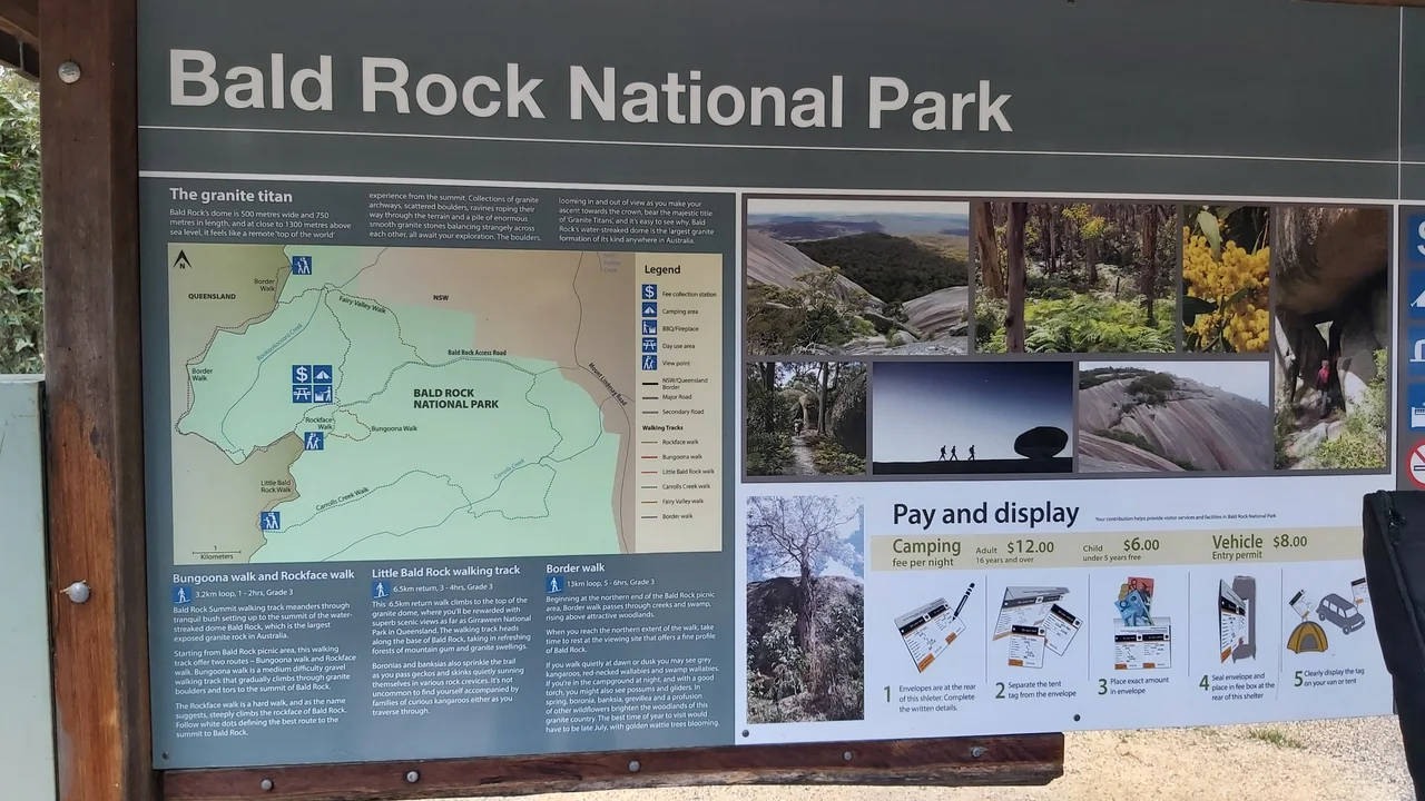

Bald Rock National Park
From a distance it looks like the bald crown of a giant breaking the surface of the forest. Bald Rock is a single mass of pale granite, 750 metres long and 500 metres wide, rising 260 metres above the surrounding bush to nearly 1,300 metres above the sea. After Uluru, it is the largest exposed granite monolith in Australia, and unlike the red heart of the continent it sits in cool, wet eucalypt country on the New South Wales tableland, straddling the Queensland border just north of Tenterfield. The state line actually runs across the rock's western flank, so a single granite dome belongs, on paper, to two states at once.
Two Hundred Million Years in the Making
The rock is a survivor. Around 220 million years ago, deep beneath the surface, a great body of molten granite called the Stanthorpe Adamellite forced its way up into older metamorphic and sedimentary rock and slowly cooled. Over the eons that followed, the softer rock around it wore away while the hard granite endured, and what was once buried magma now stands proud of the landscape. Erosion sculpted the exposed stone into something strange and sculptural: smooth domes, tumbled boulders the size of houses, and slabs balanced improbably on one another. Along the Bungoona track, a moss-covered granite arch hangs draped in ferns and orchids, the kind of detail that makes deep geological time feel suddenly intimate.
Neutral Ground
For thousands of years, this rock did something that borders rarely do: it brought people together. Bald Rock sits at the meeting point of three Aboriginal nations, the Jukambal, the Bundjalung and the Kamilaroi, and its position on the boundary made it neutral country. Here the nations could gather, hold ceremony and trade without anyone having to cross into another people's lands, a rare place of peace held in common rather than claimed. To stand on the summit is to stand on a landmark that has been significant to the people of this country far longer than any survey line or state border has existed, and that meaning deserves to be carried with respect by everyone who climbs it.
The Climb
There are two ways up, and they suit different nerves. The bold route goes straight up the exposed granite face, where painted white stripes mark the safest line and the rock can feel close to vertical under your shoes. The gentler choice is the Bungoona Walking Track, built in 1980, which winds up the eastern side through forest and boulder fields. Either way the reward is the same: a summit view that runs north to the peaks along the Queensland border, Mount Barney, Mount Lindesay and Flinders Peak, and south to Mount MacKenzie below Tenterfield. Vegetation on top blocks a full circle of horizon, but the sweep is still enormous. After fires tore through in 2019 and 2020, the state spent $800,000 rebuilding the Bungoona track and, remarkably, made part of it wheelchair-accessible, reopening in March 2023.
A Bushranger's Bolt-Hole
The park keeps a few human secrets at its edges. Just off the road in from Tenterfield lies Thunderbolt's Hideout, a jumble of caves and overhanging granite said to have sheltered the bushranger Captain Thunderbolt, the long-running outlaw of the New England ranges. A little further along the same road sit concrete tank traps left from the Second World War, when this remote high country was marked as a possible line of defence against invasion. Granite arches, balancing boulders, an outlaw's cave and a soldier's barricade: the landscape stacks its stories the way it stacks its stones, one improbable layer resting on the last.
From the Air
Bald Rock stands at 28.85°S, 152.05°E, its summit reaching nearly 1,300 metres above sea level on the New England tableland, straddling the NSW–Queensland border about 30 kilometres north of Tenterfield. From the air the rock is unmistakable: a large pale granite dome breaking cleanly out of dark eucalypt forest, brightest in low morning or evening light. The park merges into Girraween National Park on the Queensland side. Best viewed from 4,000 to 7,000 feet AGL, with the granite peaks of Mount Barney and Mount Lindesay rising to the north. Nearest scheduled-service airports are Armidale (YARM) and Inverell (YIVL) to the south, with Brisbane (YBBN) and the Gold Coast (YBCG) to the north across the border. Expect turbulence and possible mountain wave when winds rise over the ranges; the tableland's clear, dry air otherwise offers long sightlines.
Nearby Stories
- Washpool National Park 34 km away
- Kyogle 41 km away
- Casino, New South Wales 46 km away
- Glengallan Homestead 61 km away
- Susan Island Nature Reserve 65 km away
- Inverell 76 km away
- Inverell Post Office 104 km away
- Jimbour Homestead 190 km away