
Allan Cunningham Monument
Long before any surveyor put a name to this notch in the mountains, the Yuggera Ugarapul people told of how it was made. They had penned all the kangaroos in a great enclosure, the story goes, until an old woman set them free, and as the animals bounded west toward the inland they tore the gap clean between Mount Cordeaux and Mount Mitchell. The pass was a pathway, a route between the Fassifern Valley and the open plains beyond, walked for countless generations. The obelisk that now stands at its summit remembers a different man entirely, a botanist who arrived in 1828 and wrote the gap into colonial maps, and the contrast between those two histories is the whole story of this place.
The Botanist Who Found the Pass
Allan Cunningham was a collector of plants before he was an explorer of country, and the two pursuits travelled together. In 1827 he led a party north from the Hunter River and made the first recorded European sighting of the Darling Downs, naming rivers and ranges as he went and noting, from the western side, a likely break in the mountains. The following year he came back from the Moreton Bay side to find it, pushing southwest until he reached the high saddle that would carry his name. The passage he documented linked the coastal plains to the fertile country inland, and that single fact would reshape the region. Cunningham died in 1839, esteemed by his peers; an obelisk was raised over his memory in Sydney's Botanic Gardens, and his name lives on in the hoop pine, Araucaria cunninghamii, whose first specimens he collected.
A Pass That Cost a People Their Country
What opened the Darling Downs to graziers closed it to the people who had always lived there. The southern plains below the gap were the country of the Githabal people; the valley to the east belonged to the Yuggera Ugarapul. As squatters drove their flocks through the passes Cunningham had charted, that traditional life was broken apart. Across the Downs, Aboriginal people were dispossessed of their ancestral land, often violently, in the decades that followed. The monument was built to celebrate exploration as the engine of progress, and in 1927 that framing went almost entirely unquestioned. The deeper truth sits quietly alongside it: the same pass remembered here as a triumph of discovery was, for the first peoples of this land, the beginning of an enormous loss.
Raised by a Town That Wanted a Road
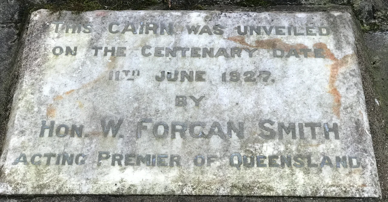
The obelisk did not come from the government. It came from the people of Warwick and the surrounding districts, who feared their town would wither if a reliable road to the coast went to Toowoomba instead. They paid for half the memorial and half the roadway themselves, and turned out as volunteers to cut the track over the range. The regional architectural partnership Dornbusch and Connolly designed the cairn, a spall-faced stone obelisk rising about five metres from a stepped base. Beneath it the builders sealed a jar of newspapers, coins, and the names of every volunteer and contractor on the job. When the road opened, the crowd cheered as the first motorcar nosed over the edge of the Gap and down the mountain. It was the age of war memorials, and this was a memorial of the same spirit, a community marking what it had built together.
Standing in the Rainforest
Today the monument keeps watch at the peak of the pass, ringed by eight mature hoop pines planted in 1935, eleven once stood, fittingly the very species that bears Cunningham's name. Around them rises the subtropical rainforest of Main Range National Park, part of the World Heritage Gondwana Rainforests of Australia, a green wall of canopy that closes in on the highway. Drivers climbing the eastern ascent catch sight of the obelisk on the final bend, set above the road on its stone-clad bank, looking out over the Fassifern Valley far below. Restored and repainted in recent years, it remains exactly where it was raised, a small grey marker at the dividing line between coast and inland, on a mountain saddle whose oldest stories are not written on any plaque.
From the Air
The Allan Cunningham Monument stands at 28.05 degrees south, 152.39 degrees east, at the crest of Cunningham's Gap on the Cunningham Highway, roughly 40 km northeast of Warwick. From the air the pass reads as a sharp saddle in the Great Dividing Range between Mount Cordeaux to the north and Mount Mitchell (1,168 m) to the south, the highway threading through dense rainforest; the monument itself is a tiny obelisk and best seen at low altitude on the northern side of the road. Amberley (YAMB) lies about 40 km northeast toward Ipswich; Warwick aerodrome (YWCK) is to the southwest. The Fassifern Valley opens to the east. Cloud and mist frequently shroud the gap, so clear, stable conditions are essential for a good look.
Nearby Stories
- Border Ranges National Park 8.6 km away
- Lone Pine Koala Sanctuary 27 km away
- Glow-Worm Caves Tamborine Mountain 28 km away
- 2010-2011 Queensland Floods 29 km away
- Darling Downs 34 km away
- Jondaryan Homestead 51 km away
- Kyogle 68 km away
- Glen Innes Showground 161 km away