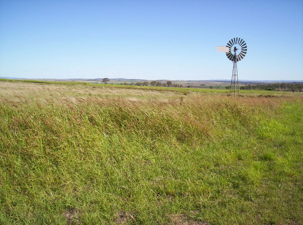

Darling Downs
Climb the range west of Brisbane and the country changes character at the top. The forested escarpment falls away behind you, and ahead the land opens into a swathe of rolling plains under enormous blue skies - the Darling Downs, a tableland of deep black soil so fertile that the explorer who first crossed it could hardly believe his diary. Allan Cunningham named the Downs in 1827 for Governor Ralph Darling, reporting four million acres of grassland he judged perfect for grazing. He was right, and the consequences arrived fast. Within a decade the squatters came, and the plains began their long second life as one of the most productive farming regions on the continent.
The Country Before the Fences
The Downs were a managed landscape long before any European called them empty. For thousands of years they were home to the Keinjan, Giabal, Jarowair and Barunggam peoples - Wakka Wakka language speakers - who kept the grasslands open with deliberate seasonal burning, the very openness that later made the country look to settlers like a ready-made sheep run. The Giabal held the land around present-day Toowoomba, the Barunggam to the west toward Dalby, the Jarowair up toward the Bunya Mountains. Those mountains hosted one of the great events of Aboriginal Australia: when the bunya pines fruited, every three or four years, the Jarowair invited nations from across southern Queensland and northern New South Wales to feast on the protein-rich nuts, settle disputes, trade, and arrange marriages. It was among the largest pan-tribal gatherings on the continent - a parliament and a festival held in the forest canopy.
Black Soil and Big Skies
What makes the Downs is the dirt. The black cracking clay holds moisture and nutrients with a generosity that has fed crops for generations - wheat, barley, sorghum, cotton, beans and vegetables roll across the hill country, and the region carries Australia's largest concentration of cattle feedlots. Drive its long straight roads and the iconography of inland farming scrolls past: herds of cattle, windmills turning slowly to pump water up from the Great Artesian Basin, light aircraft dusting the fields, and the weathered relics of an earlier era - old shearers' huts and sagging slab sheds left over from the first decades of settlement. Lake Broadwater, southwest of Dalby, is the only natural lake on the entire tableland, a rarity in a country otherwise plumbed by bore and channel.
Toowoomba, the Garden City
The capital of the Downs sits right on the lip of the escarpment. Toowoomba is Australia's largest inland city to have grown by natural increase rather than design - Canberra, the only inland city larger, was planned into being - and at around 700 metres above sea level it enjoys a cooler, greener climate than the subtropical coast below. They call it the Garden City, and the name is earned each September when the carnival of flowers fills its parks. From the range crest the view drops away over the Lockyer Valley toward Brisbane, 130 kilometres east; the descent of the highway down the escarpment is one of the most dramatic stretches of road in Queensland, switchbacking through forest from tableland to lowland in a few breathless kilometres.
Mountains, Vines and a One-Dollar Town
For all its farmland, the Downs guards real wilderness at its edges. Main Range National Park, on the Great Dividing Range, is World Heritage-listed as part of the Gondwana Rainforests of Australia, its passes - Cunninghams Gap, Spicers Gap - threading between forested peaks. The Bunya Mountains became Queensland's second national park in 1908, protecting the world's largest stand of ancient bunya pines. Down in the Granite Belt around Stanthorpe, where altitudes climb past 1,200 metres, the cool highland air supports more than sixty cellar doors and a wine industry improbable for subtropical Queensland. And then there are the Downs' quirks: the little town of Jandowae, worried about emptying out, once sold vacant building blocks for a single dollar to lure new residents in.
Reaching the Downs
Most travellers arrive by car, climbing the Warrego Highway from Brisbane - a divided road most of the way to Toowoomba - or coming up the New England Highway from northern New South Wales. The going gets lonelier and the towns farther apart as you head west toward Roma and the outback fringe. For the patient and the curious there is the Westlander, a twice-weekly train that ambles from Brisbane through Toowoomba and Miles toward Charleville at a leisurely average of around 45 kilometres an hour - less a way to get somewhere than a slow read of the plains themselves. Out here the distances are real, the truck-stop coffee is honest, and the reward is a region that has fed a nation while keeping the wide, unhurried feel of frontier Queensland.
From the Air
The Darling Downs spreads across southern inland Queensland, centred near 27.82 degrees south, 151.64 degrees east, immediately west of the Great Dividing Range. From the air the defining feature is the sharp transition from the forested escarpment - with Toowoomba perched on its crest at about 700 m elevation - to the flat, geometric patchwork of black-soil cropping land stretching west toward Dalby and Roma. The Bunya Mountains rise as a forested island to the north; Main Range National Park ridges the eastern edge. Toowoomba Wellcamp Airport (YBWW / WTB) is the main gateway, about 130 km west of Brisbane; Brisbane Airport (YBBN / BNE) lies east beyond the range, and Roma Airport (YROM / RMA) serves the far western Downs. Best viewed in clear morning light when the low sun rakes the escarpment; the open plains are prone to summer dust haze and dramatic storm build-ups in the afternoon.
Nearby Stories
- Main Range National Park 6.4 km away
- Jondaryan Homestead 25 km away
- Cressbrook Homestead 63 km away
- Border Ranges National Park 79 km away
- Bald Rock National Park 88 km away
- Warialda 167 km away
- Inverell 212 km away
- Hornet Bank Massacre 271 km away