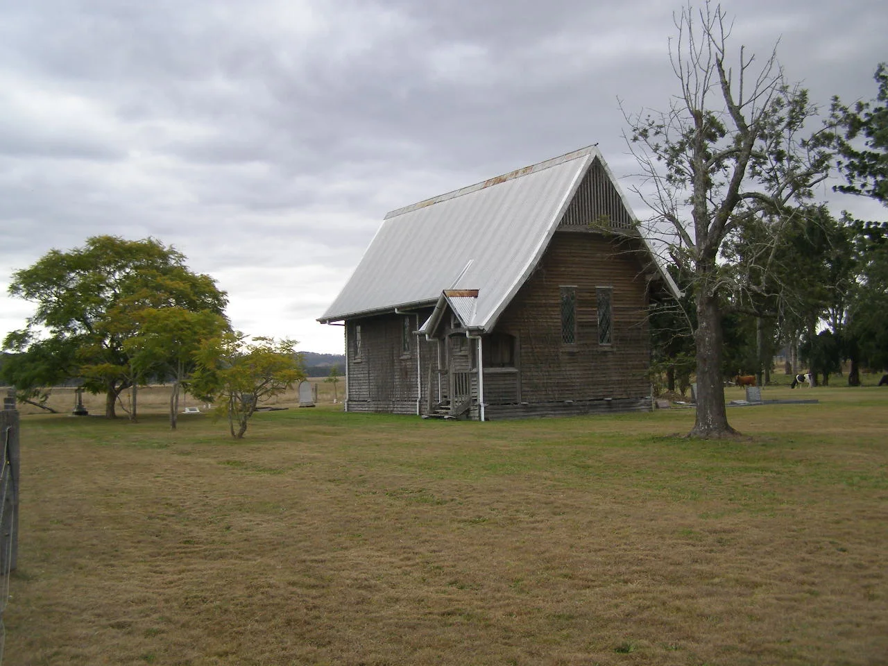

Cressbrook Homestead
In July 1841, a 23-year-old from Manchester named David Cannon McConnel ran his sheep onto the grass above the upper Brisbane River and called the place Cressbrook, after a family home back in Derbyshire. The penal colony at Moreton Bay had only just closed to settlers, and this was the first run taken up in the whole Brisbane Valley. The McConnel family has held it ever since. To stand among the weathered slab buildings today, beneath a bunya pine older than the state, is to read one continuous family story written across 180 years of Queensland history.
The Country Before the Run
Cressbrook's story does not begin in 1841. The valley McConnel rode into was the long-held country of the Jagera, Jinibara, Yuggera and neighbouring peoples, who had lived along these rivers for thousands of years and who knew, among much else, exactly which flats along the creek flooded and which did not. The arrival of squatters and their stock did not happen by agreement; it happened by occupation. In the years that followed, a loose alliance of Aboriginal nations sometimes called the United Tribes resisted across the frontier, and settlers were driven from runs at Kilcoy and at Cressbrook itself. The pastoral history that follows is genuinely remarkable, but it was built on land taken from people who were dispossessed of it, and that fact belongs at the front of the story, not in a footnote.
A Station Becomes a Township
What the McConnels built over the next century was less a farm than a small private town. A detailed 1910 plan records bachelors' quarters and married men's quarters, a schoolhouse, stores and shops, stables, a killing shed, a hay shed, dairy bails and a cattle dip, all clustered around the main houses. The original House still contains an 1840s slab wing, its walls made of split vertical timbers chamfered and slotted between top and bottom plates, the rough craft of the very first frontier years. David's wife Mary, meanwhile, had settled in Brisbane and thrown herself into civic life, helping to found one of Australia's first children's hospitals, the Hospital for Sick Children, which opened in 1878. The family's reach extended from the river flats to the heart of the colonial capital.
Milk, Money and a Chapel in the Trees
By the 1890s the run had turned to dairying. Henry McConnel opened a condensed-milk factory in 1890, fed by his own dairy and by some thirty surrounding farms carved out of the original holding; in 1906 the factory and 3,000 acres were sold to the Nestle Anglo-Swiss company. Through it all the family kept marking its life on the land. In 1901, to celebrate Henry and Madge McConnel's silver wedding anniversary, the renowned architect Robin Dods designed a small timber chapel near the entrance to the property, an early ecclesiastical work by a master of Australian Arts and Crafts design. Lit through diamond-paned leadlight and roofed with heavy hammer-beam trusses, it was deliberately ecumenical, open to workers of every creed. A lintel over its porch still reads VICTORIA 1901 CHAPEL.
What Endures
Cressbrook has survived in a way that few early stations have. The slab huts, the draft stables with an old government carriage still sheltered inside, the explosives store, the towering forests of timber posts that once held water tanks aloft, the intact tennis court and its pair of weathered swings between the House and the Cottage, all remain, layered together over a century and a half overlooking the river. The site went onto the Queensland Heritage Register in 1992, valued both as the cradle of pastoral settlement in the Brisbane Valley and as the home of Robin Dods's exquisite chapel. And the McConnels are still here, working the same ground their ancestor claimed in 1841, custodians now of a history that holds both deep continuity and an unhealed beginning.
From the Air
Cressbrook Homestead sits at approximately 27.058 degrees S, 152.405 degrees E, on the north bank of the upper Brisbane River near Toogoolawah in the Somerset Region, well inland from the city. The dominant landmarks are the winding upper Brisbane River and its open river flats, set against the forested ranges of the D'Aguilar and Brisbane Valley country; Cressbrook Creek joins nearby. The nearest sizeable airfield is Watts Bridge Memorial Airfield (ICAO YWSG), roughly 20 km to the south near Cressbrook Dam; Brisbane Airport (ICAO YBBN) lies about 90 km to the southeast. Best viewed from 2,000 to 5,000 feet; expect smooth morning air, valley haze, and afternoon build-ups over the ranges in summer that can curtail visibility.
Nearby Stories
- Thomas Petrie 5.5 km away
- Big Pineapple 8 km away
- Abbey Museum of Art and Archaeology 14 km away
- Conondale National Park 25 km away
- Jondaryan Woolshed 34 km away
- Bunya Mountains National Park 39 km away
- 2010-2011 Queensland Floods 43 km away
- Hornet Bank Massacre 269 km away