
Warialda
The name tastes of the land itself: Warialda, 'place of wild honey,' from the language of the Weraerai people, custodians of this country on the north side of the Gwydir River. Long before surveyors drew their lines, this was honey country - the Kamilaroi and their Weraerai kin reading the bush for hives and seasons. Today Warialda is a small farming town of around 1,500 people, easy to drive through in a minute. But it was once the most important place for a hundred kilometres in any direction, and just east of town a creek hides one of the strangest natural landmarks in New England.
The First Town on the Slopes
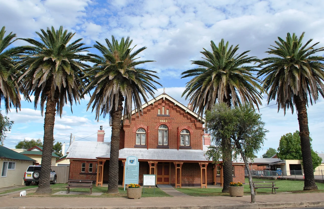
The explorer Allan Cunningham passed through this district in 1827, and settlers followed within a decade. A Border Police outpost was established here in 1840, making Warialda the first administrative centre for the whole Gwydir district - the law, the records and the authority of the colony, planted on the edge of the frontier. The townsite was formally gazetted in 1847, the first established town in the North West Slopes region. For nearly a century Warialda carried real weight: it was the seat of the old Yallaroi Shire from 1906 until that council merged with Bingara in 2004. The grand old court house and the former Yallaroi Shire chambers still stand as reminders of the days when this small town ran a large slice of northern New South Wales.
Cranky Rock
Eight kilometres east of town, beside Reedy Creek, lies Cranky Rock - a tumbled field of granite boulders that have settled into improbable balancing acts, one great stone poised as though a breath might topple it. The reserve is a favourite picnic and bushwalking spot, all dappled shade and weathered stone. The name comes from a grim piece of local folklore: the story goes that a man the district called 'cranky' fled here after a killing, and rather than be taken by the police, leapt to his death from the high rock. The tale traces back to a real and terrible crime reported in 1875, when a man named Charlie fatally attacked a local woman. Like much frontier legend, the story has hardened over generations into something simpler and crueller than the truth - a reminder that the prettiest places sometimes carry the darkest names.
Honey Country, Farming Country
Strip away the history and Warialda is, at heart, a town of the land. Mixed farming has always been its mainstay - grain and grazing across the gently rolling slopes that fall away west toward Moree and the great Murray-Darling plains. The town sits at the junction of the Gwydir Highway and Fossickers Way, a natural crossroads for travellers working their way between the tablelands and the western flats. It is the kind of place where you do your banking before you arrive, where private transport is essential, where a coach to Tamworth or Moree is the public timetable. That quietness is the point. Warialda offers the unhurried texture of country Australia, framed by the same bush the Weraerai once worked for its honey.
A Crossroads in the Gwydir
Geography made Warialda matter, and geography keeps it interesting. The town anchors the northern reach of the Gwydir Shire, with Bingara and its restored Roxy Theatre an hour to the south, Inverell's gem fields to the south-east, and the cotton plains of Moree to the west. Fossickers Way runs through, the touring route that strings together the old mining towns of the New England slopes - a reminder that this whole district was once alive with the search for tin, gold, sapphires and diamonds. Drive any direction out of Warialda and the country changes character within an hour, from timbered ranges to open black-soil flats. The town that began as the colony's first foothold on these slopes still sits where the roads meet, watching the traffic of a quieter age pass through.
From the Air
Warialda sits at roughly 29.53 degrees south, 150.57 degrees east, at the junction of the Gwydir Highway and Fossickers Way in northern New South Wales, on the western fall of the New England tablelands. From the air it appears as a compact grid in open farming country, with Cranky Rock's granite jumble tucked into the timber along Reedy Creek about 8 km to the east. The nearest airfields with scheduled flights are Inverell (YIVL), about 60 km south-east, and Moree (YMOR), to the west; Tamworth (YSTW) is the regional hub to the south. Best viewed at low altitude in the clear, dry inland light, where the country opens out for tens of kilometres.
Nearby Stories
- Wing Hing Long & Co. Store 8.9 km away
- Copeton Dam 27 km away
- Glen Innes, New South Wales 56 km away
- Tenterfield, New South Wales 89 km away
- Tenterfield School of Arts 138 km away
- Bourke Court House 403 km away
- Bourke Post Office 407 km away
- Hornet Bank Massacre 407 km away