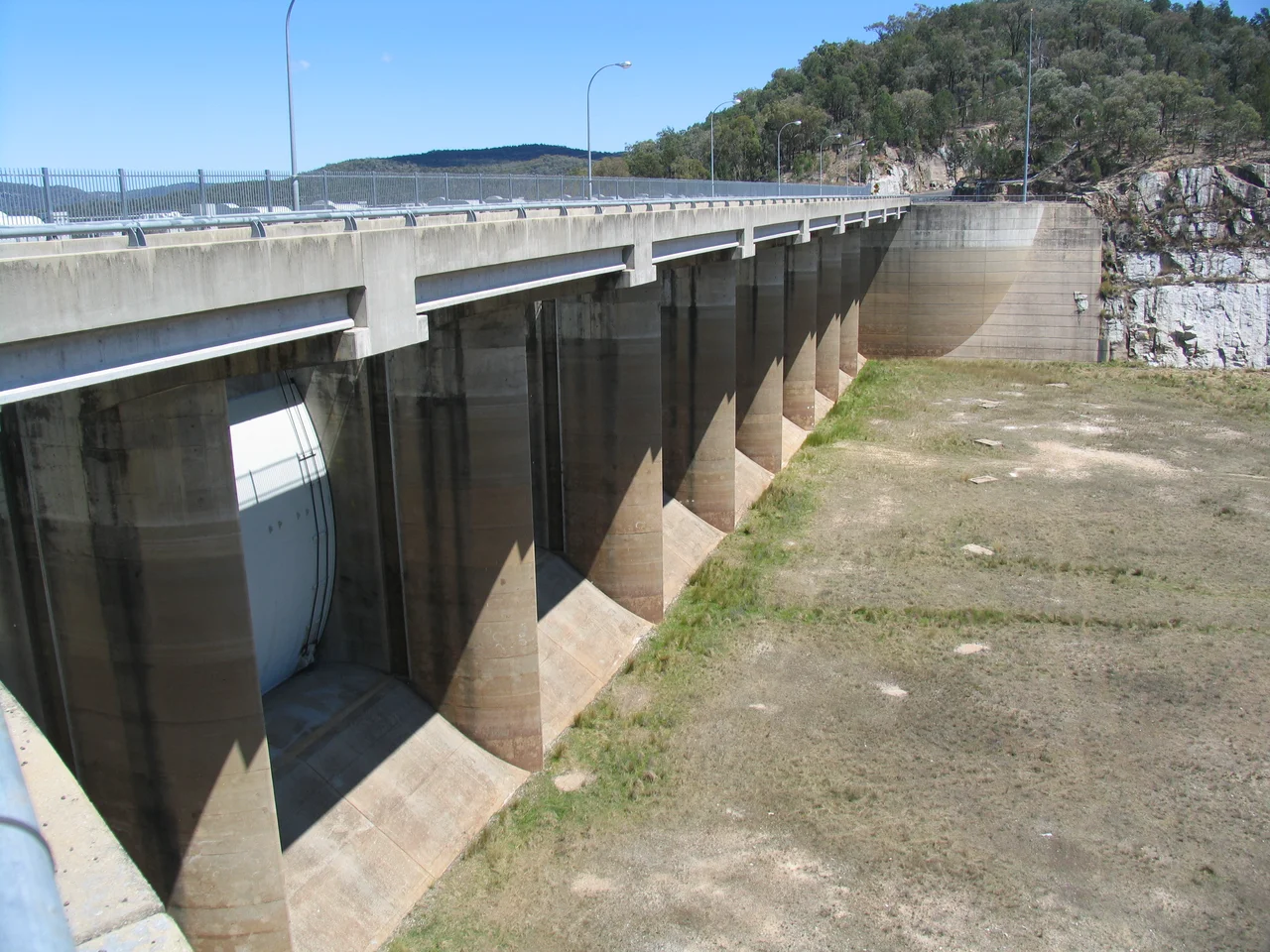

Copeton Dam
When Lake Copeton is full, it holds about three times the water of Sydney Harbour — more than 1.3 million megalitres pressed against a wall of rock and clay 113 metres high and nearly a kilometre and a half long. Out here, southwest of Inverell in the New England country, that scale feels almost improbable against the dry, rolling hills. But the numbers are the smaller story. The larger one swims somewhere in the deep, cool water: Murray cod the size of a person's leg, ambush predators that have made this artificial lake one of the most famous freshwater fishing destinations in New South Wales. Copeton is engineering and ecology tangled together, a Cold War–era public work that turned a river valley into a fishery and a playground.
Taming the Gwydir
Construction began in March 1968, the dam was commissioned in 1973, and the works were completed in 1976. The New South Wales Water Conservation and Irrigation Commission built it across the Gwydir River — a tributary of the Barwon — to bank water for farms downstream, roughly 35 km southwest of Inverell, between Bingara and Bundarra. The wall is a clay-core, rock-fill embankment containing thousands of cubic metres of rock, backed by a gate-controlled concrete spillway capable of discharging an astonishing volume of floodwater in a single day. The maximum water depth reaches 104 metres. It is a structure built for a fundamentally Australian problem: a land of long droughts broken by sudden, violent floods, where the trick is to hold the wet years over for the dry ones.
Water That Grows Cotton
Released into the Gwydir, Copeton's water feeds a string of weirs and channels that irrigate around 30,000 hectares of farmland — less than the 50,000 hectares originally planned, because the channels lost more to seepage and evaporation than the engineers expected. Even so, the result reshaped the region. With reliable water, the Gwydir Valley became Australia's major cotton-producing district, its fields also yielding wheat, lucerne, pecans, oilseeds, fruit and fodder, and pasture for sheep and cattle. A dam, in this sense, is a kind of agricultural time machine — it lets a farmer downstream plant in a dry spring on the strength of rain that fell in the catchment seasons earlier.
The Spillway That Surprised the World
Copeton handed its builders a genuine engineering puzzle. The unlined spillway channel was cut through hard, sound, unweathered granite — rock that should have shrugged off rushing water. Instead it eroded, and the cause was unusual enough that it has not been reported anywhere else on Earth: the granite was failing under high in-situ compressive stress locked into the rock itself. Engineers responded by splitting the single spillway in two with a training wall, creating a service spillway for ordinary floods and a secondary, rarely-used emergency spillway for extreme ones, with an anchored concrete slab armouring the scour channel. A later safety upgrade added a wide fuse-plug spillway designed to pass the most extreme floods imaginable.
A Lake for Cod and Quiet
For most visitors, Copeton is not infrastructure but recreation. Lake Copeton spreads across thousands of hectares, its shoreline given over to sailing, windsurfing, water skiing, boating, swimming and — above all — fishing. Anglers come from across the country chasing the lake's legendary Murray cod, alongside golden perch, silver perch, catfish and redfin. Bushwalkers find unusual geological formations and broad lake-and-mountain views, and a holiday park on the foreshore makes a base for it all. There is a particular pleasure in a working dam that has quietly become a wild-feeling place: the water exists to grow cotton two hundred kilometres downstream, and yet here it is, at dawn, perfectly still, with something enormous moving beneath it.
From the Air
Copeton Dam sits at 29.91°S, 150.93°E, about 35 km southwest of Inverell on the Gwydir River. From the air it is hard to miss: the long embankment wall and concrete spillway hold back the sprawling, irregular blue sheet of Lake Copeton, fringed by dry hills and grazing land — a striking contrast in an otherwise tawny landscape. Best viewed at medium altitude in clear conditions, when the lake's many arms and inlets are fully visible. Nearest airport is Inverell (YIVL), roughly 35 km north-east; Armidale Regional (YARM) and Tamworth (YSTW) lie further to the south-east and south. Watch for glare off the water in low sun.
Nearby Stories
- Guyra, New South Wales 29 km away
- Booloominbah 31 km away
- Warialda 46 km away
- Uralla 64 km away
- Gibraltar Range National Park 79 km away
- Bourke Court House 436 km away
- Mount Drysdale, New South Wales 451 km away
- Hornet Bank Massacre 452 km away