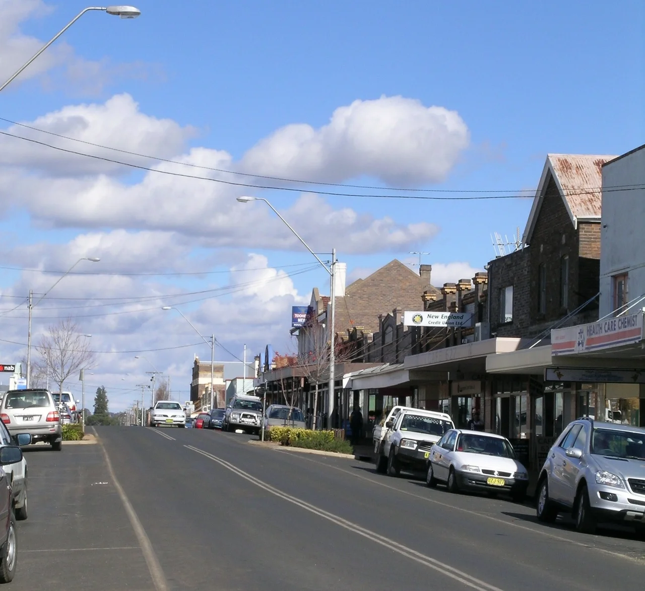
.JPG)
Guyra, New South Wales
On a February morning in 1960, a four-year-old named Steven Walls wandered away from his father on a property north of Guyra and vanished into the bush. For four days, hundreds of volunteers combed the cold, scrubby tableland, and a nation followed every bulletin. When searchers finally found the boy asleep against a log, his first words were not for them. "Where's my daddy?" he asked. Out of that ordeal came "Little Boy Lost," a Johnny Ashcroft ballad that topped the Australian charts longer than "A Pub With No Beer" and "Tie Me Kangaroo Down, Sport" combined. Guyra has never been a large place, but for one tense week it was the most watched dot on the map.
The Roof of New South Wales
At 1,330 metres above sea level, Guyra ranks among the highest towns in Australia, and the climate makes sure you know it. The town averages forty-two nights below freezing each year, and snow falls often enough that locals barely remark on it. Summer behaves strangely for this country: Guyra rarely climbs above 30 degrees, a rarity almost anywhere else on the continent. During a savage cold snap in July 1984, the town logged a daytime high of −0.3 °C on the third of the month, the most northerly sub-zero maximum temperature ever recorded in Australia. Up here on the volcanic spine of the Northern Tablelands, the air is thin and clean, and winter arrives with conviction. This is high country wearing an Australian disguise.
Two Names for One Country
Long before surveyors drew the railway line, this was Aboriginal land, and more than one nation knew it. The Gamilaraay (also written Kamilaroi or Gomeroi) people lived across the region, and the name Guyra is said to come from their language, carrying meanings of 'white cockatoo' or 'fishing place.' To the Gumbaynggirr people, whose country lay to the east, the place was associated with the black cockatoo. The land itself runs two ways here, a fact the railway makes literal. Rivers east of the line tumble toward the Pacific; those to the west drift inland, joining the long journey to the Murray. Settlers arrived from 1835, when Alexander Campbell took up Guyra Station on the ground the town now occupies, and the village was formally proclaimed in 1885.
Lamb, Spuds, and a Sea of Tomatoes
Guyra wears its livelihood proudly: its main festival, held each January, celebrates lamb and potatoes, the twin staples of a district built on fine wool, prime lambs, beef cattle, and root crops. The cold that torments gardeners turns out to be a gift for spuds. In recent years the town has reinvented itself on an industrial scale, with a vast climate-controlled glasshouse complex rising on the tableland to grow truss tomatoes by the millions of kilograms, making this frosty highland one of Australia's largest tomato producers. It is a curious image: tropical fruit ripening under glass while frost whitens the paddocks outside. The old regional abattoir that once employed up to 350 people closed in 1995, and the building found an improbable second life housing an angora rabbit operation.
The Mother of Ducks
On the edge of town lies a wetland with one of the best names in Australia: the Mother of Ducks Lagoon, a marshy sheet of water some fourteen kilometres around, cradled in the silted crater of an extinct volcano. Birdwatchers travel a long way for it. The lagoon is a rare breeding ground for several freshwater wetland species and a resting place for migratory birds that drop in from far afield, and its surrounds are protected as a nature reserve listed on the Register of the National Estate. A walkway leads to a viewing platform, with the town golf course and picnic grounds sharing the shore. To stand here at dawn, mist lifting off the water and waterfowl stirring, is to understand why the place earned such a tender, maternal name.
From the Air
Guyra sits at 30.20 degrees S, 151.67 degrees E, on the New England Highway midway between Armidale and Glen Innes. At 1,330 m elevation, the town crowns a broad volcanic tableland; the Mother of Ducks Lagoon, glinting in its crater on the town's edge, is the clearest landmark from the air, alongside the ruler-straight New England Highway and the disused northern rail line. Nearest airport is Armidale Regional (YARM / ARM), about 37 km south at 1,084 m elevation; Glen Innes (YGLI / GLI) lies a similar distance north. Expect frost, fog, and the occasional snow shower in winter; clear, cold, high-visibility air is common after a front passes.
Nearby Stories
- Booloominbah 10 km away
- Inverell Post Office 13 km away
- Guy Fawkes River National Park 15 km away
- Glen Innes, New South Wales 15 km away
- New England National Park 28 km away
- Copeton Dam 36 km away
- Gibraltar Range National Park 38 km away
- Parramatta Female Factory and Institutions Precinct 377 km away