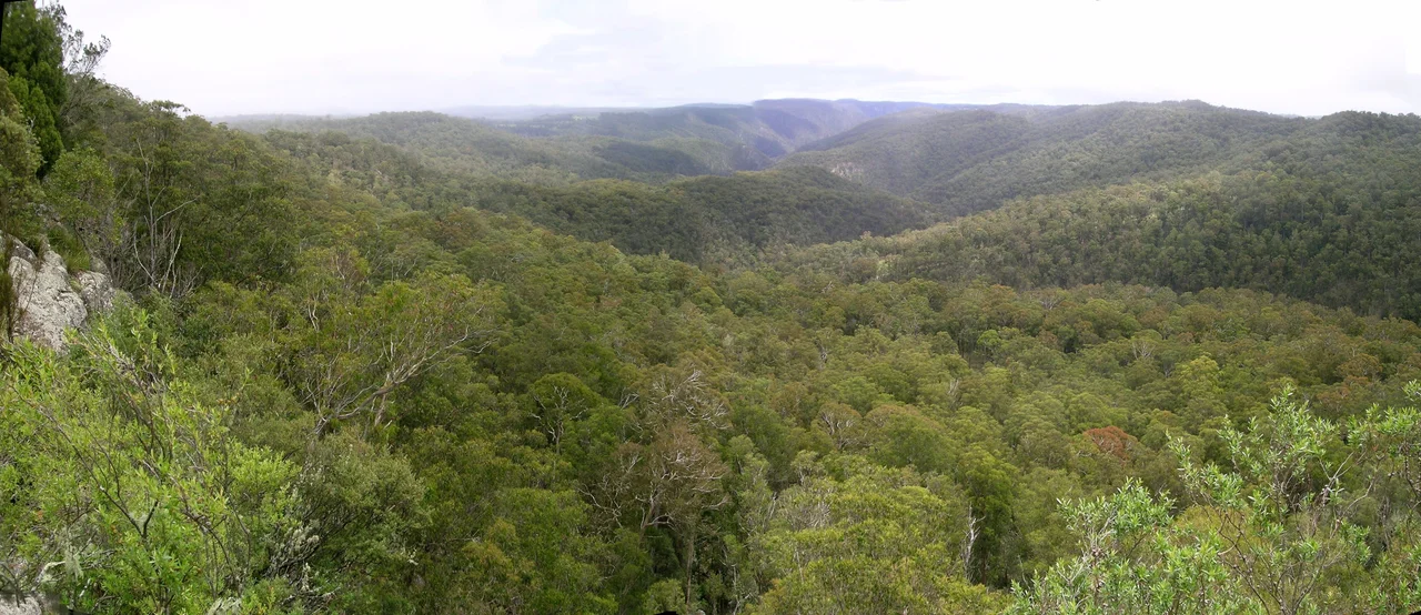

Guy Fawkes River National Park
The river starts its plunge at Ebor Falls, dropping off the rim of the Northern Tablelands in two great steps, and from there it carves its way down through one of the wildest corners of New South Wales. Guy Fawkes River National Park covers more than 100,000 hectares of gorge and ridge and old-growth forest, draped across the eastern edge of the New England Tablelands where the high country breaks and falls toward the coast. It is a place of deep, shadowed valleys and rugged rivers, and it carries a name borrowed from the man behind England's Gunpowder Plot. But the story most people know about this park is not about geology or a seventeenth-century conspirator. It is about horses.
The Cull and the Outcry
Over three days in late October 2000, professional shooters in helicopters killed 606 wild horses in this park. A long drought and a severe bushfire had stripped the country bare, and the NSW National Parks and Wildlife Service judged that the surviving horses were destroying what little vegetation remained. The aerial cull was meant to be quick. It was not always clean. Some horses were found with multiple bullet wounds, and one, discovered alive two weeks later, had to be put down by the RSPCA. When word got out, the public response was furious. The RSPCA took legal action, and aerial shooting of horses in New South Wales national parks was banned in its wake. It remains one of the most contentious episodes in the history of Australian park management, an event still argued over two decades on. There are no easy villains in it, only a hard collision between a damaged landscape and the animals living on it.
Walers, the Heritage Horses
The outcry forced a question that had never properly been asked: what, exactly, were these horses? The Environment Minister, Bob Debus, commissioned a Heritage Working Party to find out. Its 2002 report concluded that the Guy Fawkes horses carried genuine historical, military and cultural value. They were descendants of the Waler, the tough Australian-bred cavalry horse that carried Australian and Allied troops through the wars of the early twentieth century. This was the only group of wild Australian horses with proven heritage value of that kind. The horses had lived in the park since the 1930s, gone bush and bred true through the decades. Recognition did not mean they could stay. The government's answer was removal by gentler means than gunfire: passive trapping, in which horses are lured into yards rather than shot from the air.
Saving the Bloodline
Out of the controversy came an effort to keep the line alive. The Guy Fawkes Heritage Horse Association takes possession of horses passively trapped and removed from the park, offers them for sale, and manages them to preserve the genetics and characteristics that make them distinct. A formal register and stud book now exist for the breed. More than 400 horses have been trapped and taken out over the years, and many have found homes elsewhere, carried out of the wild and into paddocks where their descent from wartime cavalry mounts is a point of pride. The association sponsors classes at agricultural shows and encourages owners to put the horses to work across every discipline, proving the old Waler versatility. It is an uneasy resolution, born of a tragedy, but it has given the bloodline a future it might otherwise have lost.
Gorges, Old Growth and a Long Trail
Set the horses aside and the park is still extraordinary. The Guy Fawkes River cuts a deeply incised valley along the line of an ancient fault, and the gorges of the Aberfoyle, Sara and Henry rivers slice through the country alongside it. More than forty distinct vegetation communities grow here, sheltering 28 threatened plant species and 24 threatened animal species, with significant tracts of old-growth forest that have never been logged. This is rough, remote terrain: access comes via Waterfall Way near Ebor, or by a scatter of back roads reaching the park's wilder edges. In the 1970s the Bicentennial National Trail was routed along the western side of the river, following an old travelling stock route, so that walkers and riders could thread the length of it. It is wilderness in the genuine sense, hard to reach, easy to get lost in, and largely left to itself.
From the Air
Guy Fawkes River National Park sprawls around 30.03°S, 152.30°E on the eastern edge of the New England Tablelands in northeastern New South Wales, roughly 80 km northeast of Armidale and 46 km southwest of Dorrigo. From the air the defining features are the deeply incised river gorges cutting through forested tableland, and Ebor Falls at the park's southwestern approach where the Guy Fawkes River drops off the escarpment. Waterfall Way is the main road landmark along the southern edge. Nearest airport is Armidale (ICAO YARM / IATA ARM) to the southwest; Grafton (YGFN) lies to the east toward the coast, and Coffs Harbour (YCFS) is the larger field further east. Recommended viewing altitude 5,000–7,000 ft to take in the gorge systems. This is high, rugged country: expect rapid cloud build-up, valley fog in the mornings, and turbulence over the escarpment in strong westerlies.
Nearby Stories
- Grafton Bridge (New South Wales) 1.6 km away
- Gibraltar Range National Park 19 km away
- Ebor Falls 20 km away
- Coffs Harbour 20 km away
- Glen Innes, New South Wales 28 km away
- Woolgoolga, New South Wales 31 km away
- Armidale 36 km away
- Warialda 128 km away